Andi Frank (247).jpg")
Difficulty:easy
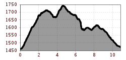
Length:30.5 kmDuration:2:00 hElevation uphill:125 m
Challenging, long-distance course with a steep start, beautiful single trails and an amazing view over the valley
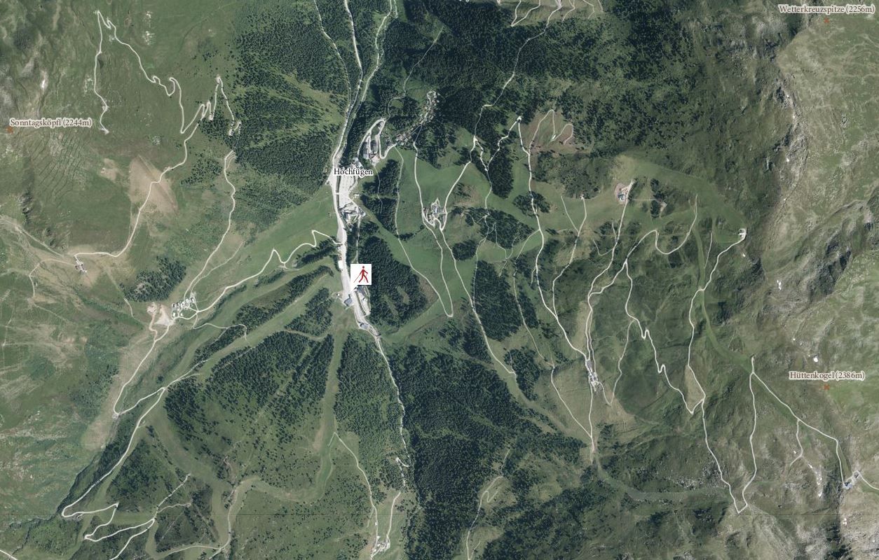
The course begins over a steep climb towards Sonntagsköpfl and on to the lower meadows of Lamarkalm pasture. The course leads from there along a narrow, winding single trail and on to a gravel path, right up to Loasattel. After passing the gate, a narrow trail leads through the forest and down to a forest road, which leads back to the starting point Hochfuegen.


.jpg")
Manfred Pfister.jpg")


