
Difficulty:medium
Length:14.4 kmDuration:6:00 hElevation uphill:925 m
Long-distance course with short, steep gradients and a very diverse course route
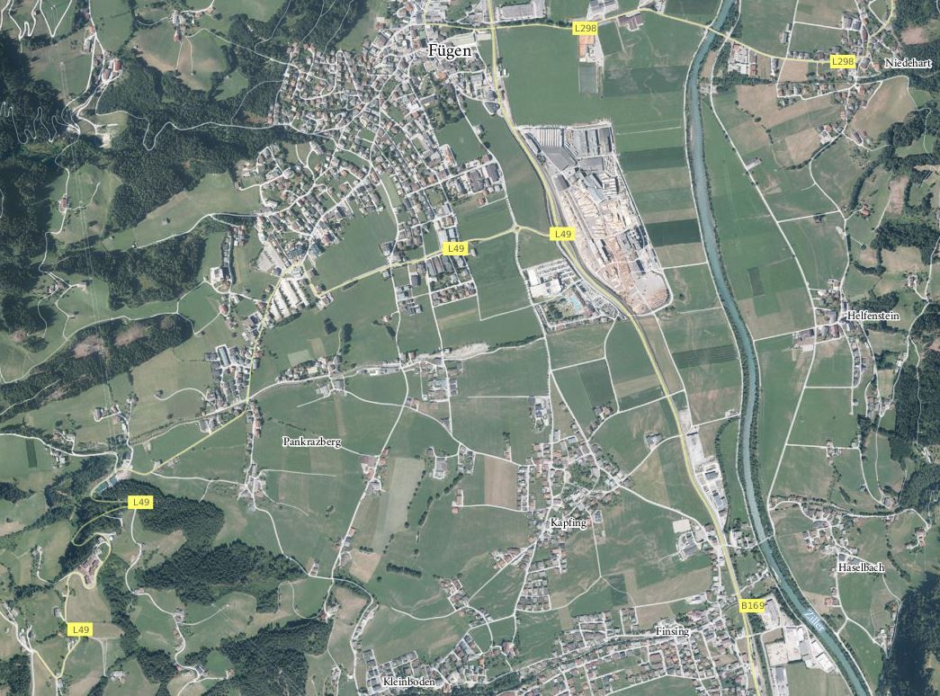
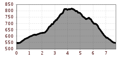
The course runs from the town centre of Fügen toward the south, through the neighbouring town of Kapfing and along a constant slightly uphill gradient until one reaches the church of St. Pankraz. After reaching the Finsingbach Stream, the course goes uphill and through the forest on the Pankraz Mountain. From here, the course goes along a road, then along gravel and forest trails on a constant downhill gradient across meadows and along the edge of the forest back toward the town centre. Coming from the south-west, one then passes through a residential area to reach the starting point.
Andi Frank (247).jpg")

.jpg")
Manfred Pfister.jpg")


