Andi Frank (247).jpg")
Difficulty:easy
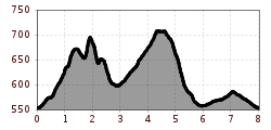
Length:30.5 kmDuration:2:00 hElevation uphill:125 m
Medium length, cross-country course, ideally suited to training methods such as Fahrtspiel (speed play)
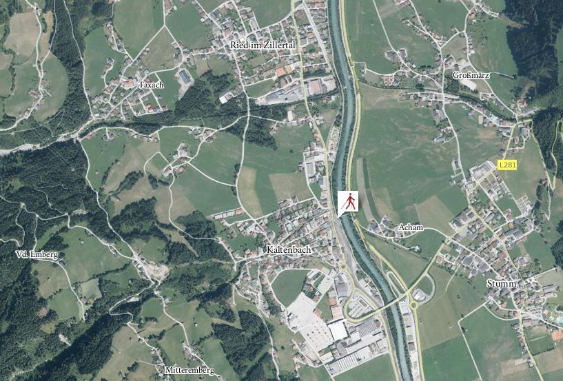
The course begins along the Kaltenbach Stream and heads uphill toward the west, passing the Marien chapel and running beneath both cable car lifts. After a short stretch of road, a trail begins, which takes one on alternating ups and downs toward the north, past the spectacular Kaltenbach waterfall and on toward Ried. After crossing the Riedbach Stream, one then follows the road uphill for a short stretch. Then the trail continues through the forest and down to Grossried. The course then goes along side roads, through the centre of Ried and back to the starting point.

Manfred Pfister.jpg")
.jpg")

