
Opening hours:Open today
Place:Matrei in Osttirol
:Restaurant, Alpine pasture / hut / mountain restaurant
a scenic ski tour between Osttirol and Salzburg
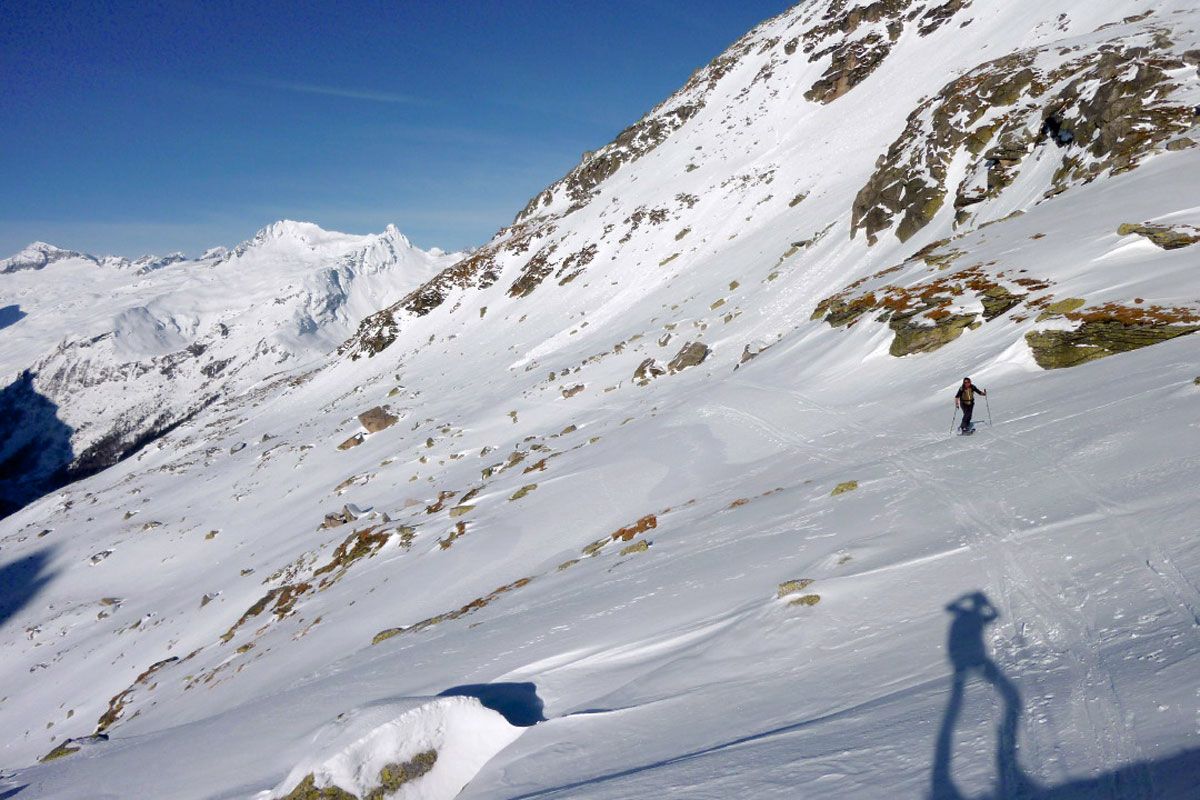
The Felbertauern, known far beyond these borders as a touring paradise, provides a variety of elegant ski ascents into surrounding areas providing an abundance of views right through to spring time. An elevated starting point and the resulting snow-assuredness are further allures for many tourers from the Alpine foothills to take on the extensive journey. Even if the quality of the snow sometimes leaves a lot to be desired due to the persistent exposure to the Nordstau weather system, you still get to enjoy being out and about in a unique scenic area which has a superb view from the summit.
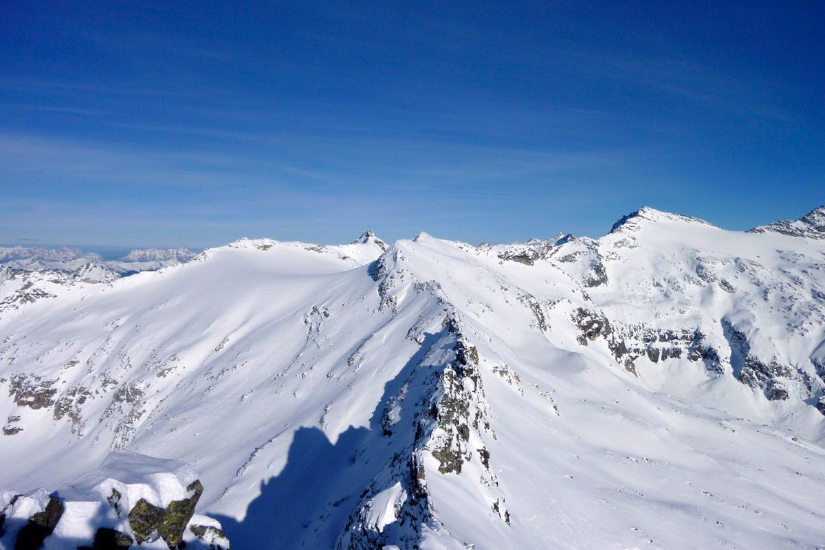
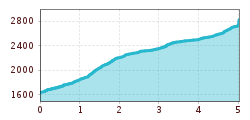
Our starting point is directly at the Felbertauern south portal. Car parking on the left before the toll area. The ski track soars opposite this area, to start with steeply via a pastureland area, to a sharp bend (supporting wall) which you can make out from below. We now follow the newly set up forest trail which takes us into open terrain. In more sharp bends we stride through the following steep slope to Grünseehütte, until at around 2300 m we bear east and cross the slope on the sunny side of the Daberkögele. At Dabersee (2424 m, 2 hours), two options open up to get to the glacier plateau of Amertaler Höhe. There is the option to cross the sunny side, down the slopes of the Riegelkopf (summer trail) and a crossing on the shaded side beneath the Glockenkogel break-offs. The gain in time here has no role to play, yet the technical aspects of avalanches should be decisive here. After the final hairpin bend the track leads to Sillingscharte, which separates our tour destinations. From there in 10 minutes to Amertalerhöhe (to the north) or 15 minutes to the Sillingkopf. Those who are first to climb the Sillingkopf, can with a courageous straight downhill run, almost reach the summit level of the Amertalerhöhe and thereby save using cumbersome climbing skins.
Additional ski tour tips can be obtained in the ski tour guides by Thomas Mariacher. These are available here: https://www.tyroliaverlag.at/item/Skitouren_in_Osttirol_und_Oberkaernten/Thomas_Mariacher/43058387
Parkplatz Felbertauern Südportal
