
Opening hours:Open today
Place:Kals am Großglockner
:Restaurant, Bar / Pub
Brunnerkogel 2.606m
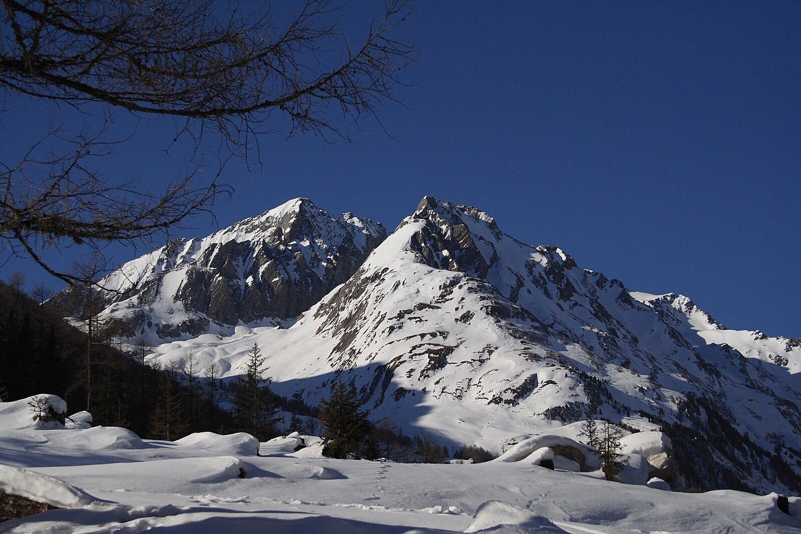
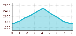
From the Tauererwirt car park, walk along the path 200 metres towards Dorfertal. Before the entrance to the Dorfertal, cross the bridge on the left and follow the path out of the valley in about 400 metres. Here, a flat slope on the right leads to the forest and through it, always to the right along a rugged brook ditch, sometimes steeply up to the alpine pastures at 1,900 metres. Continue across the meadows towards Pahlalm. Pass it on the left side. Keeping left, you will come to the Kerer Hochalm (high alpine farm). Pass the hill farm across the spacious slopes directly to the Hochtor. The summit of the Brunnerkogel can be reached on the right (north-west) via the ridge (watch out for snow being dumped by the wind!).
Possible descents:
Descent like ascent. At the alpine pastures at approx. 1,900 metres you can also use a path that leads to the south. Here you get to a ski run, across which you can ski towards the Taurerwirt. You can ski down to the Taurerwirt via a cross-country ski run 200 metres above the lift station.
by busline 952 until the busstop Kals/Taurer
Parking Dorfertal
