
Opening hours:Open today
Place:Außervillgraten
:Restaurant, Alpine pasture / hut / mountain restaurant
Hochalmspitze
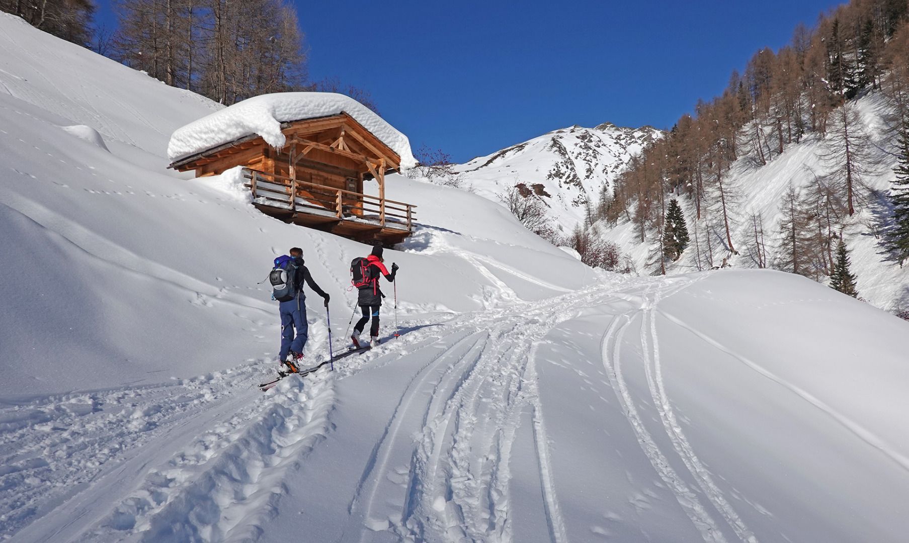
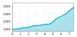
The starting point of the tour is at the Reiterstube (1,500 m) in Außervillgraten - Winkeltal. From there, take the forest road past several mountain pastures to the Volkzeinerhütte at 1,848 metres. Directly at the hut, head north along the summer trail to a small mountain hut and then continue eastwards to the so-called Tschuinggn-Schupfe. (Beware of avalanche danger) From here, the terrain becomes significantly flatter and you climb over gently rising alpine pastures in a north-easterly direction below the Kleinitzer Törl. From there, climb steeply up to the Törl and continue along the summit ridge to the Hochalmspitze (2,797 m).
Descent as ascent
Characteristics
Demanding, little-travelled tour with a long ascent to the Volkzeiner Hütte. The Hochalmspitze is usually travelled in spring, when you can ski further into the Winkeltal valley. The snow on the summit ridge is often wind-pressed in high winter, which is why good skiing technique is necessary and crampons are an advantage. Refreshments available after the tour in the Reiterstube.
