Arrival by public transport
Take regional bus line 4080 to Achenkirch and get off at the "Achenkirch Abzw. Steinberg a. R." stop. From there, it’s a 15-minute walk.
Very rewarding and popular ski tour. Take care at the traverse leading to the summit ascent.
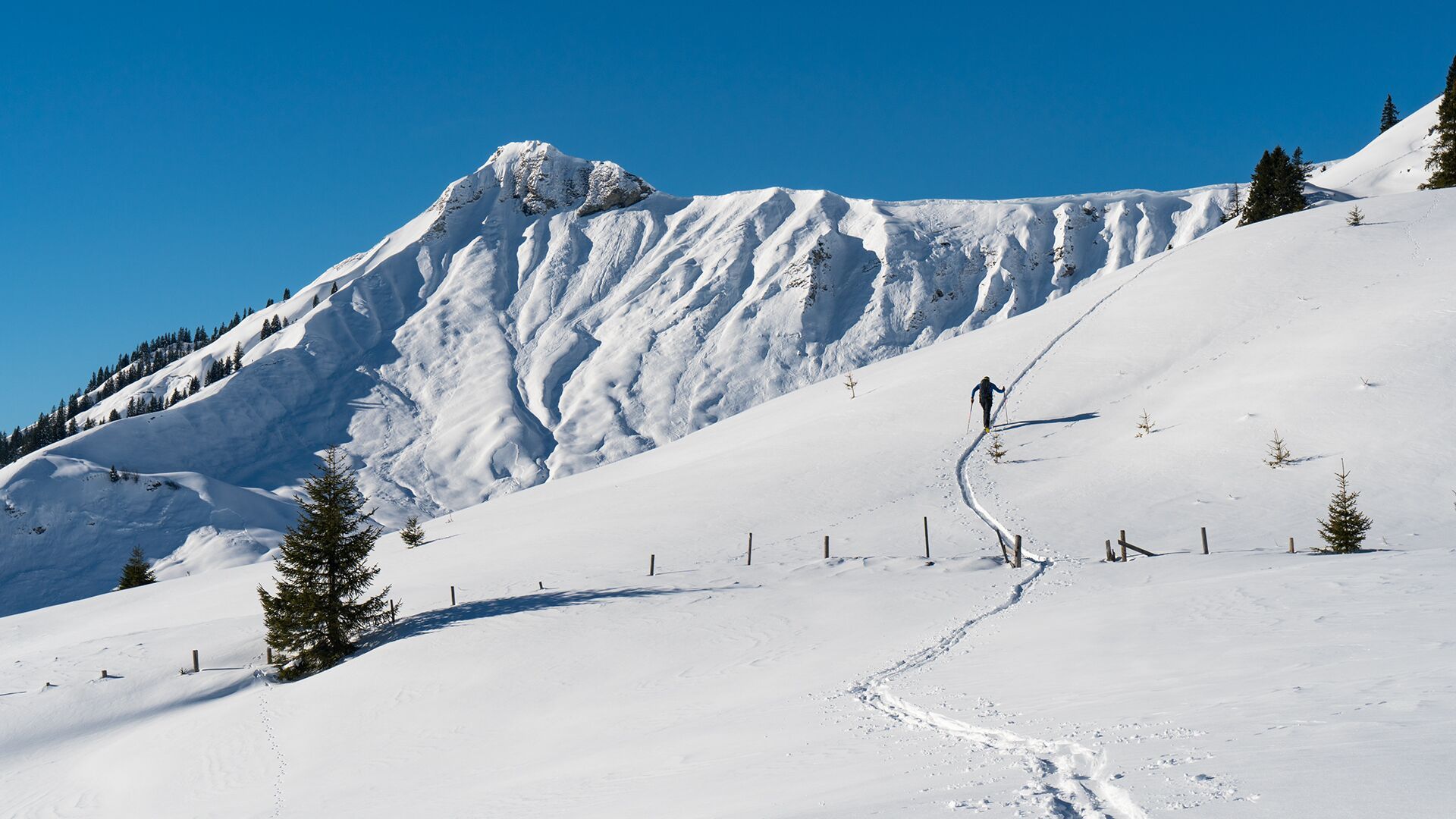
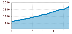
Ascend from the car park (avalanche beacon checkpoint) over open terrain in a south-westerly direction to the Falkenmoosalm forest road. Follow this road into the forest and at the first right bend, head to the left and follow the summer hiking path. At the edge of the forest, climb up to the Falkenmoosalm (1,328m) on open meadows. To the west at an elevation of 1,500m, turn left and climb the ridge in a southwestern direction. At the summer hiking path, walk around a jagged rock and turn left immediately. Continue along a wide clearing alongside the ridge in a south-westerly direction. Avoid the steep slope to the left (danger of avalanches) and walk through a basin to the summit cross.
The descent follows the ascent route. Pay attention to the direction sign (red arrow) on the final slope.
Take regional bus line 4080 to Achenkirch and get off at the "Achenkirch Abzw. Steinberg a. R." stop. From there, it’s a 15-minute walk.
Falkenmoos car park in Achenkirch (paid parking)
