
Opening hours:Open today
Place:Innervillgraten
:Restaurant, Alpine pasture / hut / mountain restaurant
Kalksteiner Jöchl & Hohe Geil
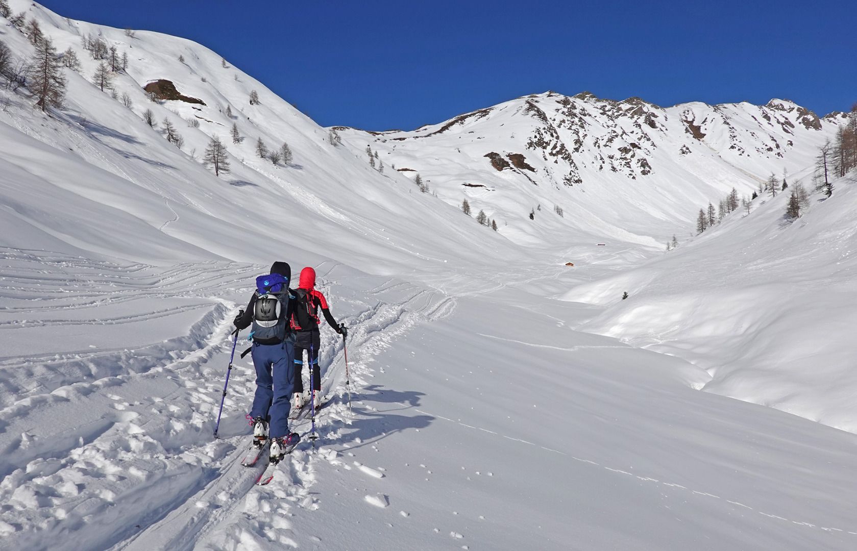
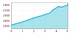
The starting point is the ski gate car park at the Badl-Alm in Kalkstein (1,640 m), approx. five kilometres after Innervillgraten. From the car park in Kalkstein, first take the forest path towards Alfenalm, turn right shortly before and follow the road north-west into the Roßtal valley to the end of the valley with a small hut (approx. 2050 m). From there, the ascent leads to the left in a westerly direction, initially over a somewhat steeper section, later over hollows and humps to the Kalksteiner Jöchl (2,350 m). From here, the ascent continues northwards over a broad ridge to the summit cross of the Hohe Geil (2,494 m)
Descent: As ascent.
Characteristics: The Kalksteinjöchl is a crossing into the neighbouring Gsiesertal on the South Tyrolean side. Until the 1950s it was considered a smugglers' path. This tour is an easy introductory tour, also suitable for beginners. Great views both from the Kalksteinjöchl and from the Hohe Geil to the Sexten Dolomites and the neighbouring Gsiesertal.
