
Opening hours:Open today
Place:Jerzens
:Restaurant, Alpine pasture / hut / mountain restaurant
Mittelstation Route - red
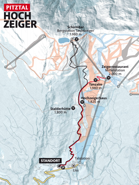
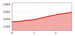
After setting off, follow a fairly flat road and walk uphill in a few serpentines on the open slope of the Liss button lift. Then continue to follow a path until you reach a wide hillside just before Hochzeiger gondola. Continue walking on this hillside across open clearings until you reach the Hochzeiger Haus, then continue keeping left, past the Hochzeiger Haus, and keep to the left side of the ski slope until you reach the toboggan run. Then cross through a short underpass and follow the toboggan run (please BE CAREFUL as there may be oncoming traffic) until you reach Tanzalm mountain hut and further on to Zeigerrestaurant at the intermediate station.


