
Opening hours:Open today
Place:Innervillgraten
:Restaurant, Alpine pasture / hut / mountain restaurant
Pürglers Kunke
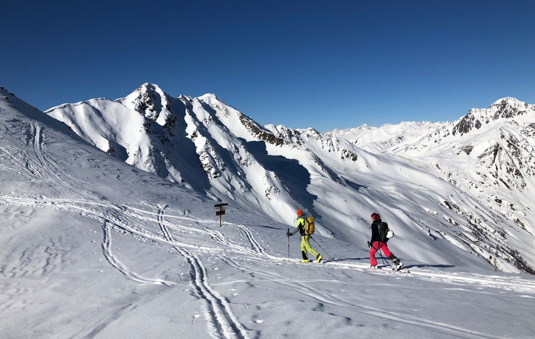
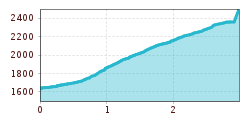
From the big car park behind the church, the ski track proceeds in a south- westerly direction to the Alfner Alm (1700 m), around 15 minutes. Keep heading to the Gaishörndl and Toblacher Pfannhorn, we are following the rutted forest trail into the valley. Beneath the Rutschlet Alm the Alpine trail branches off and we use the north-eastern branch which brings us out of the wooded belt into open pastures and later serves as the descent. This section may also be truncated; at Alfner Alm proceed through the steep forest up through a few hairpin bends and get to the upper end of the aforesaid forest trail. From here the ski track swings via trough and pastures (described as Kalksteiner Egg in the map) up to the old toll lodge at 2330 m. From here it is another 20 – 30 minutes to Pürglers Kunke, whose summit we get to after a leisurely 1 ½ to 2 hours. Descent along the ascent trail and then back via the goods road.
Additional ski tour tips can be obtained in the ski tour guides by Thomas Mariacher. These are available here: http://www.grafikzloebl.at/verlag/buecher/
Parkplatz Bad'l Alm Kalkstein
