Arrival by public transport
Take the regional bus (line 4080 to Achenkirch, change to line 7801 to Steinberg) to Steinberg am Rofan to the car park Köglboden. Get off at the stop: Achenkirch Abzw Gufferthütte.
The long ascent to the Schneidjoch is well worth the effort, rewarding you with breathtaking scenery and a peaceful descent.
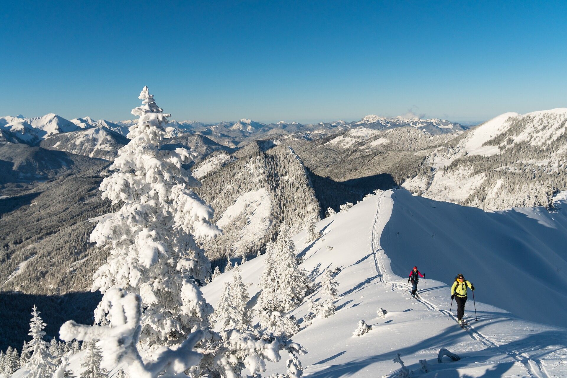
The tour begins at the car park Köglboden, running flat through the Ampelsbach valley before it narrows into a gorge. After ca. one hour, continue straight ahead at the stream bridge junction. The route leads past the Klausbodenalm (not serviced). The ascent continues through the forest, past the Angeralm, and across a clearing to the Schneidjochsattel. At the saddle, keep right and follow the broad ridge to the summit.
Descent: Follow the ascent route.
Take the regional bus (line 4080 to Achenkirch, change to line 7801 to Steinberg) to Steinberg am Rofan to the car park Köglboden. Get off at the stop: Achenkirch Abzw Gufferthütte.
car park Köglboden (paid parking)
