
Öffnungszeiten:Heute geschlossen
Ort:Kramsach
:Restaurant
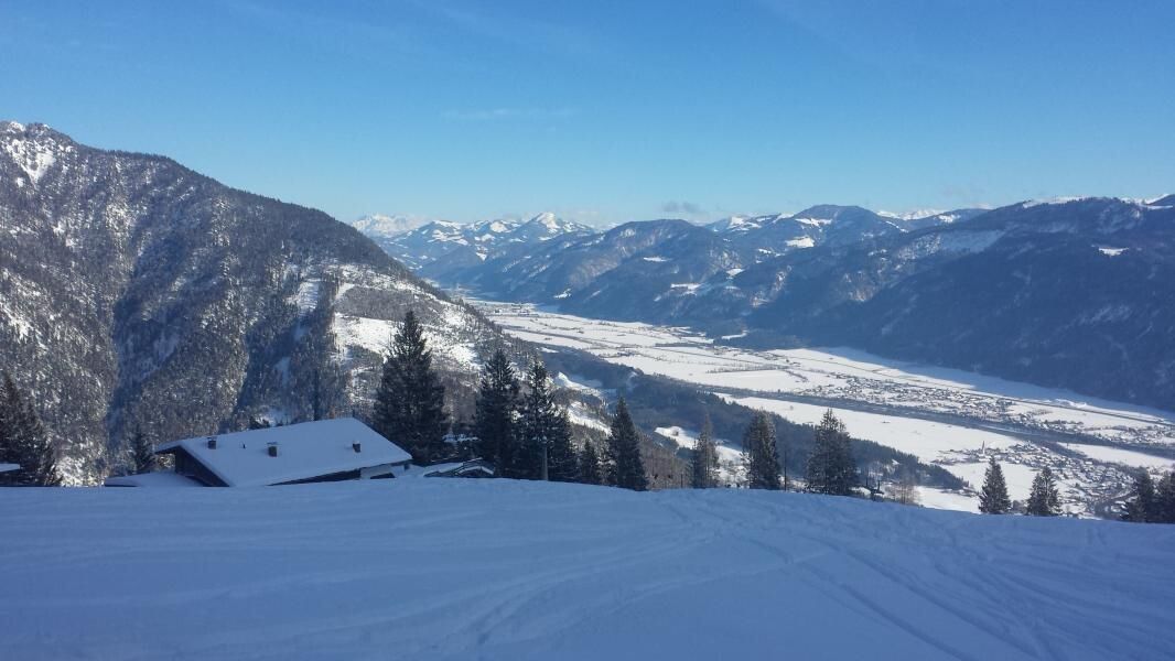
Challenging ski route with many meters of elevation up to the former upper station of the Sonnwendjochbahn
Pay attention to the current avalanche situation on every ski route.
Avalanche Warning Service Tyrol
Ski touring equipment, sufficient drinks and provisions
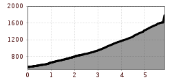
Walking time: 4 hours – 1,230 m elevation to the former upper station of the Sonnwendjochbahn
The ascent first follows the access path to the sledding track "Kaltes Wasserl", here towards the middle station. Soon you reach the former ski slope. Ascend along this, first to the middle station and from here steeply upwards to the former upper station of the Sonnwendjochbahn.
Descent: same as ascent or, if snow conditions allow, from the upper station westwards over the gully to the "Ludoialm", onwards to the "Pletzach Niederleger", and via the alpine path and "Kaltes Wasserl" back to the valley station.
no catering possibilities!
www.vvt.at Line 621/Stop: Kramsach Achenrain and Line 610/Stop: Abzw. Mariatal
Kramsach former Sonnwendjochbahn

