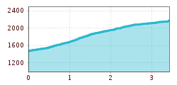
Steinrastl 2184 m
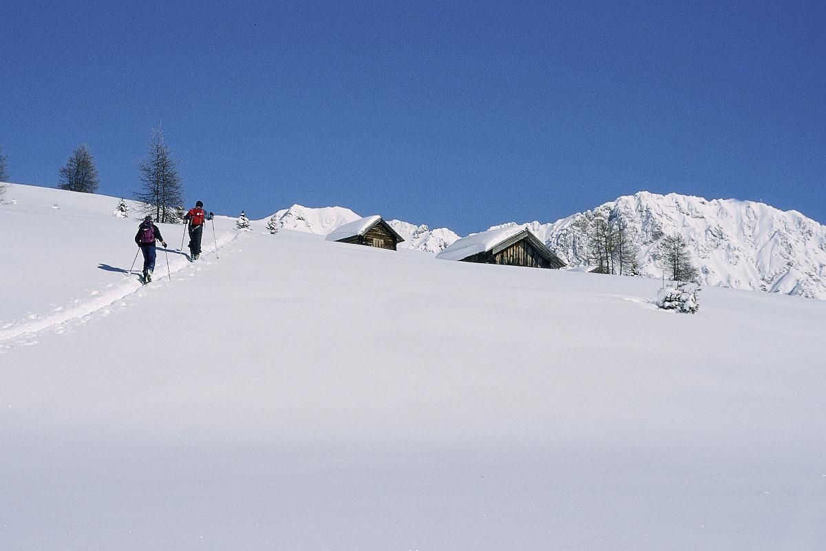
This ski tour begins in the easternmost hamlet of Obertilliach - in Flatsch. At the beginning, the trail leads left across a mountain meadow. The forest above Flatsch was almost completely destroyed by a hurricane in October 2018.
The trail now crosses the old summer ascent (no. 40) up to the right and at one point touches the forest path, which also leads in the direction of Steinrastl. Just below the tree line, the ascent track joins this forest path. We now follow the yellow signposts of hiking trail no. 40 almost always straight over a few terrain steps and in increasingly open terrain towards the north. We also cross the goods road a few times, which ends just below the Steinrastl. Only recommended if there is sufficient snow, as the tour is entirely in the sun.
Easy variant via the forest path to Schwarzmoos and then across the mountain meadows to the summit.
