
Opening hours:Open today
Place:Prägraten a.G.
:Restaurant
A wonderful ski tour in the Dorfertal
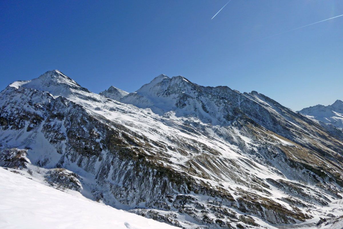
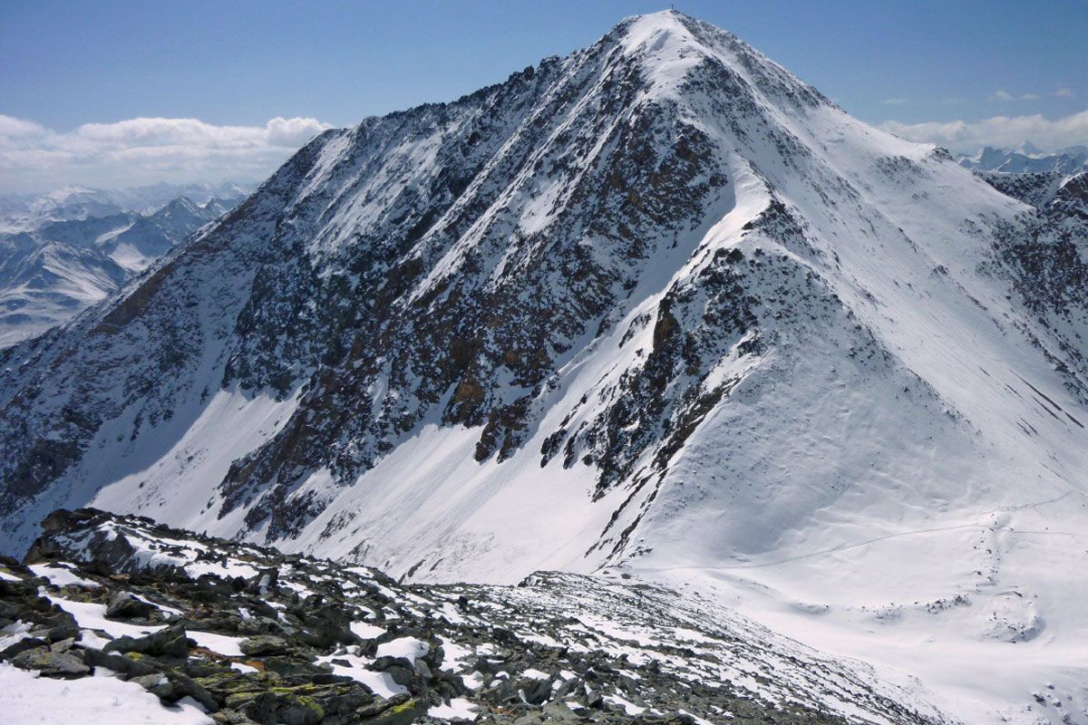
The Dorfertal just before the Hohe Tauern National Park is a real tour paradise and is not unknown by the majority of Alpine skiers as part of a climb of the Venediger. The ice-free Tulpspitze is located to the south-east of Johannishütte and is a lovely tour destination which makes a stay in an Alpine lodge one which is worthy of extending. Scaling the Tulpspitze from the valley is of course not a problem, you just have to be an ‘early bird’ in the Dorfertal, where there is a risk of avalanche.
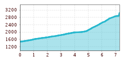
The valley town is Hinterbichl (1329 m). The branch-off into Dorfertal is 500 m to the west edge of the town. Ascend to the locked barriers at the Steinbruch (1480 m), where there are a few car parking spaces. Depending on the snow conditions the route may also be shortened by taking the lodge taxi, otherwise up to the junction for the Tulpspitze there is around 5 km to cover on the road. We now head through the long valley, crossing the fantastic arched bridge at the second Steinbruch and via the east-facing slopes, which often have huge avalanche cones, to the Gumbachkreuz, which can be seen from quite a distance. Via the flat bottom of the valley continuing to Ochsnerhütte (2000 m), where the ascent proceeds on the west side on the steep flanks. From here we head slightly out of the valley in merciless hairpin bend terrain (west, 30°) in the hidden corrie between the Tulp- and Zopetspitze. At around 2600 m we reach flatter terrain and the ski track swings in a sort of loop to the south. A ramp now takes us beneath the flanks of the Kreuzspitze, again heading east into a little wind gap (2948 m) between the Kreuz- and Tulpspitze. The final 100 metres altitude drag somewhat and are tackled mostly on foot along the tracks across the wide southern ridge (4 ½ - 5 hours from the valley, 3 hours from Johannishütte). Descent along the ascent track.Additional ski tour tips can be obtained in the ski tour guides by Thomas Mariacher. These are available here: www.grafikzloebl.at/verlag/buecher/
Bus stop Prägraten a. G. Hinterbichl
Car park Wiesenkreuz 1.490m
