Trail running Pfunds-Nauders | Terra Raetica Trails

Pfunds / Ötztal Alps
Route length: 18.2 km
Duration: 9:00 h

A long but equally beautiful trail run over the Sadererjoch to Nauders.

Tour information

  • Length: 18.2 km
  • Duration: 9:00 h
  • Elevation uphill:1,530 hm
  • Elevation downhill:1,083 hm
Highest point2,398 m

Starting point

Roundabout | Pfunds village

Finishing point

Information Office | Nauders
  • Fitness level 5 / 6
  • Technique 4 / 6

Best time of year

  • January
  • February
  • March
  • April
  • May
  • June
  • July
  • August
  • September
  • October
  • November
  • December

Equipment

We recommend equipment suitable for the tour and weather conditions, including sturdy shoes, weatherproof clothing, food, and appropriate maps.
Source: TVB Tiroler Oberland

Description

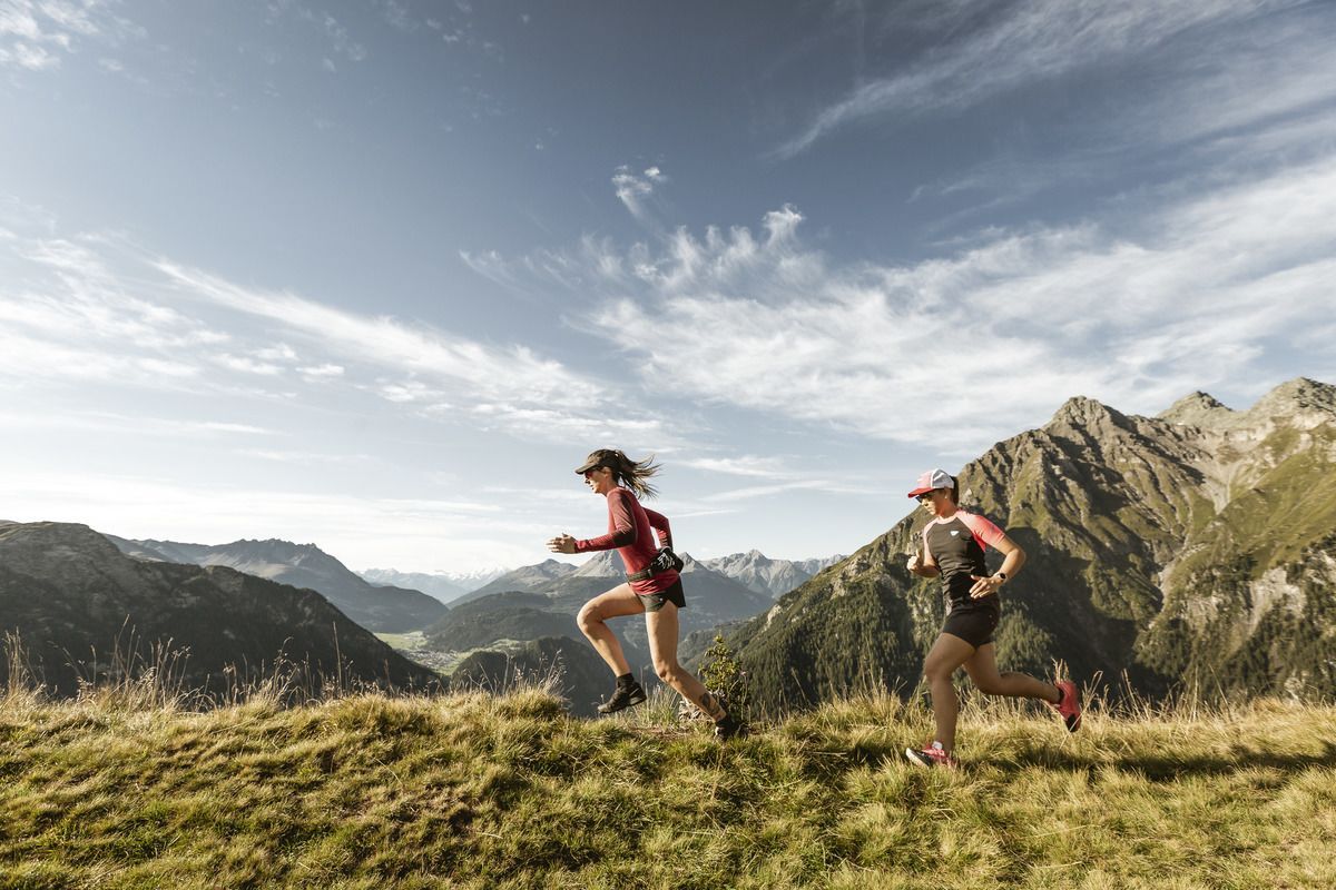
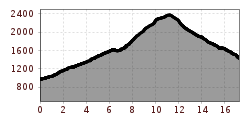
At the beginning, follow route O4 through the Pfundser Klamm gorge. At the end of the gorge, continue a little further through the Radurschl valley until you branch off to the west and follow the path to the Sadererjoch. The route now climbs steadily until you reach the pass at 2397 metres. If you still have some energy left, you can walk the additional 300 metres up to the Schmalzkopf, a fantastic panoramic mountain. The route now takes you down to the Labaunalm and onwards to Parditsch via some steep trails. Don't follow the tarmac road there, but instead keep to the left and follow the beautiful alternating forest track and path to Nauders.

Getting here

  • Arrival by public transport

    Bus route 210
    Pfunds Dorf bus stop

  • Parking

    Pfunds village roundabout
    free of charge

Newsletter

The mountain is calling? So does our newsletter!

In our monthly newsletter we reveal the best holiday tips for Tyrol.