


Length:22.8 kmElevation uphill:1,110 m
TschirgantSkyRun TS26
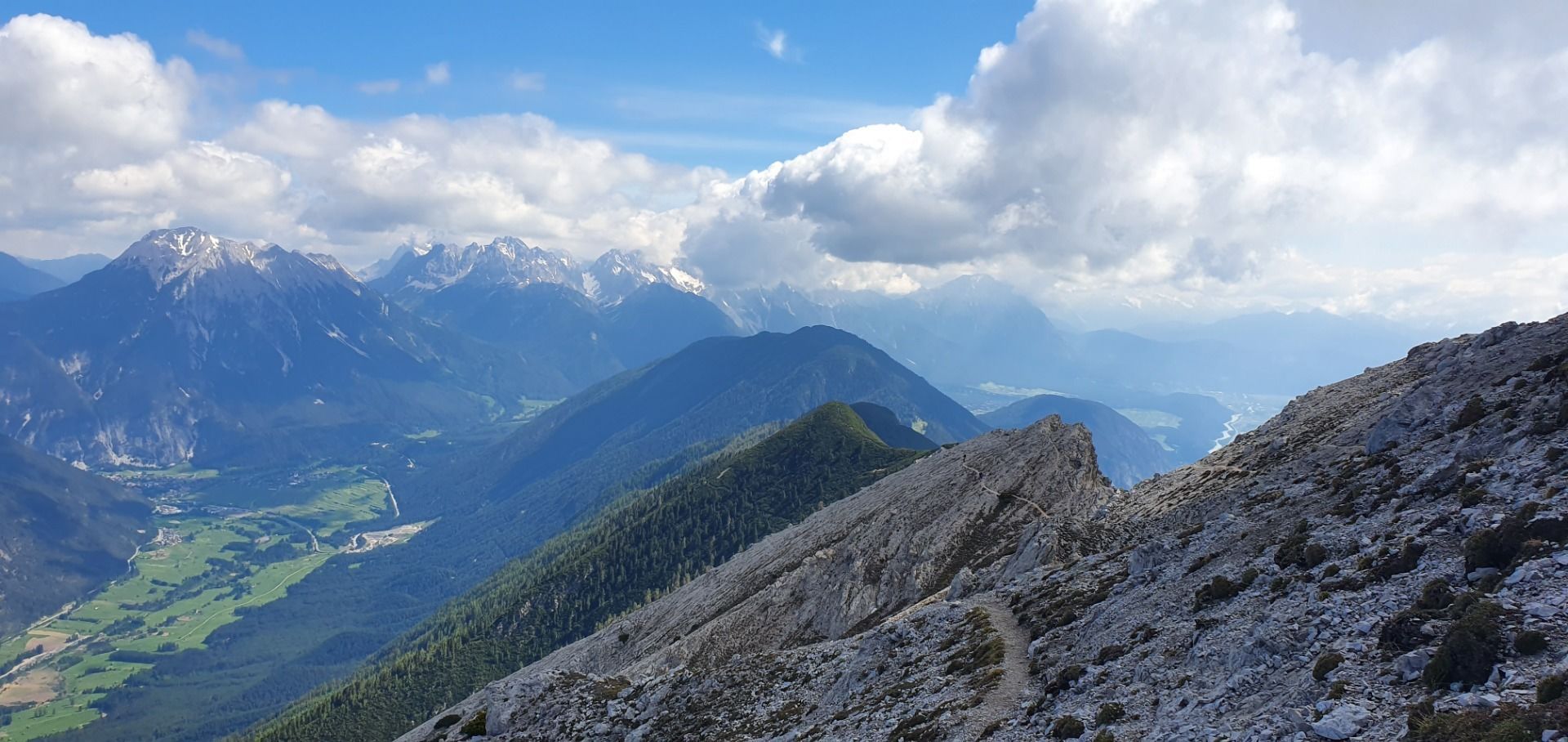
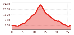
The Tschirgant Sky Run TS26 starts at the Imst Stadium, takes you through a short Gurgeltal loop and rolling meadows to Karrösten, then up a beautiful alpine path to the Karrösteralm. A short stretch of forest path follows before the technically challenging section up to the Tschirgant. The breathtaking ridge of the Tschirgant separates the Inntal and Gurgltal valleys. The technical downhill is sure to make trail runners' hearts race, before the run continues across rolling meadows from Karres towards Karrösten. From there, another narrow path leads you to the stadium, where you can cross the finish line after 26k and 1900m of elevation gain.,


.JPG")


 Andi Frank_TVB PillerseeTal (133).jpg")
")

.png")

