Contact
Juraj Mikušová
9974 Prägraten
0043/664/9758893
clarahuette@virgental.at
The Clara Hütte (2,038 metres) is a small German Alpine Club mountain refuge in the Umbaltal Valley, East Tirol. It is only open in summer.
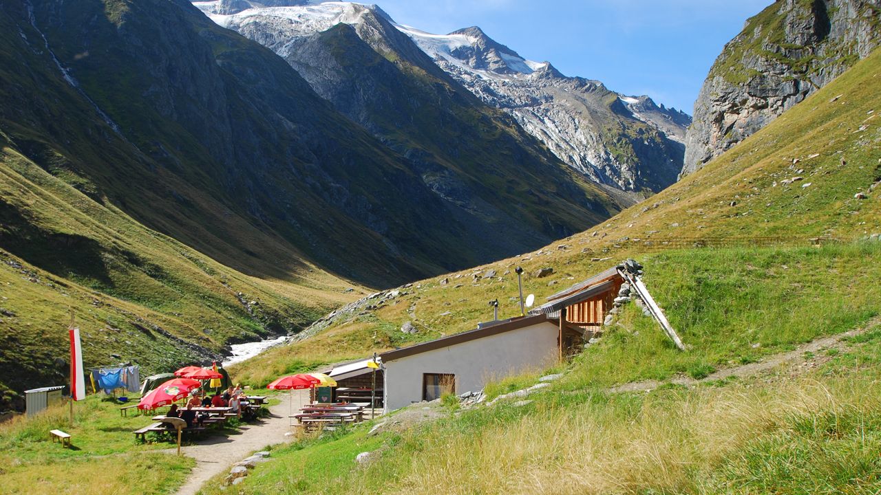

Charming mountain refuge hut in the beautiful Umbaltal Valley
German Alpine Club, Essen Division
Johann Stüdl, the famous promoter of alpinism in the Eastern Alps, commissioned the building of the Clara Hütte in 1872, making it one of the oldest mountain refuge huts in the Venediger Region. The stunning location close to Umbalsee lake, surrounded by majestic three-thousand-metre-high peaks, also has its pitfalls. It suffered extensive avalanche damage in 1914, 1926 and 2012, which is why the hut is now surrounded by protective stone walls. Guests need not worry, however, because the hut is only open in summer. The Clara Hütte is a popular starting point for glacier hikes and challenging mountaineering adventures. The Umbalgletscher Glacier Trail and demanding "Alpenkönigroute" (Alpine King Route) are among the most popular. Well known nearby mountains: Rötspitze, Dreiherrnspitze, Hohes Kreuz, Quirl, Simonyspitzen, Mittlere Malhamspitze, Steingrubenkogel, Ahrnerkopf.
Prägraten in East Tirol, Ströden car park, to Pebellalm – Islitzeralm – Umbalfälle (2.5 hours, easy accessibility for senior citizens and children). More information on hike.
Umbalgletscher Glacier Trail (2,430 metres), 2 hours, intermediate
Hohes Kreuz (3,157 metres), 5 hours, difficult
Westl. Simonyspitze (3,488 metres), 5 hours, difficult (glacier crossing)
Ahrnerkopf (3,051 metres), 4 hours, intermediate
Hintere Gubachspitze (3,388 metres), 4.5 hours, difficult
Essen-Rostocker-Hütte, 7.5 hours
Neue Reichenberger Hütte, 4.5 hours
Kleine-Philipp-Reuter-Hütte, 2.25 hours
Lenkjöchlhütte (Alto Adige, Italy), 4.5 hours


")


