Contact
Veronika&Matteo Bachmann
00000
0043/4876/8209
info@stuedlhuette.at
The Stüdlhütte (2,801 metres) is a modern mountain refuge often used by mountaineers wishing to conquer the Großglockner, Austria's highest mountain.

Important base for ascents of the Großglockner
German Alpine Club, Oberland Division
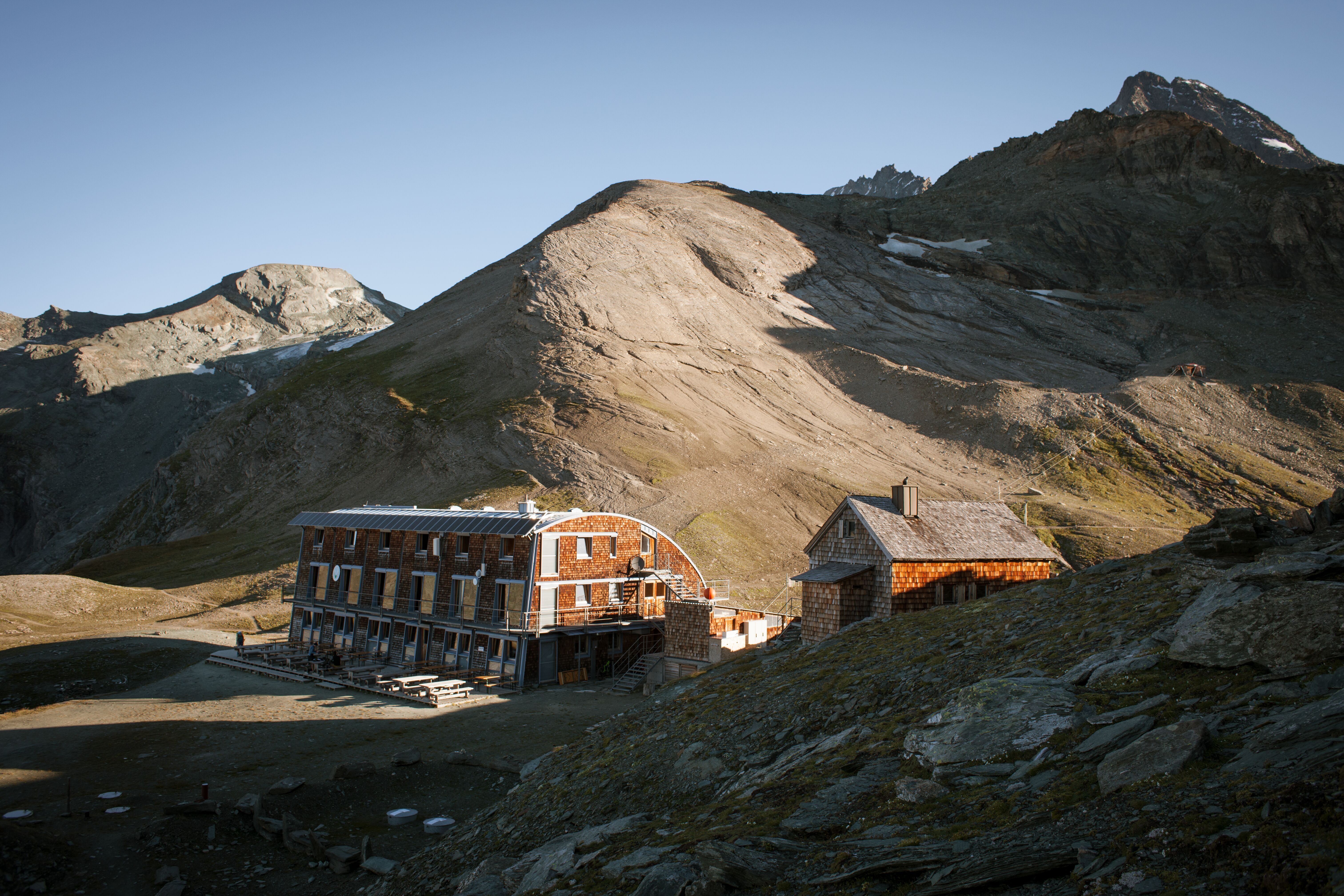
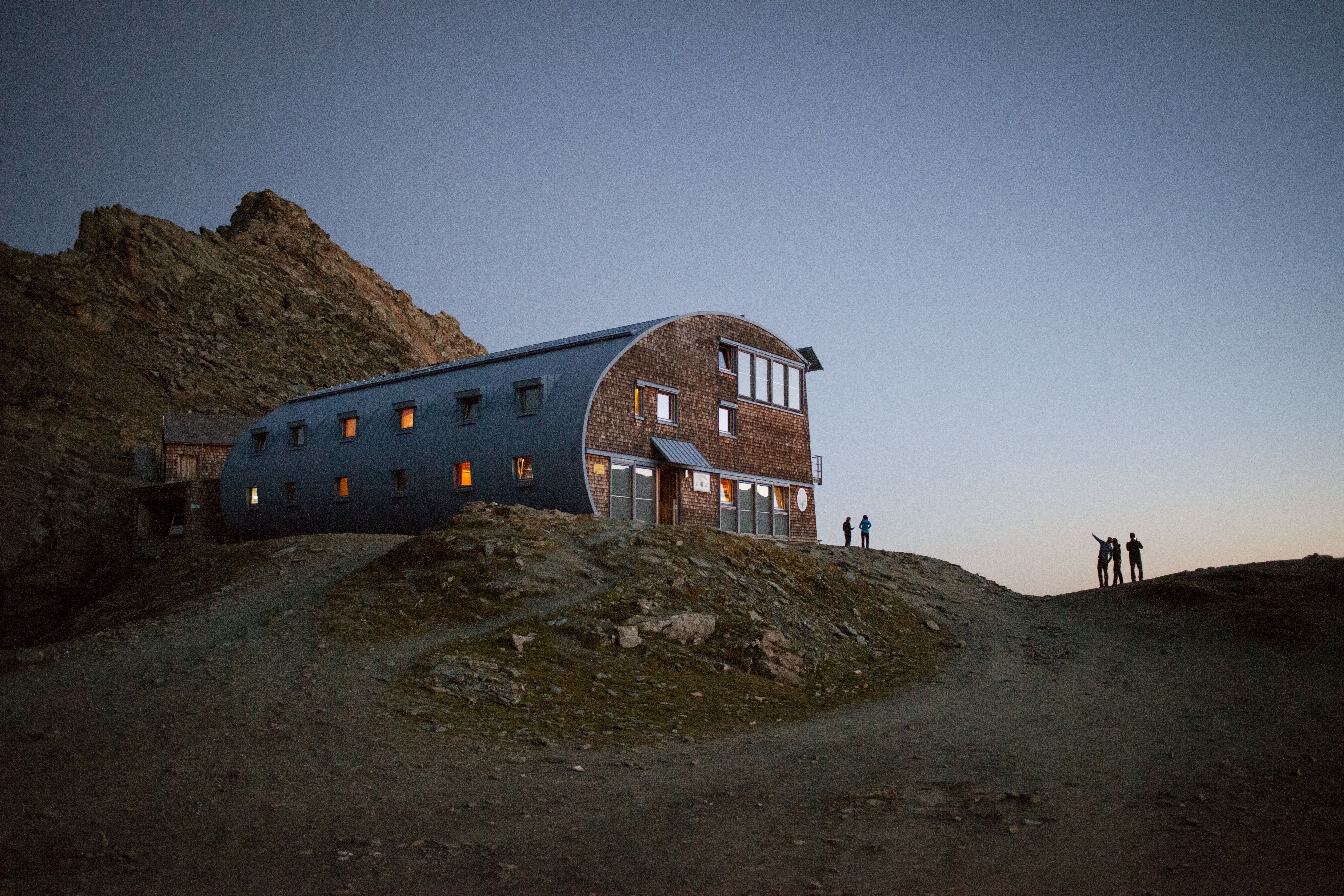
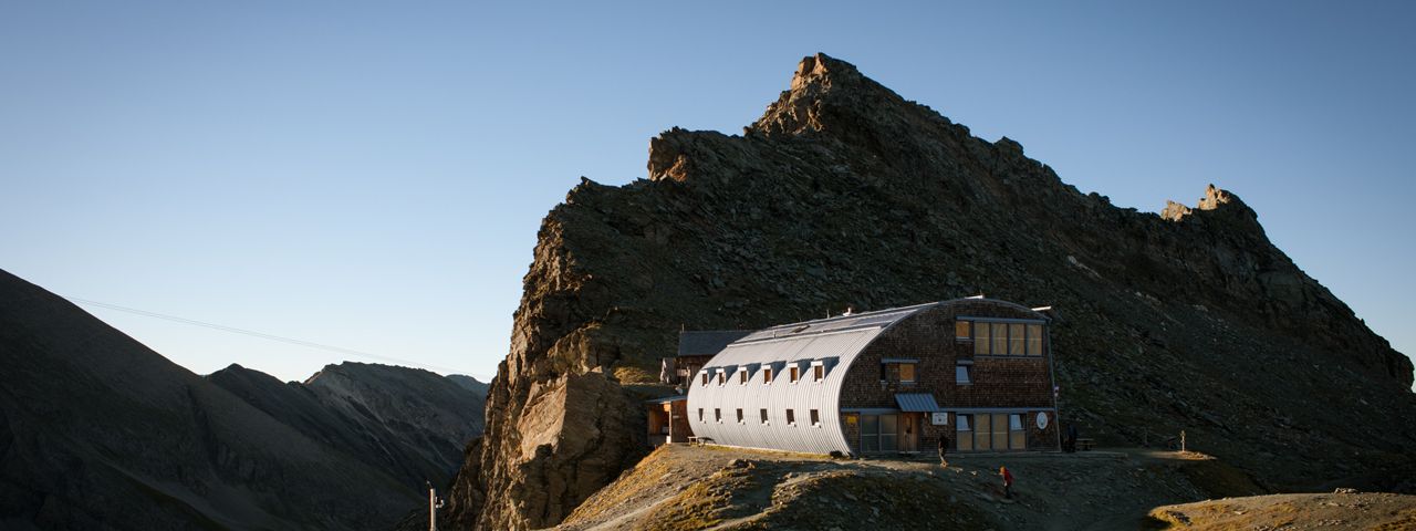
This hut looks very different to other mountain refuges with its contemporary, cylindrical architecture, adapted to suit both the mountains and mountain weather. The new building was opened in 1996, whose traditional predecessor can be traced back to Johann Stüdl. He was a mountain-loving businessman from Prague and one of the founders of the German Alpine Club. Because of his efforts in creating the New Kals Way and the Stüdlhütte - which was inaugurated in 1868 as a base for ascents of the Großglockner via the Fanatscharte ridge - Kals developed into an important base for climbing Austria's highest mountain. The new Stüdlhütte is equipped to the highest technical standards, with solar energy and a vegetable-oil-driven combined heat and power unit (CHP). It sleeps around 100 people.
From Kals am Großglockner in 5 hours, from Lucknerhaus (accessible via toll road) through the Ködnitztal Valley in 3 hours, from Gasthof Taurerwirt near Spöttling through the Teischnitztal Valley in 5 hours
Fanatkogel (2,905 metres), 30 minutes, intermediate
Schere (3,043 metres), 45 minutes, intermediate
Teufelswand / Romariswandkopf (3,511 metres), 5 hours, difficult (glacier crossing)
Großglockner (3,798 metres) via Stüdlgrat, 5 hours, difficult (glacier crossing, climbing sections rated up to IV)
Großglockner (3,798 metres), normal route via Adlersruhe, 5 hours, difficult (crevasses, climbing sections rated up to II)
Salmhütte, 4 hours
Glorer Hütte, 2.5 hours
Kalser Tauernhaus, 5.5 hours
Erzherzog-Johann-Hütte, 2.5 hours
Lucknerhaus, 2.5 hours
The Stüdlhütte marks the end of Stage 8 and the start of Stage 9 of the Eagle Walk, a long-distance hiking trail crossing Tirol in 33 stages.


