Landshuter Hütte-Kraxentrager (2.999)Difficulty: difficult Length: 8.0 km Duration: 5:00 h Elevation uphill: 1,650 m See trailMore about Landshuter Hütte-Kraxentrager (2.999)
Round tour OttenspitzDifficulty: medium Length: 7.0 km Duration: 3:30 h Elevation uphill: 735 m See trailMore about Round tour Ottenspitz
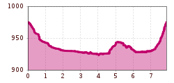
Stage 4: From Wettersteinhütte to Leutasch – Tyrol’s 1. Winter Multi-day HikeOpening hours: open Difficulty: medium Length: 9.5 km Duration: 3:30 h Elevation uphill: 25 m Go to winter hikeMore about Stage 4: From Wettersteinhütte to Leutasch – Tyrol’s 1. Winter Multi-day Hike
Stage 1: From Schanz to Weidach – Tyrol’s 1. Winter Multi-day HikeOpening hours: open Difficulty: medium Length: 14.2 km Duration: 3:30 h Elevation uphill: 140 m Go to winter hikeMore about Stage 1: From Schanz to Weidach – Tyrol’s 1. Winter Multi-day Hike
Stage 3: From Mösern to Wettersteinhütte – Tyrol’s 1. Winter Multi-day HikeOpening hours: open Difficulty: medium Length: 14.0 km Duration: 6:00 h Elevation uphill: 718 m Go to winter hikeMore about Stage 3: From Mösern to Wettersteinhütte – Tyrol’s 1. Winter Multi-day Hike
Högtrail 7081Opening hours: closed Difficulty: easy Length: 3.8 km Go to biketourMore about Högtrail 7081
Bach - Memminger HütteDifficulty: medium Length: 13.6 km Duration: 5:45 h Elevation uphill: 1,200 m See trailMore about Bach - Memminger Hütte
Kaisers - Kaiserjoch-HausDifficulty: medium Length: 6.6 km Elevation uphill: 919 m See trailMore about Kaisers - Kaiserjoch-Haus
Stage 2: From Leutasch to Mösern – Tyrol’s 1. Winter Multi-day HikeOpening hours: open Difficulty: medium Length: 16.0 km Duration: 5:00 h Elevation uphill: 402 m Go to winter hikeMore about Stage 2: From Leutasch to Mösern – Tyrol’s 1. Winter Multi-day Hike
Summit hike Salfainssee - Schaflegerkogel (2,405 m) - Kemater Alm mountain hutDifficulty: medium Length: 14.8 km Duration: 7:00 h Elevation uphill: 1,029 m See trailMore about Summit hike Salfainssee - Schaflegerkogel (2,405 m) - Kemater Alm mountain hut
Bannwaldsee circuitDifficulty: medium Length: 94.5 km Duration: 3:45 h Elevation uphill: 877 m Go to biketourMore about Bannwaldsee circuit
BiathlonpfadDifficulty: medium Length: 14.0 km Duration: 4:00 h Elevation uphill: 360 m See trailMore about Biathlonpfad
Berwang - To the Sennalpe RaazDifficulty: medium Length: 16.6 km Duration: 3:30 h Elevation uphill: 768 m Go to biketourMore about Berwang - To the Sennalpe Raaz
Hamberg (2095m) from the Gasthof Almluft (Trail No. 37)Difficulty: medium Length: 9.4 km Duration: 4:45 h Elevation uphill: 865 m See trailMore about Hamberg (2095m) from the Gasthof Almluft (Trail No. 37)
Museum goes wild - digital circular walkDifficulty: easy Length: 700 m Duration: 0:30 h See trailMore about Museum goes wild - digital circular walk
Peter Habeler RundeDifficulty: difficult Length: 41.3 km Duration: 17:00 h Elevation uphill: 2,236 m See trailMore about Peter Habeler Runde
Foodie TrailDifficulty: easy Length: 3.0 km Duration: 1:39 h Elevation uphill: 210 m See trailMore about Foodie Trail
Berwang circular hike AlmkopfDifficulty: easy Length: 8.9 km Duration: 3:30 h Elevation uphill: 466 m See trailMore about Berwang circular hike Almkopf
Mountain station Spieljochbahn - Hochfügen Difficulty: medium Length: 12.2 km Duration: 4:00 h Elevation uphill: 270 m See trailMore about Mountain station Spieljochbahn - Hochfügen
Mountain Hike to the WedelhütteDifficulty: medium Length: 3.0 km Duration: 3:00 h Elevation uphill: 490 m See trailMore about Mountain Hike to the Wedelhütte
Hike to Neuen Reichenberger HütteDifficulty: medium Length: 9.1 km Duration: 9:00 h Elevation uphill: 1,210 m See trailMore about Hike to Neuen Reichenberger Hütte
Winter hiking trail Speichersee-GfasDifficulty: easy Length: 3.5 km Duration: 2:30 h Elevation uphill: 103 m Go to winter hikeMore about Winter hiking trail Speichersee-Gfas
Hiking tour to Lasörlinghütte 2.350mDifficulty: medium Length: 14.6 km Duration: 7:10 h Elevation uphill: 1,080 m See trailMore about Hiking tour to Lasörlinghütte 2.350m
Hut hike: Ginzling Schlegeis reservoir - OlpererhütteDifficulty: medium Length: 6.1 km Duration: 3:00 h Elevation uphill: 600 m See trailMore about Hut hike: Ginzling Schlegeis reservoir - Olpererhütte
Give feedback for a chance to win a special holiday experience!Click here for the surveyClick here for the survey


.jpg")
.jpg")
.jpg")


")

 neu.jpg")


