Mountain hikes Hike to Neuen Reichenberger Hütte

Prägraten am Großvenediger / Venedigergruppe
Difficulty ratings: medium
Route length: 9.1 km
Duration: 9:00 h

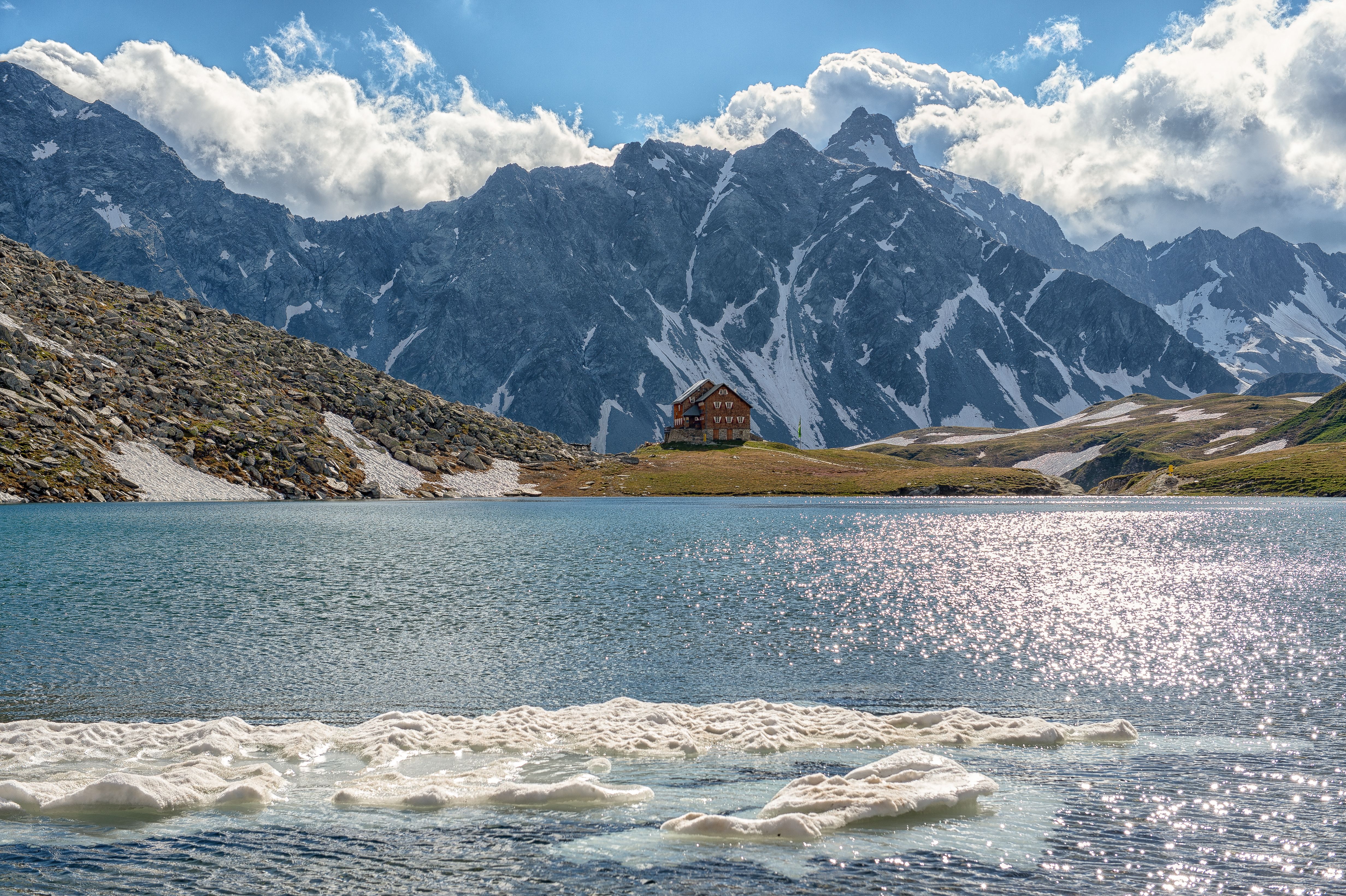
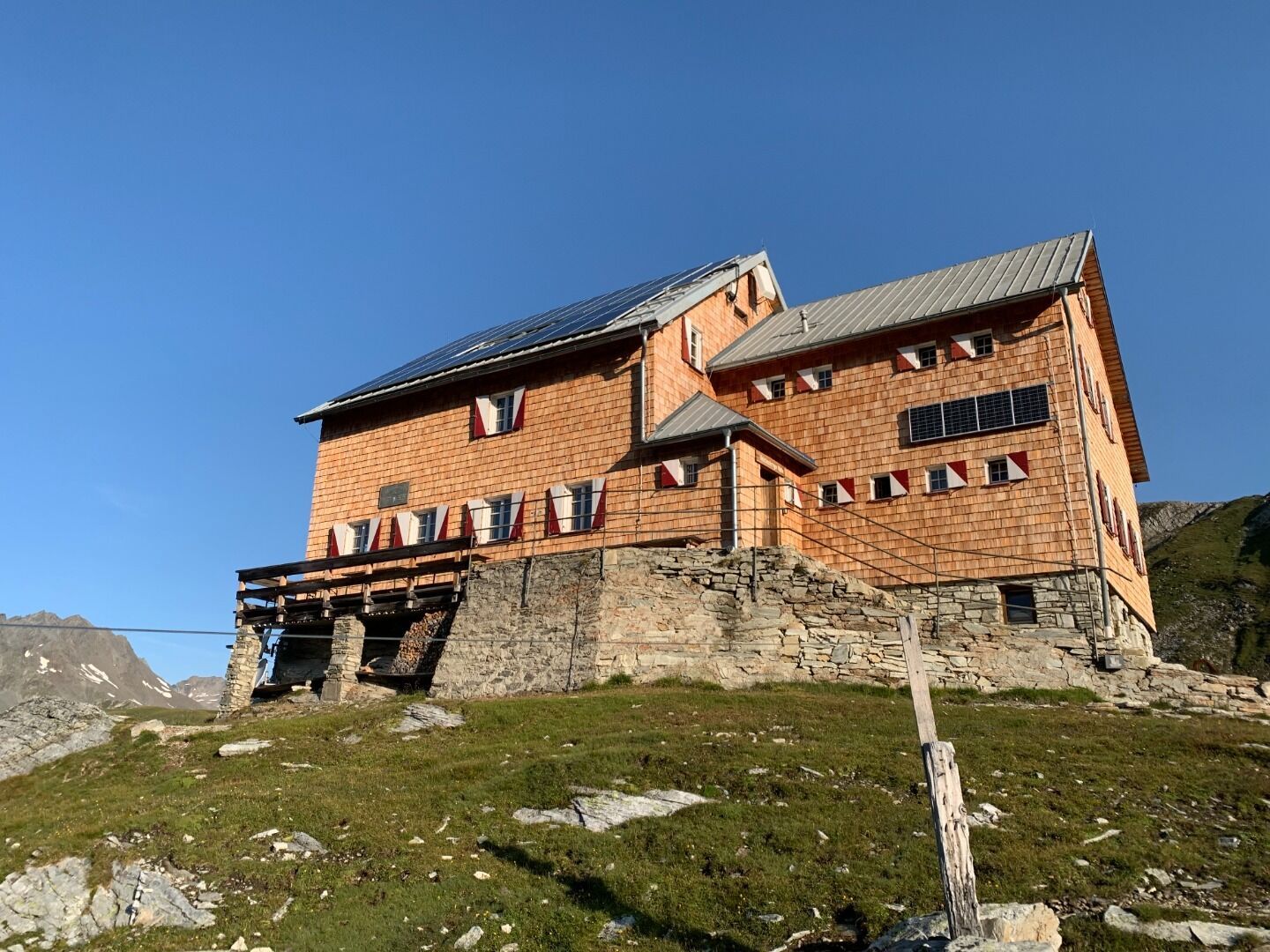
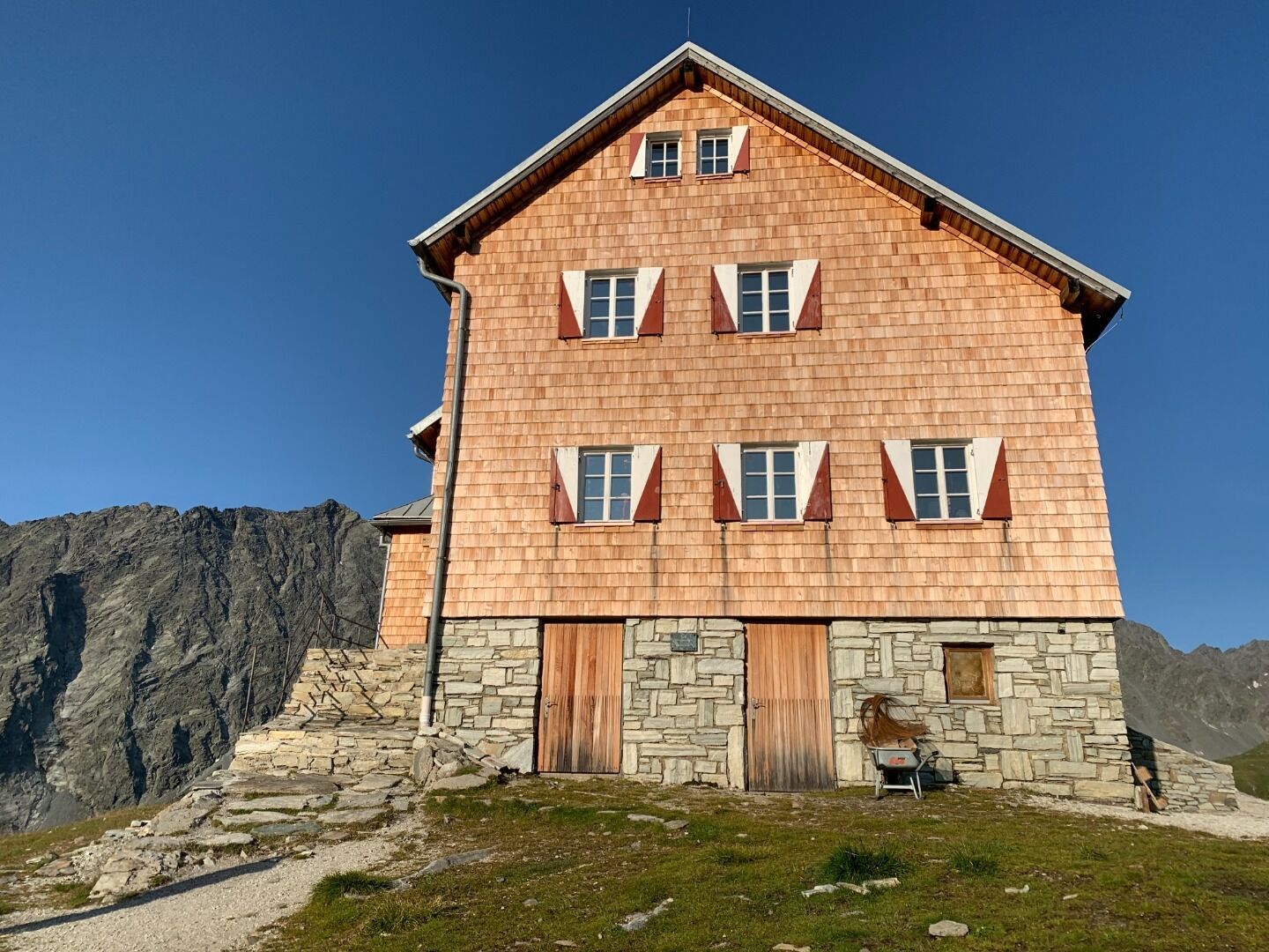
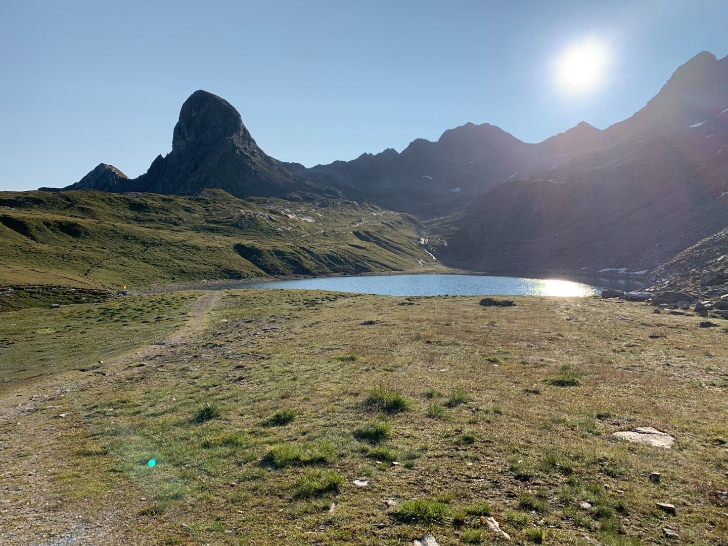
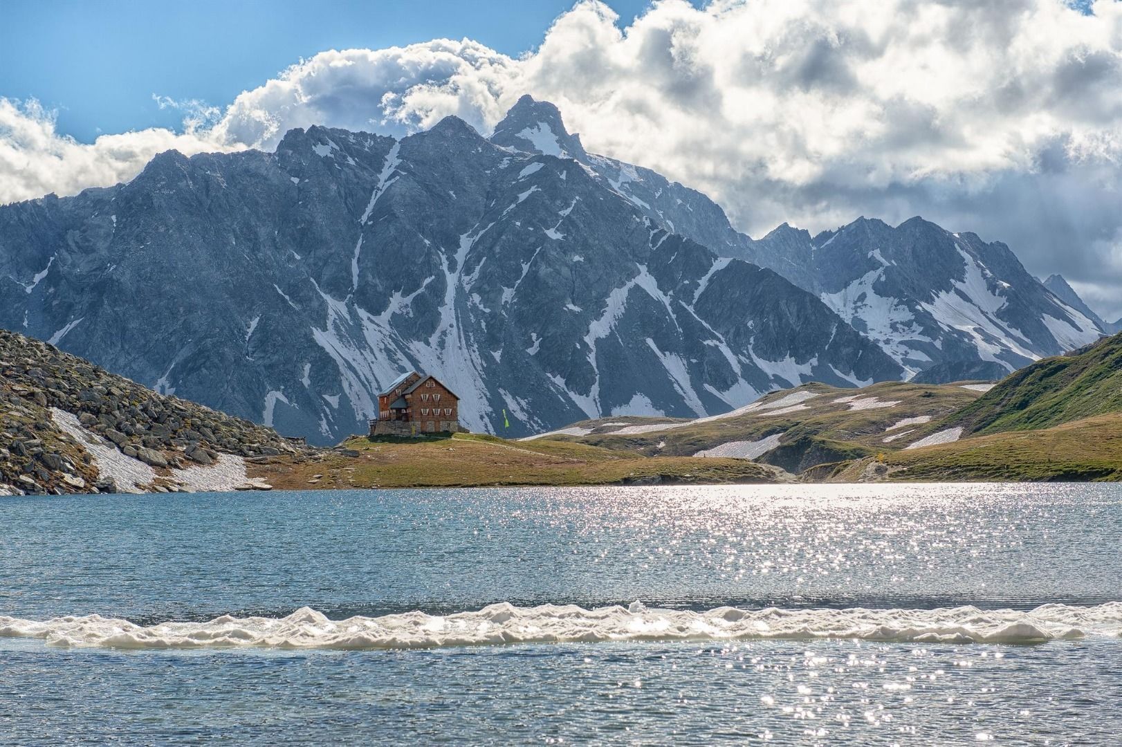
Panargenkamm, Lasörlinggruppe, Trojeralmtal - even connoisseurs of East Tyrol rarely hear these names. Yet the secluded area between the Virgen and Deferregental valleys, where gently rolling alpine pastures meet majestic mountain massifs, is beautiful. The fantastic location of the Neue Reichenberger Hütte is underlined by the pretty Bödensee lake, which is just a stone's throw away.

Tour character

This moderately difficult hike leads from the Trojeralm parking lot through the picturesque landscape of the rear Defereggen Valley. Passing the Trojeralm snack station, the route follows gently ascending paths to the Hintere Trojeralmen before taking the path along the side of the slope towards Sentenböden. The final ascent to the Reichenberger Hütte is steeper, but rewards you with a magnificent view of the surrounding mountains - and a dip in the Bödensee lake.

Tour information

  • Requirement: medium
  • Length: 9.1 km
  • Duration: 9:00 h
  • Elevation uphill:1,210 hm
  • Elevation downhill:1,210 hm
Highest point2,600 m

Starting point

Parkplatz Ströden

Finishing point

Parkplatz Ströden
  • Fitness level 4 / 6
  • Technique 3 / 6

Best time of year

  • January
  • February
  • March
  • April
  • May
  • June
  • July
  • August
  • September
  • October
  • November
  • December
Source: Nationalparkregion Hohe Tauern Osttirol

Description

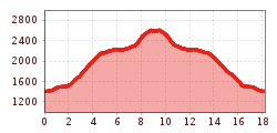
The hike to Neue Reichenberger Hütte starts from Ströden carpark, which is conveniently accessible by post bus. From here, walk across the broad driveway to get to Islitzer- and Pebellalm in half an hour. From here on, the walkway leads through Großbachtal Valley, passing by Stürmitzalm and Großbachalm. All in all, it takes 4 hours to walk up to Neue Reichenberger Hütte, where you will be right away rewarded with a view onto Lake Bödensee.

Neue Reichenberger Hütte is also a perfect place to stop by when you walk the Lasörling High Route or serves as starting point for further excursions to mountain peaks.

Getting here

  • Arrival by public transport

    Prägraten a.G. Ströden

  • Parking

    Parkplatz Ströden

More tours in the surrounding area

  • Venediger altitude trail

    Difficulty: difficult
    Length: 55.5 km Duration: 27:00 h Elevation uphill: 3,915 m
  • Lasörling 3.098m

    Difficulty: difficult
    Length: 21.9 km Duration: 12:00 h Elevation uphill: 1,940 m
  • Umbal waterfalls nature force trail

    Difficulty: easy
    Length: 5.8 km Duration: 2:30 h Elevation uphill: 250 m
  • Hike to the Venedigerhaus Innergschlöß

    Difficulty: easy
    Length: 8.5 km Duration: 2:30 h Elevation uphill: 180 m
  • Hiking tour to Neue Sajathütte 2.600m

    Difficulty: medium
    Length: 10.3 km Duration: 6:50 h Elevation uphill: 1,080 m
  • Hiking tour to Lasörlinghütte 2.350m

    Difficulty: medium
    Length: 14.6 km Duration: 7:10 h Elevation uphill: 1,080 m
  • Lasörling altitude trail

    Difficulty: medium
    Length: 57.0 km Duration: 25:00 h Elevation uphill: 3,740 m
  • Figerhorn

    Difficulty: difficult
    Length: 6.5 km Duration: 6:00 h Elevation uphill: 807 m
  • Muhs panorama trail

    Difficulty: medium
    Length: 15.2 km Duration: 6:00 h Elevation uphill: 1,090 m
  • Hike to Kalser Tauernhaus

    Difficulty: medium
    Length: 12.2 km Duration: 4:00 h Elevation uphill: 244 m
  • Badener Hütte

    Difficulty: difficult
    Length: 23.2 km Duration: 11:30 h Elevation uphill: 1,750 m
  • Lucknerhaus - Stüdlhütte

    Difficulty: medium
    Length: 9.3 km Duration: 5:30 h Elevation uphill: 862 m
  • Böses Weibl

    Difficulty: difficult
    Length: 14.1 km Duration: 8:00 h Elevation uphill: 1,193 m
  • Rotenkogel

    Difficulty: difficult
    Length: 3.9 km Duration: 3:00 h Elevation uphill: 383 m
Newsletter

The mountain is calling? So does our newsletter!

In our monthly newsletter we reveal the best holiday tips for Tyrol.