Long-distance hike Carnic altitude trail. Stage 3: Obstansersee Hütte – Porzehütte

Kartitsch / Karnischer Hauptkamm
Difficulty ratings: medium
Route length: 11.3 km
Duration: 6:00 h

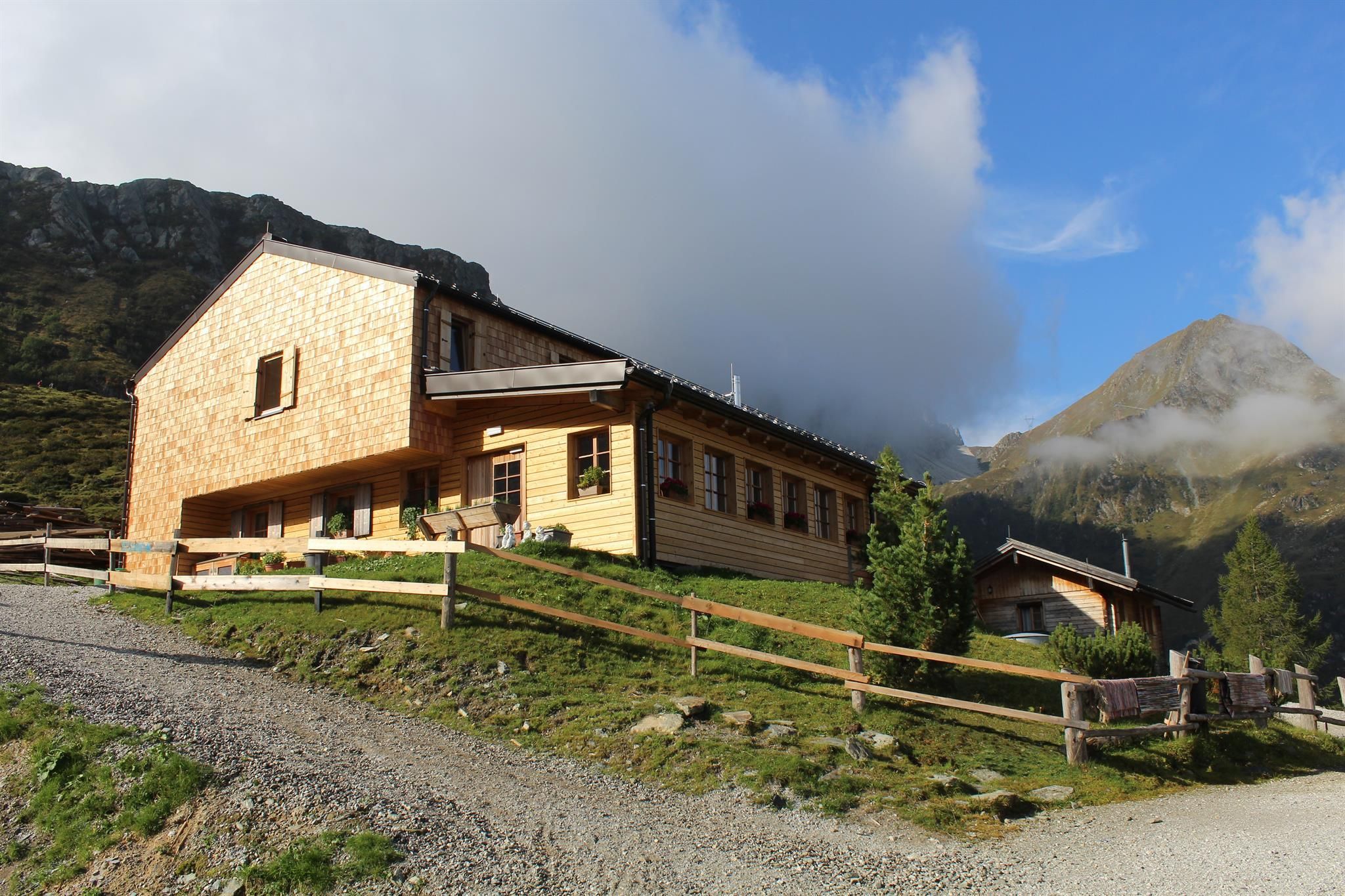
On the third day of long-distance hiking, routine sets in: pack, check the weather, start walking. We have found our walking mode and are looking forward to a new, not too long day of hiking against a magnificent backdrop. And the stage destination, the Porzehütte, also sounds promising: a picturesque panoramic location with good food. Luxury in Tyrolean style.

Tour character

Medium-difficulty stage on red mountain paths. The route requires surefootedness, good walking technique and a good level of fitness.

Tour information

  • Requirement: medium
  • Length: 11.3 km
  • Duration: 6:00 h
  • Elevation uphill:650 hm
  • Elevation downhill:1,020 hm
Highest point2,678 m

Starting point

Obstansersee Hütte

Finishing point

Porzehütte
  • Fitness level 4 / 6
  • Technique 3 / 6

Best time of year

  • January
  • February
  • March
  • April
  • May
  • June
  • July
  • August
  • September
  • October
  • November
  • December
Source: Hochpustertal

Description

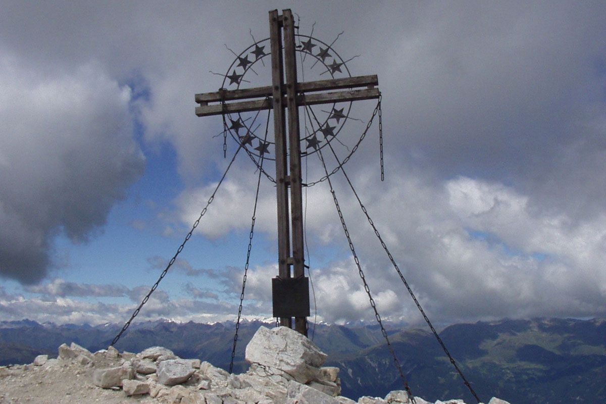
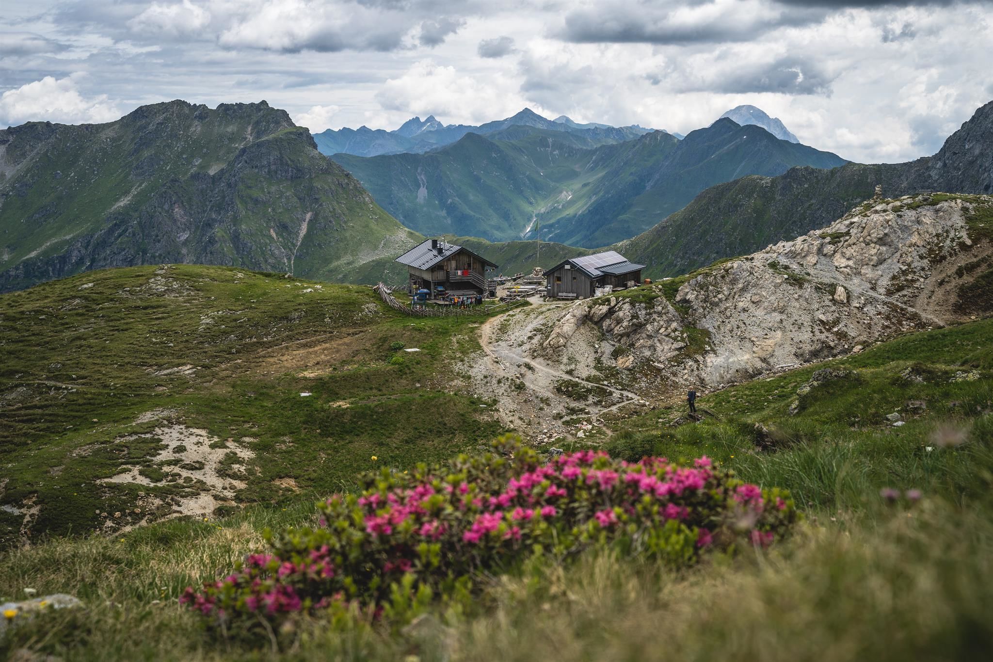
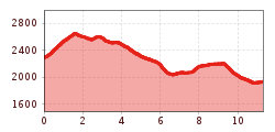
From Obstansersee Hütte the Carnic altitude trail is well signposted, proceeding steeply uphill initially to the Pfannspitze and from there past a stony bouldered area at the Kleinen and Gr. Kingiat (those of you who are fit can hike to the summit of the Gr. Kinigat which has the European Cross – a head for heights and surefootedness required). Just after the Gr. Kinigat descend to the Filmoor Standschützenhütte. After some refreshments in the Filmoor Standschützenhütte continue to the upper Stuckensee and on to Porzehütte.


Nearby huts and mountain restaurants

More tours in the surrounding area

  • Rote Spitze 2,956 m

    Difficulty: medium
    Length: 10.2 km Duration: 5:30 h Elevation uphill: 1,260 m
  • Oberstalleralm

    Difficulty: easy
    Length: 2.8 km Duration: 0:50 h Elevation uphill: 170 m
  • Volkzeiner Hütte

    Difficulty: easy
    Length: 13.4 km Duration: 3:30 h Elevation uphill: 370 m
  • Höfe Trail stage 1: Sillian - Kartitsch

    Opening hours: closed
    Difficulty: easy
    Length: 11.7 km Duration: 3:00 h Elevation uphill: 551 m
  • Herz-Ass Villgratental

    Difficulty: medium
    Length: 76.0 km Duration: 34:00 h Elevation uphill: 5,750 m
  • Lake Schwarzsee

    Difficulty: medium
    Length: 7.8 km Duration: 3:30 h Elevation uphill: 790 m
  • Golzentipp 2.317 m

    Difficulty: easy
    Length: 5.6 km Duration: 2:00 h Elevation uphill: 267 m
  • Toblacher Pfannhorn

    Difficulty: medium
    Length: 9.8 km Duration: 4:30 h Elevation uphill: 1,020 m
  • Dorfberg

    Difficulty: medium
    Length: 17.6 km Duration: 5:30 h Elevation uphill: 770 m
  • Große Kinigat

    Difficulty: difficult
    Length: 8.5 km Elevation uphill: 1,250 m
  • Ganalm-Walderalm

    Difficulty: difficult
    Length: 15.4 km Duration: 4:00 h Elevation uphill: 662 m
  • The Höfe Trail

    Difficulty: easy
    Length: 50.6 km Duration: 10:15 h Elevation uphill: 1,882 m
Newsletter

The mountain is calling? So does our newsletter!

In our monthly newsletter we reveal the best holiday tips for Tyrol.