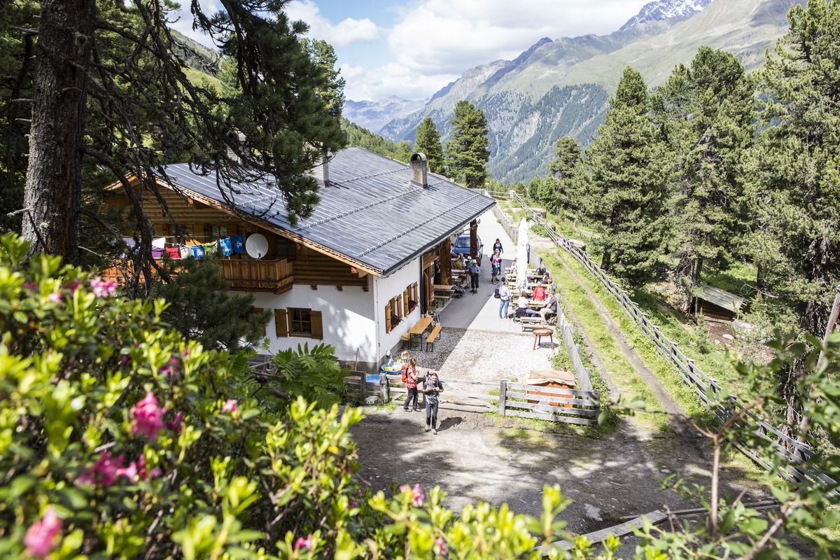
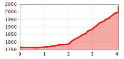
The wheelchair hike to the Nassereinalm is a somewhat more challenging tour with steep and rocky passages. However, it is easily manageable with a Swiss Trac.
Open interactive mapOpen this POI on the interactive mapElevation profiledownloadRolli-Wanderung Nassereinalm.gpx
©-TVB-Tiroler-Oberland-Kaunertal-Michael-Veit-Klima-Führer-2018-Gepatsch-Nasserein © Michael Veit Sternenweg im GepatschDifficulty:mediumLength:4.0 kmDuration:1:30 hElevation uphill:202 mSee trailSee trail: Sternenweg im Gepatsch
Nauders mountain trailDifficulty:mediumLength:18.0 kmDuration:7:00 hElevation uphill:407 mSee trailSee trail: Nauders mountain trail
Großer MutzkopfOpening hours:closedDifficulty:easyLength:10.3 kmDuration:4:00 hElevation uphill:507 mSee trailSee trail: Großer Mutzkopf
Schwarzer and Grüner SeeDifficulty:easyLength:8.3 kmDuration:4:30 hElevation uphill:368 mSee trailSee trail: Schwarzer and Grüner See
©-TVB-Tiroler-Oberland-Kaunertal-Michael-Veit-Klima-Führer-2018-Talwanderweg-Vergötschen-Platz-2018 © Michael Veit Talwanderweg KaunertalDifficulty:easyDuration:2:30 hElevation uphill:295 mSee trailSee trail: Talwanderweg Kaunertal
Gallruth Stollenwanderung_Daniel Zangerl.jpg © Daniel Zangerl Kaunerberger WasserwegOpening hours:openDifficulty:mediumLength:15.2 kmDuration:6:00 hElevation uphill:935 mSee trailSee trail: Kaunerberger Wasserweg
Brandenburgerhaus © Katharina Schatz Ötztal Trek Stage 15Difficulty:difficultLength:6.5 kmDuration:2:30 hElevation uphill:332 mSee trailSee trail: Ötztal Trek Stage 15
©-TVB-Tiroler-Oberland-Kaunertal-Daniel-Zangerl-2016-Gepatschhaus-(3).jpg © Daniel Zangerl Rolli-Wanderung GepatschhausLength:8.5 kmDuration:1:45 hElevation uphill:156 mSee trailSee trail: Rolli-Wanderung Gepatschhaus
©-TVB-Tiroler-Oberland-Kaunertal-Daniel-Zangerl-Aifneralm-2016-(19).jpg © Daniel Zangerl Rolli-Wanderung Aifner AlmDifficulty:mediumLength:6.0 kmDuration:2:30 hElevation uphill:460 mSee trailSee trail: Rolli-Wanderung Aifner Alm
©-TVB-Tiroler-Oberland-Kaunertal-Daniel-Zangerl-Falkaunsalm-2016-(6).jpg © Daniel Zangerl Rolli-Wanderung FalkaunsalmDifficulty:mediumLength:4.5 kmDuration:1:45 hElevation uphill:392 mSee trailSee trail: Rolli-Wanderung Falkaunsalm
Kaunergrathütte © TVB Pitztal Day 2 - Kaunergrat circuit 5-day tourDifficulty:difficultLength:5.4 kmDuration:4:30 hElevation uphill:1,056 mSee trailSee trail: Day 2 - Kaunergrat circuit 5-day tour
©-TVB-Tiroler-Oberland-Rudi-Wyhlidal-Herbstwanderung-Frudiger-2022 (68).jpg © Rudi Wyhlidal Rundwanderung FrudigerDifficulty:mediumLength:13.5 kmDuration:4:55 hElevation uphill:588 mSee trailSee trail: Rundwanderung Frudiger
Pfunds, Pfundser Tschey_Tirol Advertising_Mario Webhofer_Pfunds (2) © Tirol Werbung | Mario Webhofer Kapelle Maria SchneeDifficulty:easyLength:1.7 kmDuration:0:30 hElevation uphill:90 mSee trailSee trail: Kapelle Maria Schnee
©-TVB-Tiroler-Oberland-Rudi-Wyhlidal-Radurschlklamm-Pfunds-2022 (5).jpg © Rudi Wyhlidal Radurschlklamm GorgeOpening hours:openDifficulty:mediumLength:7.5 kmDuration:3:20 hElevation uphill:442 mSee trailSee trail: Radurschlklamm Gorge
Wallfahrtsweg Kauns (1.050 m) - Kaltenbrunn (1.287 m)Opening hours:openDifficulty:easyLength:9.2 kmDuration:3:30 hElevation uphill:290 mSee trailSee trail: Wallfahrtsweg Kauns (1.050 m) - Kaltenbrunn (1.287 m)
Panoramaweg Aifner Alm - Falkauns AlmOpening hours:openDifficulty:mediumLength:6.2 kmDuration:2:40 hElevation uphill:300 mSee trailSee trail: Panoramaweg Aifner Alm - Falkauns Alm
©-TVB-Tiroler-Oberland-Rudi-Wyhlidal-Aifnerspitze-Wanderführerin (124).jpg © Rudi Wyhlidal Hohe Aifnerspitze (2.779 m)Difficulty:mediumLength:7.2 kmDuration:5:15 hElevation uphill:815 mSee trailSee trail: Hohe Aifnerspitze (2.779 m)
©-TVB-Tiroler-Oberland-Kaunertal-Susanne-Larcher-Fernergries-Roter-Felsen.jpg © Susanne Larcher Gletscherlehrpfad GepatschfernerDifficulty:mediumLength:8.4 kmDuration:3:45 hElevation uphill:400 mSee trailSee trail: Gletscherlehrpfad Gepatschferner
RauhekopfhütteDifficulty:difficultLength:4.5 kmDuration:3:00 hElevation uphill:493 mSee trailSee trail: Rauhekopfhütte
©-TVB-Tiroler-Oberland-Kaunertal-Teammedia-Michael-Obex-2021-Verpeilschlucht-_A025725.jpg © Teammedia, Michael Obex VerpeilschluchtOpening hours:openDifficulty:mediumDuration:3:00 hElevation uphill:386 mSee trailSee trail: Verpeilschlucht
Give feedback for a chance to win a special holiday experience!Click here for the surveyClick here for the survey