Rolli-Wanderung Falkaunsalm

Kaunertal / Ötztal Alps
Difficulty ratings: medium
Route length: 4.5 km
Duration: 1:45 h

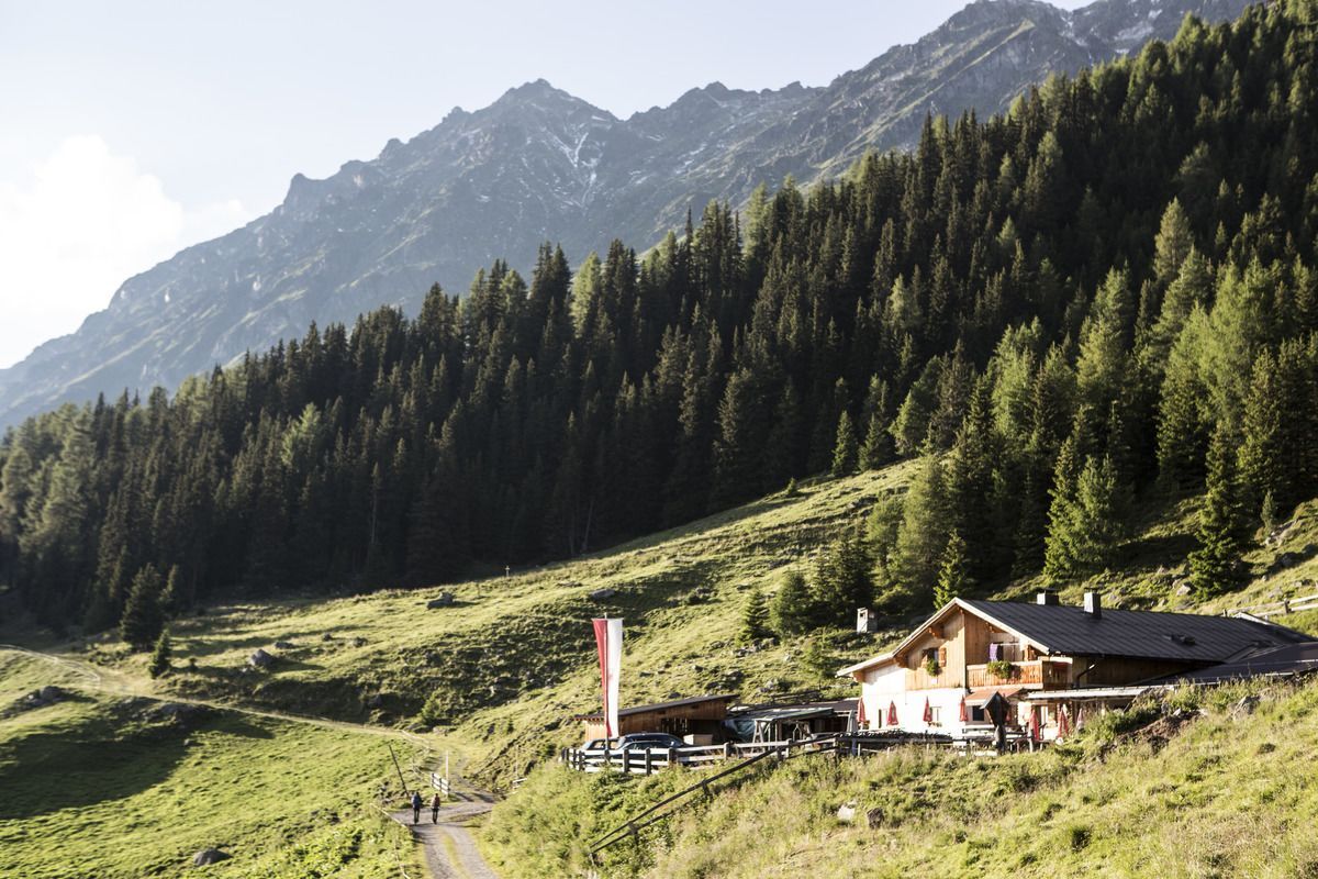
The hike to Falkaunsalm may be steep and rugged in places, but it’s easy to manage with a Swiss-Trac.
Tour character

  • Accessible terrace at the Alpine Pasture
  • Accessible via Swiss Trac
  • Refreshments available at the Falkaunsalm

Tour information

  • Requirement: medium
  • Length: 4.5 km
  • Duration: 1:45 h
  • Elevation uphill:392 hm
  • Elevation downhill:392 hm
Highest point1,962 m

Starting point

Parking Lot at the Kaltenbrunn Pilgrimage Church | Kaunertal

Finishing point

Falkaunsalm | Kaunertal
  • Fitness level 3 / 6
  • Technique 3 / 6

Features

  • Wheelchair hike

Best time of year

  • January
  • February
  • March
  • April
  • May
  • June
  • July
  • August
  • September
  • October
  • November
  • December

Trail condition

Gravel, Asphalt
Source: TVB Tiroler Oberland

Description

Shortly before the hamlet of Platz (the first settlement in the Kaunertal), turn left toward Nufels to reach the Kaltenbrunn pilgrimage church in the Kaunertal. From there, continue toward Wiesenhöfe. At the 6. hairpin turn, there are a few parking spots available along the road. From here, the route to the Falkaunsalm continues along a forest road (gravel), which includes some steep and rough sections but is generally easy to navigate. After about 4.5 km and 55 minutes, you’ll reach the Falkaunsalm. A ramp leads up to the outdoor dining area. The restroom facilities at the Falkaunsalm are only partially accessible to wheelchair users. The Falkaunsalm is a working restaurant where you can enjoy delicacies of Tirolean cuisine.

© Regio L | Rolli Road Book

Getting here

  • Arrival by public transport

    Take Line 230 to Platz—get off at the Kaunertal/Platz stop

  • Parking

    Take the Kaunertal State Road toward Platz—take the Nufels turnoff toward the Kaltenbrunn pilgrimage church. Before the pilgrimage church’s parking lot, turn right toward Wiesenhof and Falkaunsalm. During the summer months, the Falkaunsalm can be reached by car via a forest road.

Weather

Today

light rain
9°C/3°C
75%6.4l5 km/h

Wed

light rain showers
7°C/1°C
60%1.3l5 km/h

Thu

snow showers
6°C/1°C
65%3.5l5 km/h
Go to weather forecast

More tours in the surrounding area

  • Hohe Aifnerspitze (2.779 m)

    Difficulty:medium
    Length:7.2 kmDuration:5:15 hElevation uphill:815 m
  • Gletscherlehrpfad Gepatschferner

    Difficulty:medium
    Length:12.0 kmDuration:5:00 hElevation uphill:407 m
  • Großer Mutzkopf

    Opening hours:closed
    Difficulty:easy
    Length:10.3 kmDuration:4:00 hElevation uphill:507 m
  • Kapelle Maria Schnee

    Difficulty:easy
    Length:1.7 kmDuration:0:30 hElevation uphill:90 m
  • Radurschlklamm Gorge

    Opening hours:closed
    Difficulty:medium
    Length:7.5 kmDuration:3:20 hElevation uphill:442 m
  • Rundwanderung Frudiger

    Difficulty:medium
    Length:13.5 kmDuration:4:55 hElevation uphill:588 m
  • Verpeilschlucht

    Opening hours:open
    Difficulty:medium
    Length:4.9 kmDuration:3:00 hElevation uphill:386 m
  • Sternenweg im Gepatsch

    Difficulty:medium
    Length:4.0 kmDuration:1:30 hElevation uphill:202 m
  • Rolli-Wanderung Gepatschhaus

    Length:8.5 kmDuration:1:45 hElevation uphill:156 m
  • Rolli-Wanderung Nassereinalm

    Difficulty:medium
    Length:5.5 kmDuration:1:45 hElevation uphill:269 m
  • Rolli-Wanderung Aifner Alm

    Difficulty:medium
    Length:6.0 kmDuration:2:30 hElevation uphill:460 m
  • Kaunerberger Wasserweg

    Opening hours:open
    Difficulty:medium
    Length:15.2 kmDuration:6:00 hElevation uphill:935 m
  • Talwanderweg Kaunertal

    Difficulty:easy
    Duration:2:30 hElevation uphill:295 m
  • Ötztal Trek Stage 15

    Difficulty:difficult
    Length:6.5 kmDuration:2:30 hElevation uphill:332 m
Newsletter

The mountain is calling? So does our newsletter!

In our monthly newsletter we reveal the best holiday tips for Tyrol.
