Arrival by public transport
Line 210, Bus stop Pfunds Dorf, walking distance to Tscheylücke: 6,9 km
Line 273, Bus stop Pfunds Stuben, walking distance to Tscheylücke: 8,1 km
Tip: There ist a hiking shuttle to the Tschey every Thursday
The Pfundser Frudiger and the Tösener Frudiger vie for the best views on this impressive circular hike to the summit. Who will win? In any case, the higher one is a well-known vantage point!
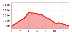
This technically easy to medium-difficult, but 13-kilometre summit hike, which requires a good level of fitness, starts in the beautiful Pfundser Tschey high valley. It leads across high mountain meadows and through a stone pine forest up to the summit of the Pfundser Frudiger (2,153 m), then downhill and uphill again to the Tösener Frudiger (2,053 m), before the loop ends at the Tscheywiesen.
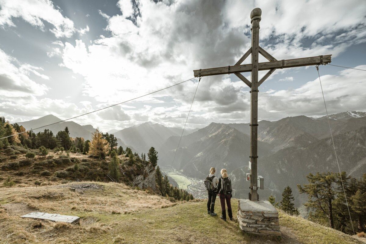
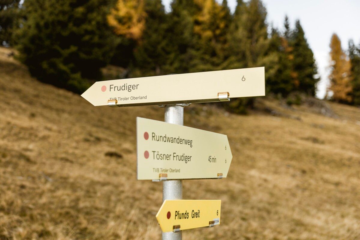
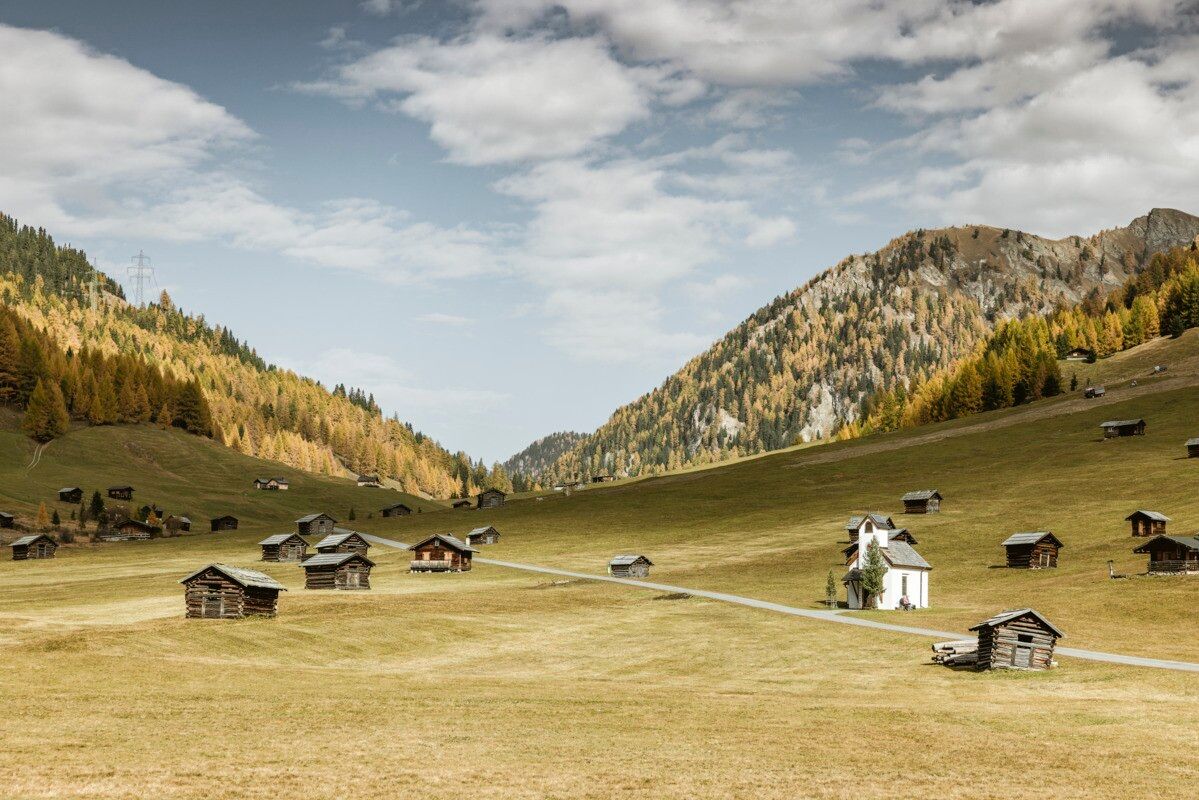
At the beginning of the wonderful high valley of the Pfundser Tschey, a forest path starts on the left at the roundabout up to high mountain meadows. The sign Frudiger points to a path across pastures, through the Swiss stone pine forest up to the summit. A wonderful view of the neighbouring Samnaun group and the holiday resort Pfunds opens up. Descent from the cross into the hollow where you turn left in the direction of Tösner Frudier, on an almost flat path, above the calf hut you continue to the Bio-Top. Accompanied by young cattle, the trail leads past the calf hut to Tösner Frudiger. The well-marked path no. 7 leads back to the Tscheywiesen. Return through the Tscheywiesen past the Maria Schnee chapel to the car park.
Tip: Every Thursday a hiking bus drives to the Tschey
Line 210, Bus stop Pfunds Dorf, walking distance to Tscheylücke: 6,9 km
Line 273, Bus stop Pfunds Stuben, walking distance to Tscheylücke: 8,1 km
Tip: There ist a hiking shuttle to the Tschey every Thursday
Parking area Tscheylücke, free of charge.


.jpg")


.jpg")
.jpg")


")
