Rollitour with Swiss Trac

Kals am Großglockner / Glocknergruppe
Difficulty ratings: easy
Route length: 3.2 km
Duration: 1:30 h

Experience the Hohe Tauern National Park at the foot of the Großglockner in a wheelchair.

Tour character

  • reaches the end of the valley at the foot of the Großglockner
  • many Tyrolean animals can be spotted
  • a lot can be learned on the "GlocknerSpur BergeDenken" educational trail

Tour information

  • Requirement: easy
  • Length: 3.2 km
  • Duration: 1:30 h
  • Elevation uphill:135 hm
  • Elevation downhill:135 hm
Highest point2,060 m

Starting point

Parkplatz Glocknerwinkel

Finishing point

Parkplatz Glocknerwinkel
  • Fitness level 1 / 6
  • Technique 1 / 6

Features

  • Circular route
  • Suitable for families
  • Wheelchair hike
  • suitable for pushchairs

Best time of year

  • January
  • February
  • March
  • April
  • May
  • June
  • July
  • August
  • September
  • October
  • November
  • December

Trail condition

Schotter mit zwei Bachquerungen

Equipment

Rollstuhl
Source: TVB Osttirol

Description

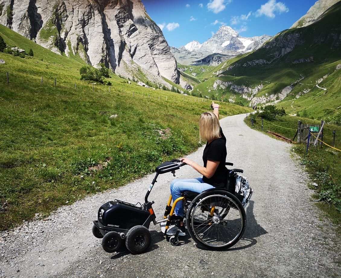
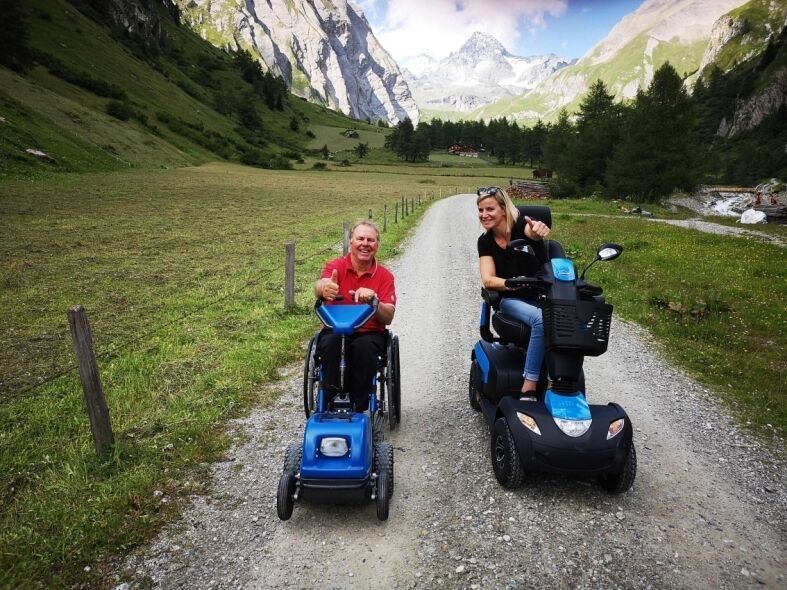
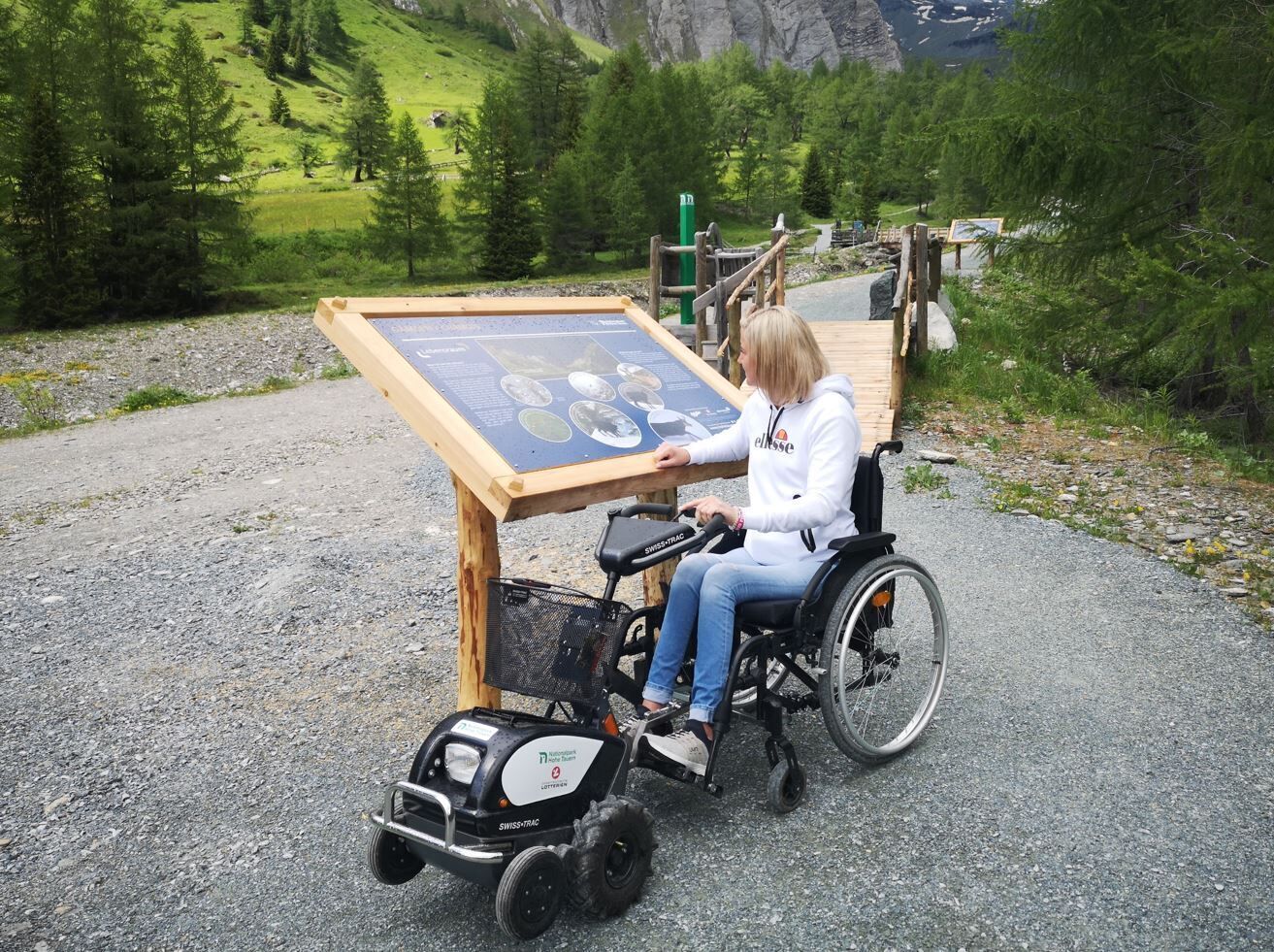
In Kalser Ködnitztal, you can use an all-terrain ‘towing vehicle’, the SwissTrac, from the Glocknerwinkel car park on a barrier-free hiking trail towards the Grossglockner to the end of the valley free of charge. You can experience the diverse fauna, such as marmots, chamois, ibexes, eagles and bearded vultures up close in the NP panorama exhibition, enjoy the splendour of the flowers and learn about historical and geological features on the ‘GlocknerSpur BergeDenken’ educational trail. 

Nearby huts and mountain restaurants

More tours in the surrounding area

  • Hike to the Venedigerhaus Innergschlöß

    Difficulty:easy
    Length:8.5 kmDuration:2:30 hElevation uphill:180 m
  • Badener Hütte

    Difficulty:difficult
    Length:23.2 kmDuration:11:30 hElevation uphill:1,750 m
  • Lucknerhaus - Stüdlhütte

    Difficulty:medium
    Length:9.3 kmDuration:5:30 hElevation uphill:862 m
  • Hike to Neuen Reichenberger Hütte

    Difficulty:medium
    Length:9.1 kmDuration:9:00 hElevation uphill:1,210 m
  • Hiking tour to Lasörlinghütte 2.350m

    Difficulty:medium
    Length:14.6 kmDuration:7:10 hElevation uphill:1,080 m
  • Hike to Kalser Tauernhaus

    Difficulty:medium
    Length:12.2 kmDuration:4:00 hElevation uphill:244 m
  • Hiking tour to Neue Sajathütte 2.600m

    Difficulty:medium
    Length:10.3 kmDuration:6:50 hElevation uphill:1,080 m
  • Theme path "Virgen crossroads"

    Difficulty:easy
    Length:3.1 kmDuration:1:00 hElevation uphill:90 m
  • Figerhorn

    Difficulty:difficult
    Length:6.5 kmDuration:6:00 hElevation uphill:807 m
  • Lasörling altitude trail

    Difficulty:medium
    Length:57.0 kmDuration:25:00 hElevation uphill:3,740 m
  • Venediger altitude trail

    Difficulty:difficult
    Length:55.5 kmDuration:27:00 hElevation uphill:3,915 m
  • Muhs panorama trail

    Difficulty:medium
    Length:15.2 kmDuration:6:00 hElevation uphill:1,090 m
  • Rotenkogel

    Difficulty:difficult
    Length:3.9 kmDuration:3:00 hElevation uphill:383 m
  • Lasörling 3.098m

    Difficulty:difficult
    Length:21.9 kmDuration:12:00 hElevation uphill:1,940 m
  • Umbal waterfalls nature force trail

    Difficulty:easy
    Length:5.8 kmDuration:2:30 hElevation uphill:250 m
  • Böses Weibl

    Difficulty:difficult
    Length:14.1 kmDuration:8:00 hElevation uphill:1,193 m
  • Eagle Walk Stage O1: Ströden - Johannis Hütte

    Difficulty:medium
    Length:13.0 kmDuration:6:30 hElevation uphill:1,430 m
Newsletter

The mountain is calling? So does our newsletter!

In our monthly newsletter we reveal the best holiday tips for Tyrol.