Mountain hikes Hiking tour to Lasörlinghütte 2.350m

Virgen in Osttirol / Venediger Group
Difficulty ratings: medium
Route length: 14.6 km
Duration: 7:50 h

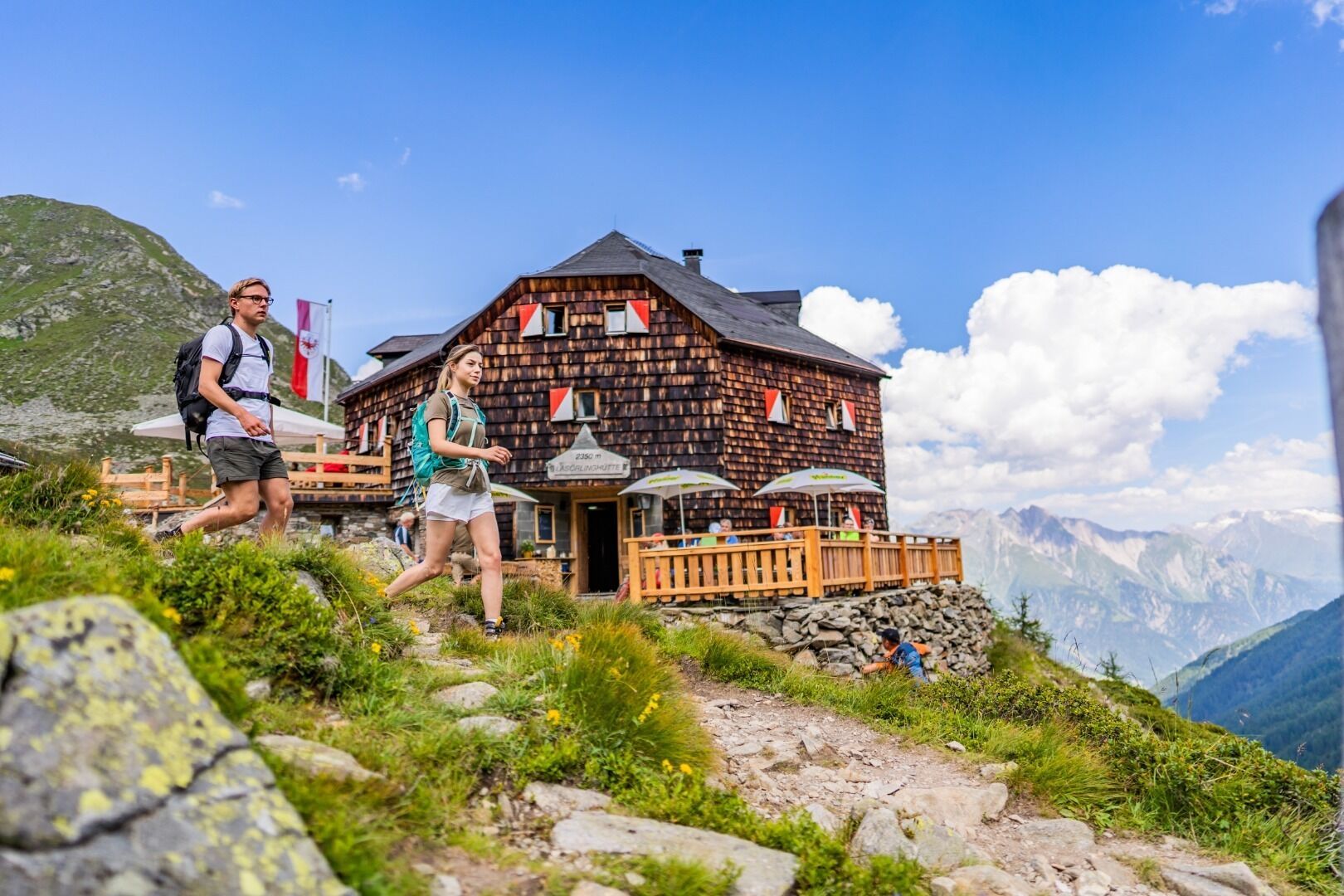
Floor plan of a honeycomb, but with eight corners: The Lasörling hut with its shingle façade and pretty outbuildings is an original eye-catcher in the fascinating Lasörling group.

Tour character

The shortest route to the Lasörlinghütte starts in the Virg district of Welzelach and takes around 3.5 hours on a picturesque forest path through the Mullitztal valley to the destination. From the Wetterkreuz hut (you can take an alpine cab up to here), it takes about 4 hours to walk. The technical difficulty is rather easy, so it is also suitable for children with good stamina and mountain experience. From the sun terrace of the Lasörling hut, there is a magnificent view of the Großglockner and the Virger Nordkette.

Tour information

  • Requirement: medium
  • Length: 14.6 km
  • Duration: 7:50 h
  • Elevation uphill:1,135 hm
  • Elevation downhill:1,135 hm
Highest point2,350 m

Starting point

Car park Lasörlinghütte 1.150m

Finishing point

Car park Lasörlinghütte 1.150m
  • Fitness level 4 / 6
  • Technique 3 / 6

Best time of year

  • January
  • February
  • March
  • April
  • May
  • June
  • July
  • August
  • September
  • October
  • November
  • December

Trail condition

Gravel, hiking trail
Source: TVB Osttirol

Description

The starting point for the hiking trip to the hut Lasörlinghütte is the parking place Lasörlinghütte. From there, walk in the direction of the stream Mullitzbach and follow it and the signposts. Initially you will find yourself on a narrow path, which later leads into a forest path. Then walk past the Raineralm and continue to the end of the valley. Once there, a path branches off to the right up to the hut Lasörlinghütte.

Nearby huts and mountain restaurants

Getting here

  • Arrival by public transport

    Virgen Abzw. Welzelach

  • Parking

    Parking place Welzelach

More tours in the surrounding area

  • Lasörling altitude trail

    Difficulty:medium
    Length:57.0 kmDuration:25:00 hElevation uphill:3,740 m
  • Venediger altitude trail

    Difficulty:difficult
    Length:55.5 kmDuration:27:00 hElevation uphill:3,915 m
  • Figerhorn

    Difficulty:difficult
    Length:6.5 kmDuration:6:00 hElevation uphill:807 m
  • Theme path "Virgen crossroads"

    Difficulty:easy
    Length:3.2 kmDuration:1:00 hElevation uphill:104 m
  • Muhs panorama trail

    Difficulty:medium
    Length:15.2 kmDuration:6:00 hElevation uphill:1,090 m
  • Hike to Neuen Reichenberger Hütte

    Difficulty:medium
    Length:18.2 kmDuration:9:00 hElevation uphill:1,252 m
  • Hiking tour to Zupalsee Hütte 2.350m

    Difficulty:medium
    Length:14.9 kmDuration:8:30 hElevation uphill:1,261 m
  • Hiking tour to St. Pöltner Hütte and 3 lakes

    Difficulty:difficult
    Length:14.8 kmDuration:7:40 hElevation uphill:1,119 m
  • Badener Hütte

    Difficulty:difficult
    Length:23.2 kmDuration:12:00 hElevation uphill:1,754 m
  • Hike to Kalser Tauernhaus

    Difficulty:medium
    Length:12.2 kmDuration:4:00 hElevation uphill:244 m
  • Hiking tour to Neue Sajathütte 2.600m

    Difficulty:medium
    Length:10.3 kmDuration:6:50 hElevation uphill:1,086 m
  • Lucknerhaus - Stüdlhütte

    Difficulty:medium
    Length:9.3 kmDuration:4:30 hElevation uphill:862 m
  • Hike to the Venedigerhaus Innergschlöß

    Difficulty:easy
    Length:8.6 kmDuration:2:30 hElevation uphill:184 m
  • Rotenkogel

    Difficulty:difficult
    Length:3.9 kmDuration:3:00 hElevation uphill:383 m
  • Umbal waterfalls nature force trail

    Difficulty:easy
    Length:6.0 kmDuration:2:30 hElevation uphill:257 m
  • Glacier trail Innergschlöss/Schlatenkees

    Difficulty:medium
    Length:9.4 kmDuration:4:50 hElevation uphill:680 m
  • Böses Weibl

    Difficulty:difficult
    Length:14.1 kmDuration:8:00 hElevation uphill:1,193 m
  • Rollitour with Swiss Trac

    Difficulty:easy
    Length:3.2 kmDuration:1:30 hElevation uphill:135 m
  • Lasörling 3.098m

    Difficulty:difficult
    Length:22.0 kmDuration:12:00 hElevation uphill:1,940 m
Newsletter

The mountain is calling? So does our newsletter!

In our monthly newsletter we reveal the best holiday tips for Tyrol.