Mountain hikes Wilder Mann

Sölden / Ötztal Alps
Difficulty ratings: medium
Route length: 7.0 km
Duration: 2:30 h

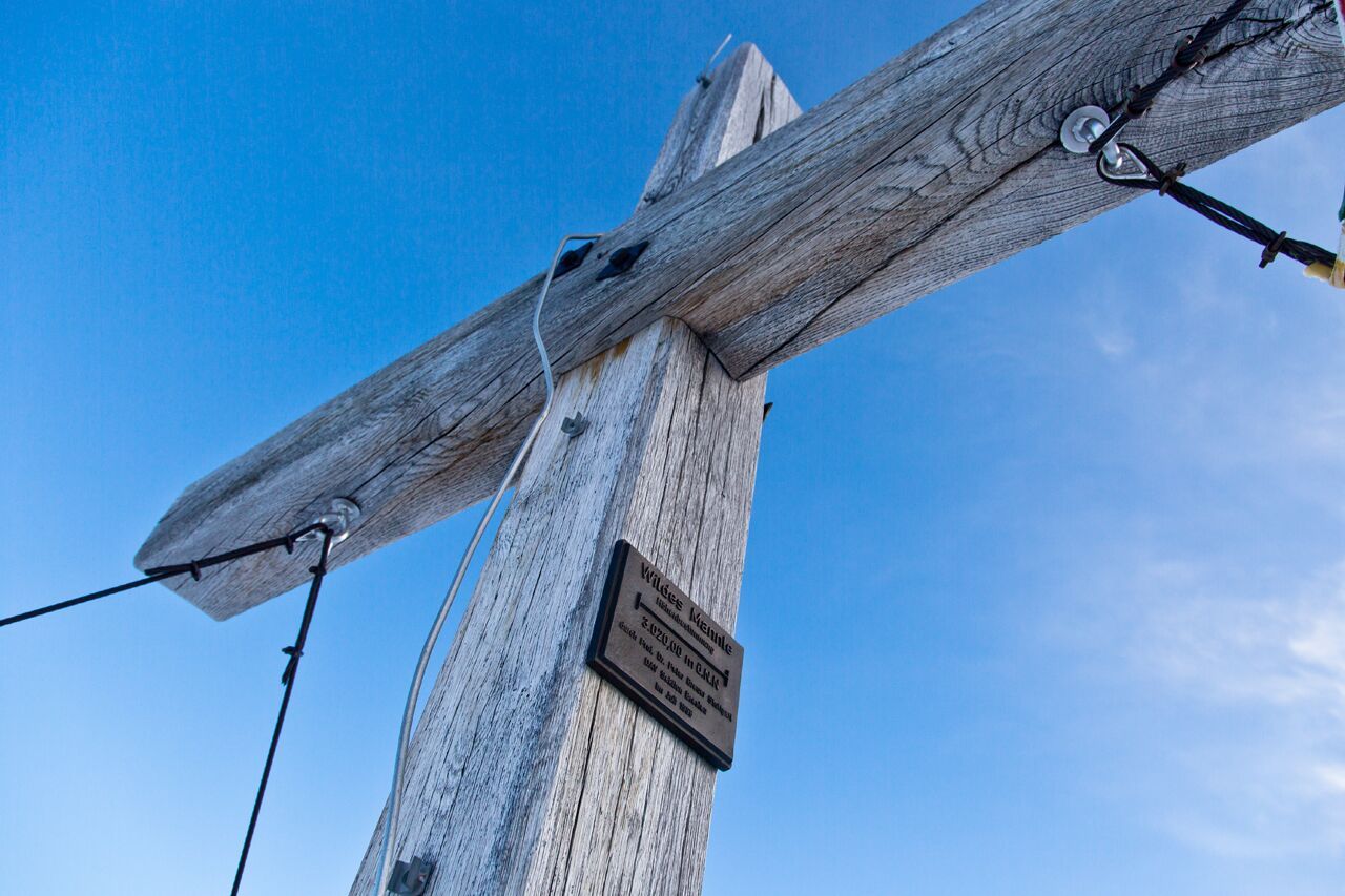
You can make it to the not-so-wild Mannle in the Ötztal Alps in just four hours. Probably one of the best 3,000 meter peaks for a fast number.

Tour character

Short tour to a panoramic 3,000 m peak in the Ötztal Alps. Access by chairlift, then initially easy and later through rocky and partly rope-insured terrain to the summit. For the descent, the variant via the Rofenkarsteig to the Breslauer Hütte, which is also secured, is recommended.
Tour information

  • Requirement: medium
  • Length: 7.0 km
  • Duration: 2:30 h
  • Elevation uphill:665 hm
  • Elevation downhill:1,108 hm
Highest point3,019 m

Starting point

Vent

Finishing point

Wildes Mannle
  • Fitness level 4 / 6

Best time of year

  • January
  • February
  • March
  • April
  • May
  • June
  • July
  • August
  • September
  • October
  • November
  • December

Equipment

For those free from vertigo, sure-footed and experienced in high alpine terrain; excellent physical condition, extensive mountain experience, alpine climbing equipment, securing and navigation tools, and good weather conditions are recommended. Please observe the current weather report at: www.oetztal.com/de/sommer.html

Appropriate equipment such as breathable and weather-appropriate outdoor clothing, ankle-high hiking boots, wind, rain and sun protection, hat, possibly gloves, is required for all hikes and routes. Carrying a first aid kit, a mobile phone and possibly a hiking map, as well as sufficient provisions for hikes without dining options, is necessary.

Source: TVB Ötztal Tourismus

Description


From the top station of the DSB Wildspitze chairlift, it is about a 30-minute walk towards Breslauer Hut, then turn right at the junction leading to the top station of the Wildes Mannle six-seater chairlift.

Alternatively, you can take both chairlifts to the start of the route.

From the Wildes Mannle top station, follow a beautiful hiking trail and later continue through steep, rocky terrain (with fixed cable protection) to the summit.

From the summit, there are magnificent views of Wildspitze directly opposite, the Vent Mountains, and the Ortler Group.

The descent continues over the summit to a small mountain saddle and then down a secured trail to the tongue of the Rofenkarferner glacier. From there, you can either continue to Breslauer Hut or descend to the Stableinalm panoramic restaurant (closed on Saturday).


Nearby huts and mountain restaurants

Getting here

  • Arrival by public transport

    Travel comfortably and safely by train to the Ötztal train station. The final stop or exit point is ÖTZTAL station. Then travel conveniently and quickly by public transport or local taxi companies through the entire valley to your desired destination! The current bus timetable is available at: http://fahrplan.vvt.at

  • Parking

    The car journey to the ÖTZTAL. Located in Tyrol, the Ötz valley branches south as the longest side valley of the Eastern Alps. The car journey leads vacationers through the Inn valley to the valley entrance and further along the Ötztal. In addition to the toll motorway, country roads can also be used. With the route planner, your trip can be determined quickly and conveniently: To the route planner: www.google.at/maps


    In the mountaineering village of Vent, the following parking options are available:

    Summer: before entering the village (parking meter, coins or EC/debit card only), at the chairlift valley station (parking meter), and at the Mountaineers’ Chapel.

    Winter: only at the chairlift valley station and the Mountaineers’ Chapel.

    Cost: €7.00 per day per car.

More tours in the surrounding area

  • Ötztaler Urweg

    Difficulty:difficult
    Length:177.2 kmDuration:60:49 hElevation uphill:7,541 m
  • Ötztal Trek Stage 22

    Difficulty:difficult
    Length:21.5 kmDuration:8:00 hElevation uphill:647 m
  • Ötztal Trek Stage 6

    Difficulty:difficult
    Length:7.6 kmDuration:3:30 hElevation uphill:640 m
  • Ötztal Trek Stage 4

    Difficulty:difficult
    Length:8.9 kmDuration:4:00 hElevation uphill:802 m
  • Ötztal Trek Stage 3

    Difficulty:difficult
    Length:10.4 kmDuration:4:00 hElevation uphill:842 m
  • Ötztal Trek Stage 10

    Opening hours:closed
    Difficulty:difficult
    Length:11.1 kmDuration:4:30 hElevation uphill:1,476 m
  • Ötztal Trek Stage 7

    Difficulty:difficult
    Length:5.3 kmDuration:2:00 hElevation uphill:376 m
  • Ötztal Trek Stage 8

    Difficulty:difficult
    Length:9.3 kmDuration:3:30 hElevation uphill:274 m
  • Ötztal Trek

    Length:246.4 kmDuration:84:25 hElevation uphill:18,910 m
  • Ötztal Trek Stage 1

    Difficulty:medium
    Length:18.6 kmDuration:6:30 hElevation uphill:1,561 m
  • Ötztal Trek Stage 17

    Difficulty:difficult
    Length:16.4 kmDuration:6:00 hElevation uphill:1,080 m
  • Ötztal Trek Stage 14

    Difficulty:difficult
    Length:6.3 kmDuration:3:00 hElevation uphill:1,004 m
  • Ötztal Trek Stage 16

    Difficulty:difficult
    Length:6.9 kmDuration:2:30 hElevation uphill:358 m
  • Ötztal Trek Stage 5

    Difficulty:difficult
    Length:8.1 kmDuration:3:30 hElevation uphill:1,105 m
  • Ötztal Trek Stage 20

    Difficulty:medium
    Length:6.4 kmDuration:3:00 hElevation uphill:610 m
  • Ötztal Trek Stage 12

    Difficulty:difficult
    Length:4.8 kmDuration:2:00 hElevation uphill:592 m
  • Ötztal Trek Stage 11

    Difficulty:difficult
    Length:12.0 kmDuration:5:00 hElevation uphill:705 m
  • Ötztal Trek Stage 21

    Difficulty:difficult
    Length:9.4 kmDuration:4:30 hElevation uphill:1,270 m
  • Mountain peak Rosskopf

    Difficulty:medium
    Length:2.0 kmDuration:2:00 hElevation uphill:379 m
Newsletter

The mountain is calling? So does our newsletter!

In our monthly newsletter we reveal the best holiday tips for Tyrol.
