Long-distance hike Ötztal Trek Stage 12

Sölden / Ötztaler Alpen
Difficulty ratings: difficult
Route length: 4.8 km
Duration: 2:00 h

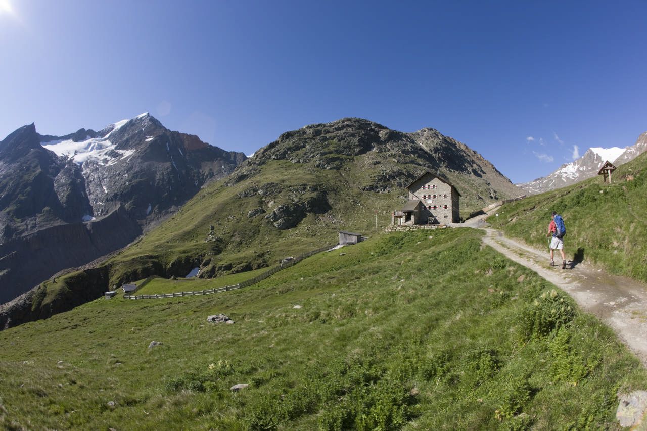
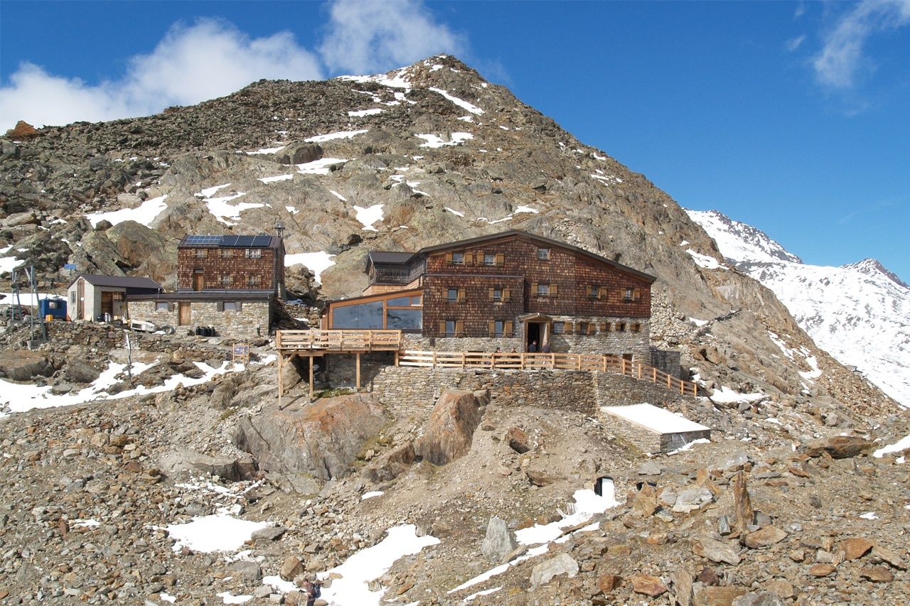
On today's stage, the glacier man "Ötzi" is our constant companion. How did he feel, was he cold or hungry? We don't know, but we are glad to have modern equipment and good footwear. If you like, you can bypass the Niederjochferner on the way to the Similaunhütte. Experienced mountaineers are tempted by the Similaun summit (3,599 m).

Tour character

Moderately difficult stage. Sure-footedness and high alpine experience are required. A good level of fitness is required. A head for heights and glacier equipment are required for the ascent of the Similaun.

Tour information

  • Requirement: difficult
  • Length: 4.8 km
  • Duration: 2:00 h
  • Elevation uphill:592 hm
  • Elevation downhill:74 hm
Highest point3,078 m

Starting point

Martin-Busch Hut

Finishing point

Similaun Hut
  • Fitness level 5 / 6

Best time of year

  • January
  • February
  • March
  • April
  • May
  • June
  • July
  • August
  • September
  • October
  • November
  • December

Equipment

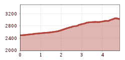
Suitable for people free from fear of heights, surefooted and with alpine experience; very good physical condition, alpine experience and mountain equipment (see under equipment), sometimes alpine safety equipment, good weather conditions recommended. Please observe the current weather report.

Appropriate equipment such as breathable and weather-appropriate outdoor clothing is required for all hikes and routes. Carrying a first aid kit, a mobile phone, and possibly a hiking map, as well as sufficient provisions for hikes without food stops, is necessary.

Source: Ötztal

Description

  • Route: trail
  • Requirements: basic surefootedness
  • Mountain trail red
  • Difficulty: no particular difficulties
  • Equipment: normal hiking equipment
  • Overnight stays, food stops: Martin-Busch Hut, Similaun Hut

Nearby huts and mountain restaurants

Getting here

  • Arrival by public transport

    Travel comfortably and safely by train to the Ötztal train station. The final stop or exit point is the ÖTZTAL station. Afterwards, you can conveniently and quickly travel through the entire valley with public bus services or local taxi companies to your desired destination.

    The current bus timetable is available at: http://fahrplan.vvt.at

  • Parking

    In Gurgl, the following parking options are available: 

    - Parking garage Dorfzentrum Obergurgl (right down in front of the church) | paid 

    - Parking garage town entrance – Festkoglbahn valley station | paid | no overnight parking 

    - Parking lot Hochgurglbahn valley station, free | no overnight parking

More tours in the surrounding area

  • Ötztal Trek Stage 3

    Difficulty: difficult
    Length: 10.4 km Duration: 4:00 h Elevation uphill: 842 m
  • Ötztal Trek Stage 10

    Difficulty: difficult
    Length: 11.1 km Duration: 4:30 h Elevation uphill: 1,476 m
  • Ötztal Trek Stage 1

    Difficulty: medium
    Length: 18.6 km Duration: 6:30 h Elevation uphill: 1,561 m
  • Ötztal Trek Stage 14

    Difficulty: difficult
    Length: 6.3 km Duration: 3:00 h Elevation uphill: 1,004 m
  • Ötztal Trek Stage 11

    Difficulty: difficult
    Length: 12.0 km Duration: 5:00 h Elevation uphill: 705 m
  • Winter hiking trail Rotes Wandl - No. 431

    Opening hours: closed
    Difficulty: easy
    Length: 1.5 km Duration: 0:45 h Elevation uphill: 52 m
  • Ötztal Trek Stage 21

    Difficulty: difficult
    Length: 9.4 km Duration: 4:30 h Elevation uphill: 1,270 m
  • Ötztal Trek Stage 6

    Difficulty: difficult
    Length: 7.6 km Duration: 3:30 h Elevation uphill: 640 m
  • Ötztal Trek Stage 17

    Difficulty: difficult
    Length: 16.4 km Duration: 6:00 h Elevation uphill: 1,080 m
  • Mountain peak Rosskopf

    Difficulty: medium
    Length: 2.0 km Duration: 2:00 h Elevation uphill: 379 m
  • Mutsbühl

    Difficulty: medium
    Length: 4.5 km Duration: 1:30 h Elevation uphill: 470 m
  • Fundusfeiler - Umhausen

    Difficulty: difficult
    Length: 4.5 km Duration: 3:00 h Elevation uphill: 1,109 m
  • Wilder Mann

    Difficulty: medium
    Length: 2.4 km Duration: 2:30 h Elevation uphill: 665 m
  • Siegerlandhütte - Sölden

    Difficulty: medium
    Length: 8.0 km Duration: 3:30 h Elevation uphill: 780 m
  • Stuibenfall hike - Umhausen

    Opening hours: open
    Difficulty: easy
    Length: 2.9 km Duration: 1:45 h Elevation uphill: 456 m
  • Ötztal Trek Stage 4

    Difficulty: difficult
    Length: 8.9 km Duration: 4:00 h Elevation uphill: 802 m
  • Ötztal Trek Stage 7

    Difficulty: difficult
    Length: 5.3 km Duration: 2:00 h Elevation uphill: 376 m
Newsletter

The mountain is calling? So does our newsletter!

In our monthly newsletter we reveal the best holiday tips for Tyrol.