Multi-day hikes Kaunergrat Circular Route - 3 Days

St. Leonhard im Pitztal / Ötztal Alps
Difficulty ratings: difficult
Route length: 22.8 km
Duration: 3 days

The Kaunergrat Circuit in the Kaunergrat Nature Park offers a unique hiking experience: in several stages, it leads through unspoiled nature, past clear mountain lakes and rustic huts.  
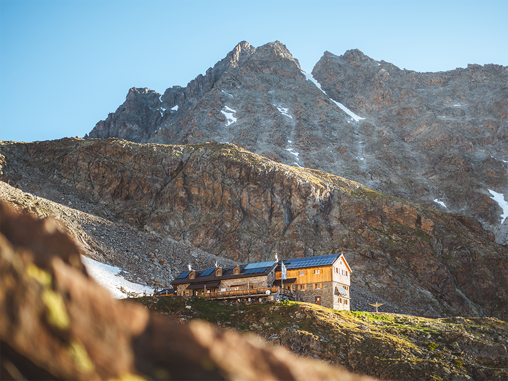
Tour information

  • Requirement: difficult
  • Length: 22.8 km
  • Duration: 3 days
  • Elevation uphill:2,650 hm
  • Elevation downhill:2,646 hm
Highest point3,035 m

Starting point

Plangeroß

Finishing point

Plangeroß

Features

  • Circular route
  • Multi-day hike

Best time of year

  • January
  • February
  • March
  • April
  • May
  • June
  • July
  • August
  • September
  • October
  • November
  • December

Trail condition

Alpine paths, high alpine trails
Source: TVB Pitztal

Description

1. Day
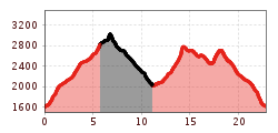
Ascent to the Kaunergrathütte from Plangeross approx. 3,5 hrs
 
2. Day
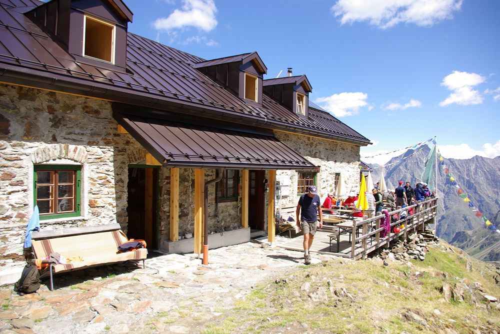
Kaunergrathütte – Madatschjoch – Verpeilhütte

The Madatschjoch is secured with steps and safety cables. The descent to the Verpeilhütte is easy. Approx. 4,5 hrs
 
3. Day
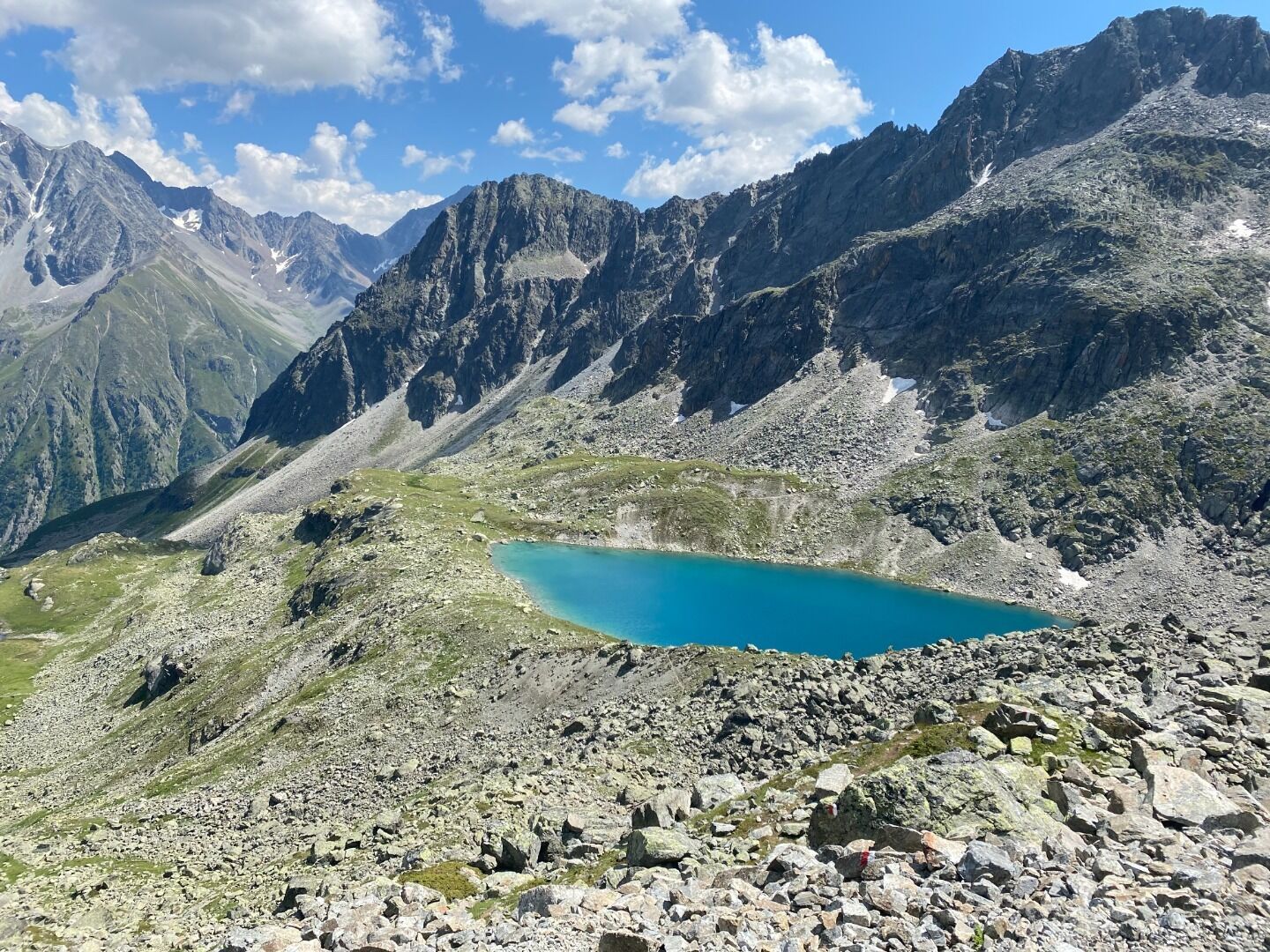
Verpeihlütte – Verpeiljoch – Mittelberglesee – Auf den Saßen – Plangeroß

The ascent to the Verpeiljoch is mostly without any difficulties but very steep and in parts secured with climbing aids. After the ridge, follow a newly marked section to Mittelberglesee. From there ascend to a section called “auf die Saßen” and then all the way downhill to Plangeross. Approx. 6 hrs

Nearby huts and mountain restaurants

Getting here

  • Arrival by public transport

    Take the bus to Plangeroß and from there follow the signs to Kaunergrathütte.

  • Parking

    Parking lot for the Rüsselsheimer and Kaunergrathütte between the hamlets of Weißwald and Plangeroß.

More long-distance hiking trails

  • 3-day Family Tour Alpbachtal

    Difficulty:easy
    Length:18.3 kmDuration:7:00 hElevation uphill:998 m
  • 4 days - 4 summits tour

    Difficulty:medium
    Length:54.4 kmDuration:23:00 hElevation uphill:3,408 m
  • Koasa Trail

    Difficulty:medium
    Length:83.0 kmElevation uphill:4,700 m
  • Two day tour - Höhenweg Zahmer Kaiser

    Opening hours:open
    Difficulty:medium
    Length:30.0 kmDuration:13:15 hElevation uphill:2,100 m
  • Two days tour Wilder Kaiser

    Difficulty:difficult
    Length:42.5 kmDuration:15:57 hElevation uphill:2,475 m
  • KAT WALK ALPINE

    Difficulty:medium
    Length:113.0 kmDuration:45:00 hElevation uphill:6,300 m
  • 2TälerTrail

    Difficulty:medium
    Length:92.0 kmDuration:41:30 hElevation uphill:5,550 m
  • Arlberg Trail

    Difficulty:difficult
    Length:52.1 kmElevation uphill:4,730 m
  • Karwendel tour

    Difficulty:difficult
    Length:44.2 kmDuration:24:00 hElevation uphill:3,955 m
  • KAT Walk: Three Valleys Hike

    Difficulty:medium
    Length:69.0 kmDuration:30:00 hElevation uphill:3,684 m
  • 3-day hut tour Wilder Kaiser

    Difficulty:difficult
    Length:24.6 kmDuration:14:00 hElevation uphill:2,060 m
  • Tiroler Pilgerweg

    Difficulty:medium
    Length:220.0 kmElevation uphill:1,840 m
  • EUREGIO Mary Way-M1

    Difficulty:medium
    Length:84.1 kmDuration:25:01 hElevation uphill:2,238 m
  • Tiroler Burgenweg

    Difficulty:medium
    Length:63.0 kmDuration:25:00 hElevation uphill:2,228 m
  • Rofan tour

    Difficulty:medium
    Length:30.5 kmDuration:16:00 hElevation uphill:1,450 m
Newsletter

The mountain is calling? So does our newsletter!

In our monthly newsletter we reveal the best holiday tips for Tyrol.