Long-distance hike Glockner Crown

Matrei in Osttirol / Granatspitzgruppe
Difficulty ratings: medium
Route length: 65.6 km
Duration: 31:00 h

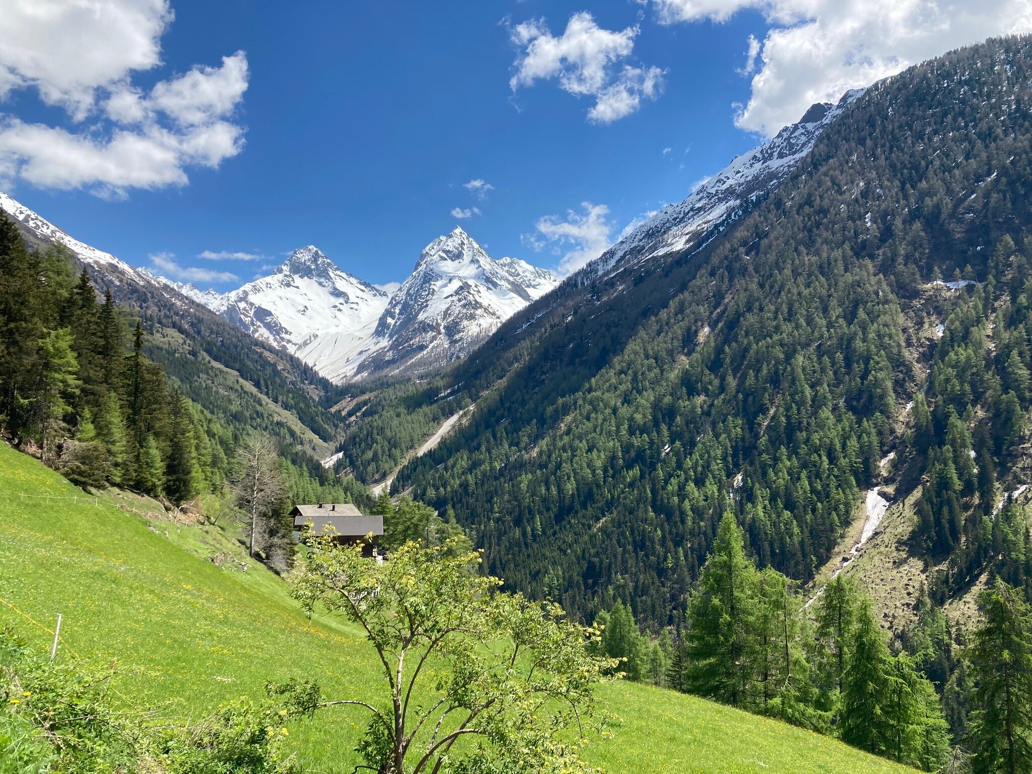
Hike the Jewels at the Southpart of the Großglockner in six stages.

Tour information

  • Requirement: medium
  • Length: 65.6 km
  • Duration: 31:00 h
  • Elevation uphill:3,737 hm
  • Elevation downhill:3,408 hm
Highest point2,834 m

Starting point

Kals/Großdorf

Finishing point

Kals/Großdorf
  • Fitness level 5 / 6
  • Technique 5 / 6

Features

  • Circular route
  • Multi-day hike

Best time of year

  • January
  • February
  • March
  • April
  • May
  • June
  • July
  • August
  • September
  • October
  • November
  • December

Trail condition

Hike in partly alpine terrain, mostly gravel path and stony ground.

Equipment

Hiking boots, rain protection, hiking sticks, warm changing cloths, snacks, sun protection, cap, gloves
Source: Nationalparkregion Hohe Tauern Osttirol

Description

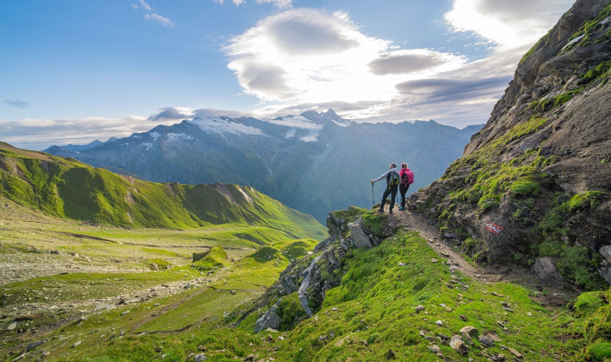
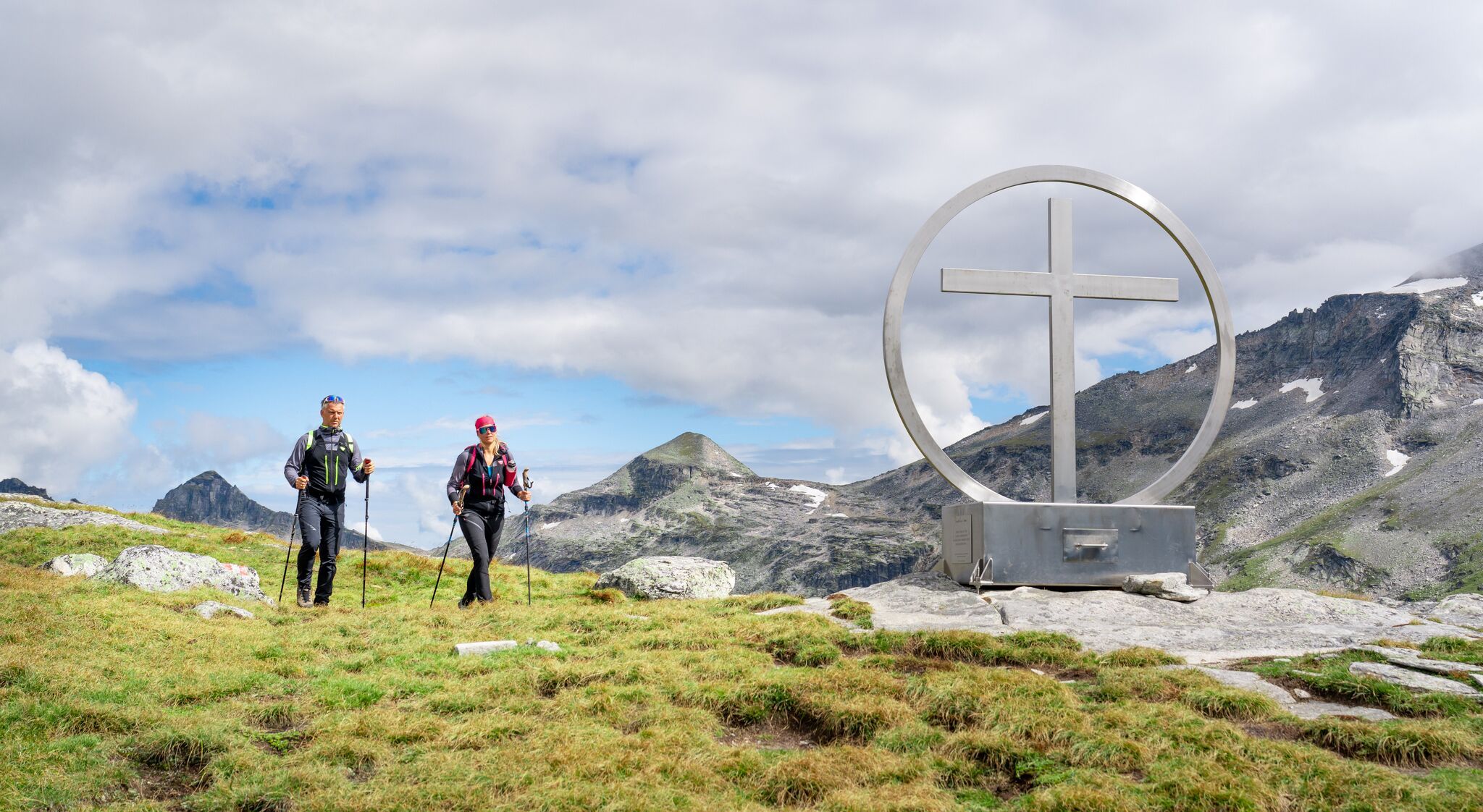
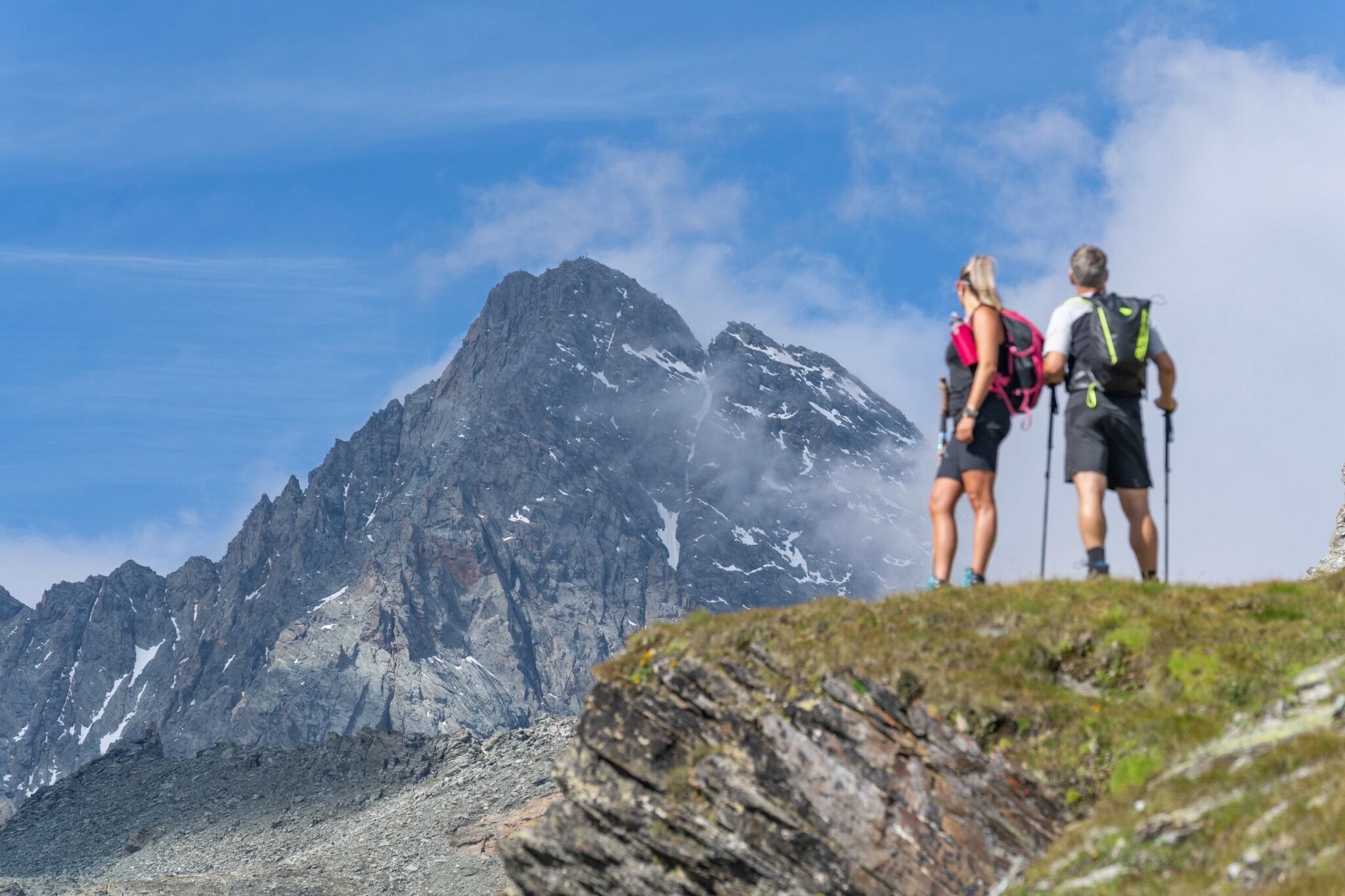
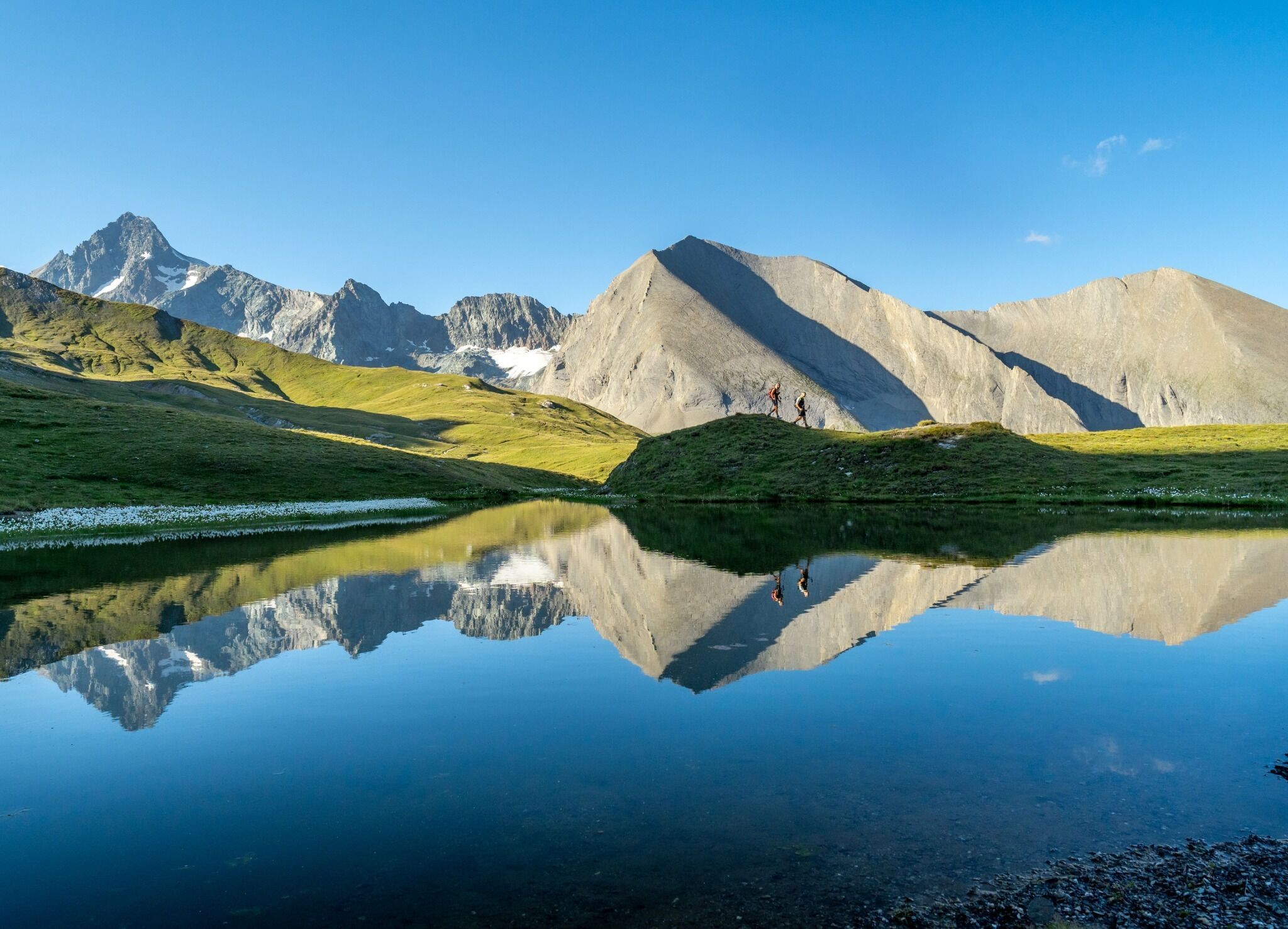
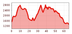
Crown your long distance hiking desires, on this fabulous mountain ridge trail. In six daily stages you will be able to hike the approximately 60 Kilometers of the Glockner Crown, within the realm of the
King Großglockner. High alpine farmland and the famous peaks of the Hohe Tauern National Park set the stage. You'll discover Edelweiss Meadow and the nature power spot Spinevitrol, as well as spacious grazing pastures along your way. Providing you with a sense of being in a Tibetan High Valley.

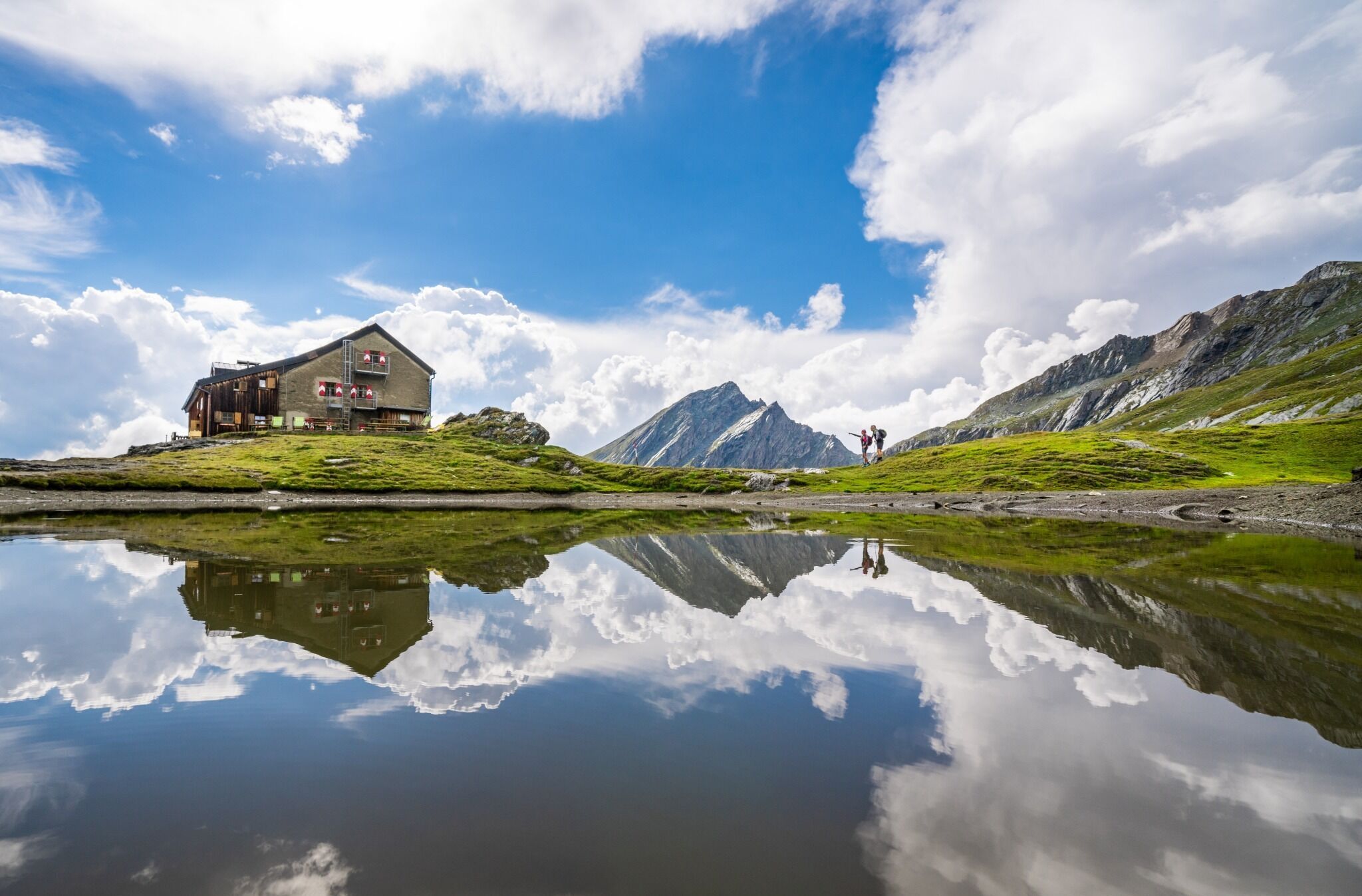
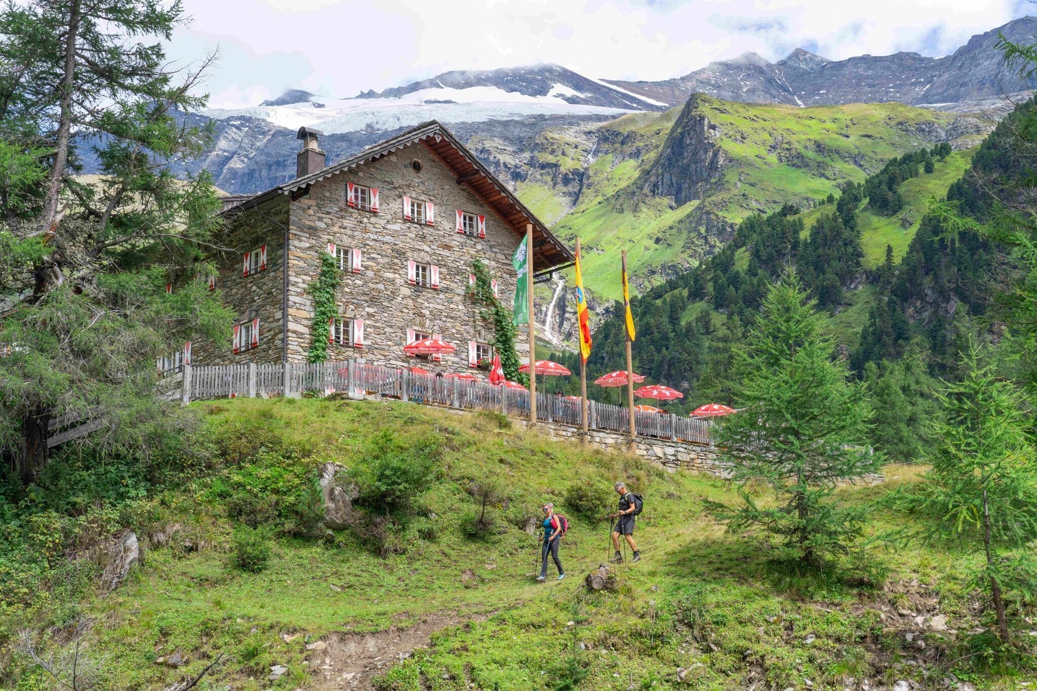
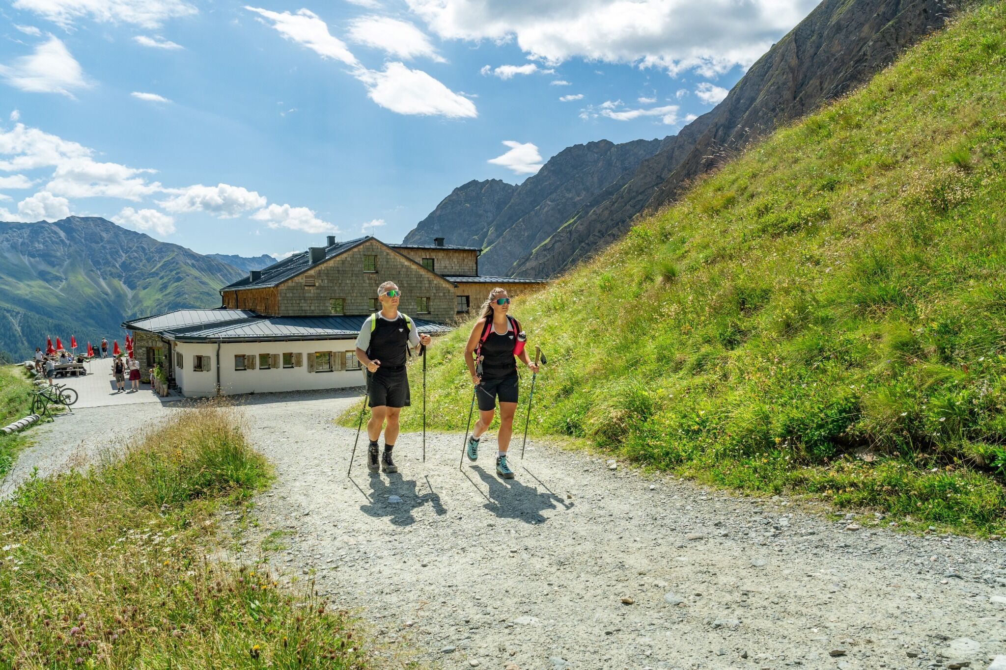
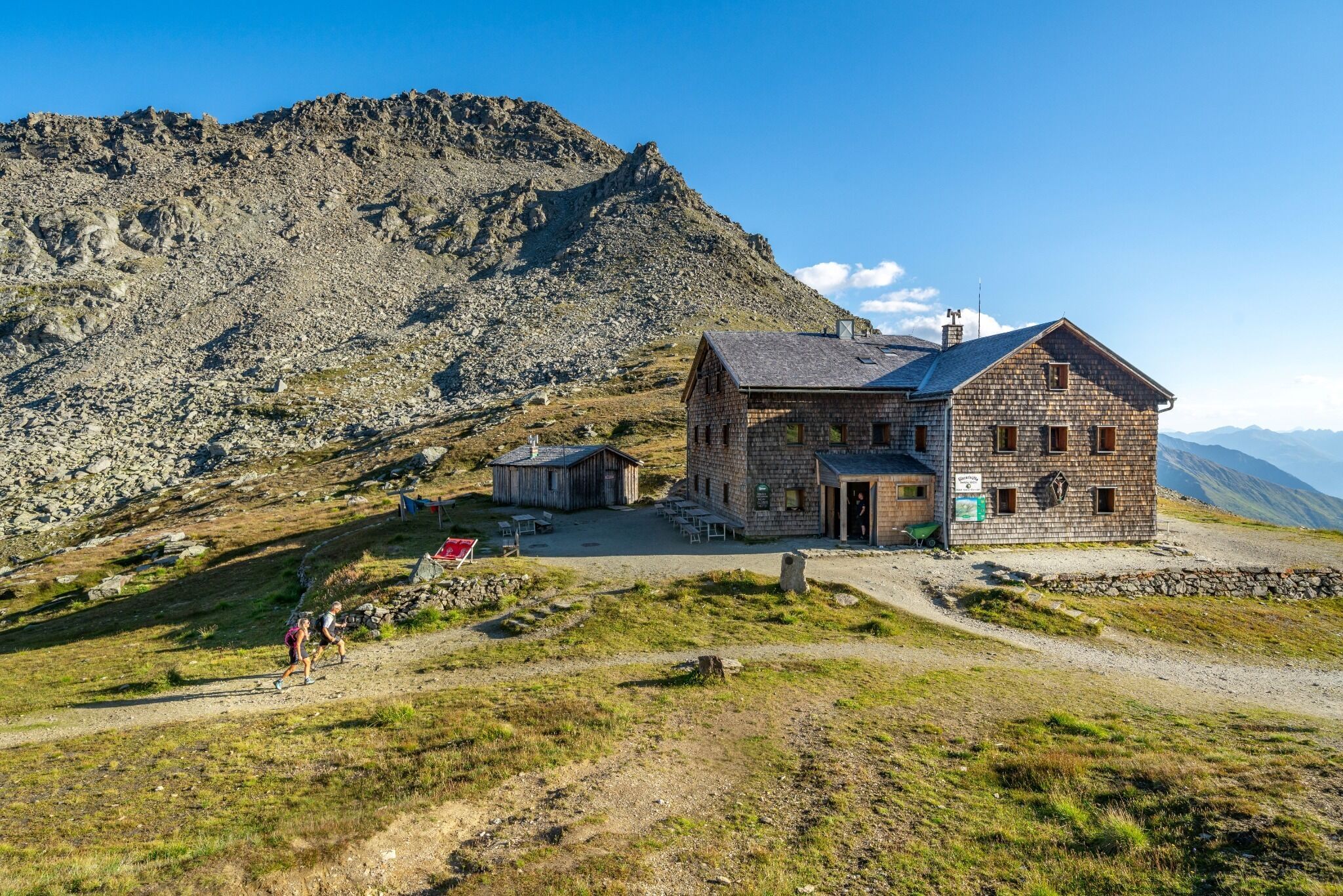
Crossing varying vegetation zones, from flower meadows, animal pastures and sparse areas, all the way to scree fields and glacier ice. Culinary delights and the special rustic vibe of our mountain huts await you. The five jewels of our Glockner Crown are the Sudetendeutsche Hütte, Kalser Tauernhaus, Lucknerhütte, Glorerhütte and the Alpen Inn Glödis Refugium.

They are individually reachable, as the final destination of your daily stages and offer you a place for rest and regeneration. Also part of the high mountain Glockner Crown Trail are the Äußere Steiner Alm, Bergeralm, Stüdlhütte and the Salmhütte, where you can stop for refreshments. The Kals-Matreier-Törl Haus or the Adler Lounge will be along your trail, should you decide to have Kals a.G. as your starting point. FYI: You have the opportunity for day hiking every segment of the trail, as you can enter and exit the trail at the end of each daily stage.

Nearby huts and mountain restaurants

Getting here

  • Arrival by public transport

    Bus line 952, bus stop Kals/Gemeindeamt or Kals/Großdorf

  • Parking

    Parking center of Kals/Ködnitz or parking of the cablecar Kals/Großdorf

More tours in the surrounding area

  • Hike to the Venedigerhaus Innergschlöß

    Difficulty: easy
    Length: 8.5 km Duration: 2:30 h Elevation uphill: 180 m
  • Muhs panorama trail

    Difficulty: medium
    Length: 15.2 km Duration: 6:00 h Elevation uphill: 1,090 m
  • Hiking tour to Lasörlinghütte 2.350m

    Difficulty: medium
    Length: 14.6 km Duration: 7:10 h Elevation uphill: 1,080 m
  • Hike to Neuen Reichenberger Hütte

    Difficulty: medium
    Length: 9.1 km Duration: 9:00 h Elevation uphill: 1,210 m
  • Badener Hütte

    Difficulty: difficult
    Length: 23.2 km Duration: 11:30 h Elevation uphill: 1,750 m
  • Hike to Kalser Tauernhaus

    Difficulty: medium
    Length: 12.2 km Duration: 4:00 h Elevation uphill: 244 m
  • Hiking tour to Neue Sajathütte 2.600m

    Difficulty: medium
    Length: 10.3 km Duration: 6:50 h Elevation uphill: 1,080 m
  • Lucknerhaus - Stüdlhütte

    Difficulty: medium
    Length: 9.3 km Duration: 5:30 h Elevation uphill: 862 m
  • Lasörling altitude trail

    Difficulty: medium
    Length: 57.0 km Duration: 25:00 h Elevation uphill: 3,740 m
  • Figerhorn

    Difficulty: difficult
    Length: 6.5 km Duration: 6:00 h Elevation uphill: 807 m
  • Venediger altitude trail

    Difficulty: difficult
    Length: 55.5 km Duration: 27:00 h Elevation uphill: 3,915 m
  • Lasörling 3.098m

    Difficulty: difficult
    Length: 21.9 km Duration: 12:00 h Elevation uphill: 1,940 m
  • Rotenkogel

    Difficulty: difficult
    Length: 3.9 km Duration: 3:00 h Elevation uphill: 383 m
  • Umbal waterfalls nature force trail

    Difficulty: easy
    Length: 5.8 km Duration: 2:30 h Elevation uphill: 250 m
  • Böses Weibl

    Difficulty: difficult
    Length: 14.1 km Duration: 8:00 h Elevation uphill: 1,193 m
Newsletter

The mountain is calling? So does our newsletter!

In our monthly newsletter we reveal the best holiday tips for Tyrol.