Long-distance hike Rofan tour

Eben am Achensee / Brandenberg Alps (Rofan)
Difficulty ratings: medium
Route length: 30.5 km
Duration: 4 days

Four days, 30 km, pure summit joy: The Rofan Circuit takes you along varied trails through the Brandenberg Alps, with an Overnight Stay at a Mountain Lodge.

Tour character

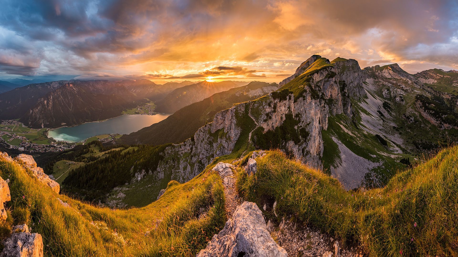
The Rofan Circuit is a challenging multi-day hike through the Rofan Mountains, the southwestern part of the Brandenberg Alps. You’ll explore the Rofan Mountains over four Day Hikes along varied forest trails and hiking paths. The stages follow red and Difficult Trails. Sure-footedness and a head for heights are required in some places.
Tour information

  • Requirement: medium
  • Length: 30.5 km
  • Duration: 5 days
  • Elevation uphill:1,450 hm
  • Elevation downhill:2,290 hm
Highest point2,291 m

Starting point

Maurach, Rofan Cable Car Valley Station

Finishing point

Maurach, Rofan Cable Car Valley Station
  • Fitness level 5 / 6
  • Technique 4 / 6

Features

  • Circular route

Best time of year

  • January
  • February
  • March
  • April
  • May
  • June
  • July
  • August
  • September
  • October
  • November
  • December

Trail condition

Forest trail, hiking trail

Equipment

For the multi-day Rofan Loop hike, we recommend bringing easy but complete gear. This includes a hiking backpack with a capacity of up to 40 liters and a rain cover, sturdy hiking boots, and weatherproof clothing such as a rain jacket, rain pants, technical shirts, an insulating layer, and trekking pants. You should also pack a hut sleeping bag, cash, a water bottle, snacks, a pocket knife, a headlamp, a first-aid kit, sunscreen, and a hiking map. Toiletries, a small towel, and a cell phone with emergency numbers saved complete the basic gear. Optional items include hiking poles, a softshell jacket, an emergency bivouac sack, earplugs, blister bandages, an Alpine Club membership card, hut slippers, or a bandana.
Source: Achensee Tourismus

Description

The Rofan Loop is a challenging Multi-Day Tour that takes you through the Rofan Mountains—which form the southwestern part of the Brandenberg Alps—in four stages. The total distance covered is about 30 kilometers, and you’ll spend the nights in cozy Mountain huts along the way. If you enjoy hiking over rocky terrain like a chamois and might even spot a marmot along the way, this loop is exactly what you’re looking for.

Getting here

  • Arrival by public transport

    Take the regional bus to Maurach (lines 8332, 4080, or 390) and get off at the bus stop: Maurach a. A. Rofan Cable Cars.

  • Parking

    The Rofan Cable Car’s Valley station is located directly on the Achensee Federal Highway B181, above the center of Maurach.
    Rofan Cable Car Parking Lot 1 or 2. (fee applies). For parking lasting several days (e.g., with an Overnight Stay at a Mountain Lodge), a booking confirmation is required. A refund is only possible if the Uphill Facilities are used and is limited to two days.

Weather

Today

light rain showers
11°C/5°C
90%20.6l10 km/h

Fri

partly Cloudy
5°C/-5°C
65%0l10 km/h

Sat

clear sky
7°C/-7°C
0%0l10 km/h

More long-distance hiking trails

  • KAT Walk: Three Valleys Hike

    Difficulty:medium
    Length:69.0 kmDuration:30:00 hElevation uphill:3,684 m
  • Gschnitztaler Hüttenstern

    Difficulty:medium
    Length:82.1 kmDuration:7 daysElevation uphill:5,503 m
  • 2TälerTrail

    Difficulty:medium
    Length:92.0 kmDuration:41:30 hElevation uphill:5,550 m
  • Gschnitztaler Hüttenstern

    Difficulty:medium
    Length:10.8 kmDuration:7 daysElevation uphill:538 m
  • 3-Tages-Tour Wilder

    Difficulty:difficult
    Length:11.0 kmDuration:4:51 hElevation uphill:1,122 m
  • 3-Tages-Tour Wilder

    Difficulty:difficult
    Length:13.6 kmDuration:7:09 hElevation uphill:694 m
  • KAT WALK COMPACT

    Difficulty:medium
    Length:83.0 kmDuration:5 daysElevation uphill:5,462 m
  • Tiroler Silberpfad

    Difficulty:easy
    Length:88.0 kmDuration:32:00 hElevation uphill:3,500 m
  • 3-day hut tour Wilder Kaiser

    Difficulty:difficult
    Length:24.6 kmDuration:14:00 hElevation uphill:2,060 m
  • EUREGIO-Maria-Weg-M5

    Difficulty:easy
    Length:166.6 kmDuration:46:16 hElevation uphill:2,971 m
  • Glockner Crown

    Difficulty:medium
    Length:64.2 kmDuration:31:00 hElevation uphill:4,104 m
Newsletter

The mountain is calling? So does our newsletter!

In our monthly newsletter we reveal the best holiday tips for Tyrol.