Mountain hikes The Gailtal altitude trail - stages of Osttirol

Kartitsch / Gailtal Alps
Difficulty ratings: medium
Route length: 30.9 km
Duration: 13:30 h

The Gailtal altitude trail - stages of Osttirol

Tour information

  • Requirement: medium
  • Length: 30.9 km
  • Duration: 13:30 h
  • Elevation uphill:1,738 hm
  • Elevation downhill:1,931 hm
Highest point2,179 m

Starting point

St. Oswald bei Kartitsch

Finishing point

Untertilliach - Gasthof Wacht
  • Fitness level 4 / 6
  • Technique 4 / 6

Best time of year

  • January
  • February
  • March
  • April
  • May
  • June
  • July
  • August
  • September
  • October
  • November
  • December

Equipment

Gutes Schuhwerk, Regenschutz, Sonnenbrille, Zelt zum Übernachten - weil auf Kärntner Seite keine bzw. kaum Übernachtungsmöglichkeiten bestehen.
Source: TVB Osttirol

Description

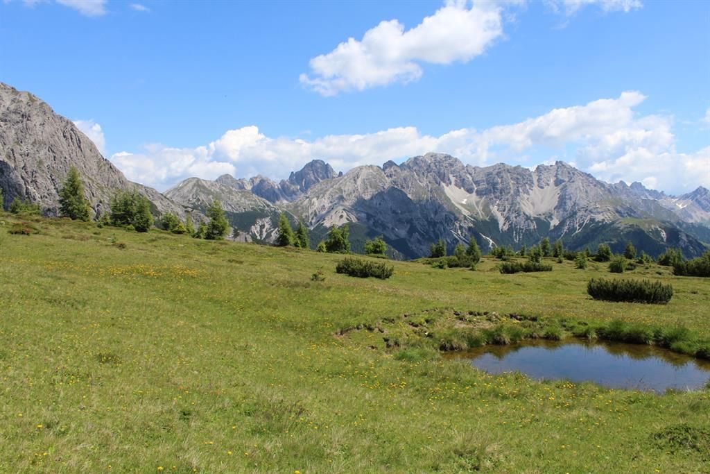
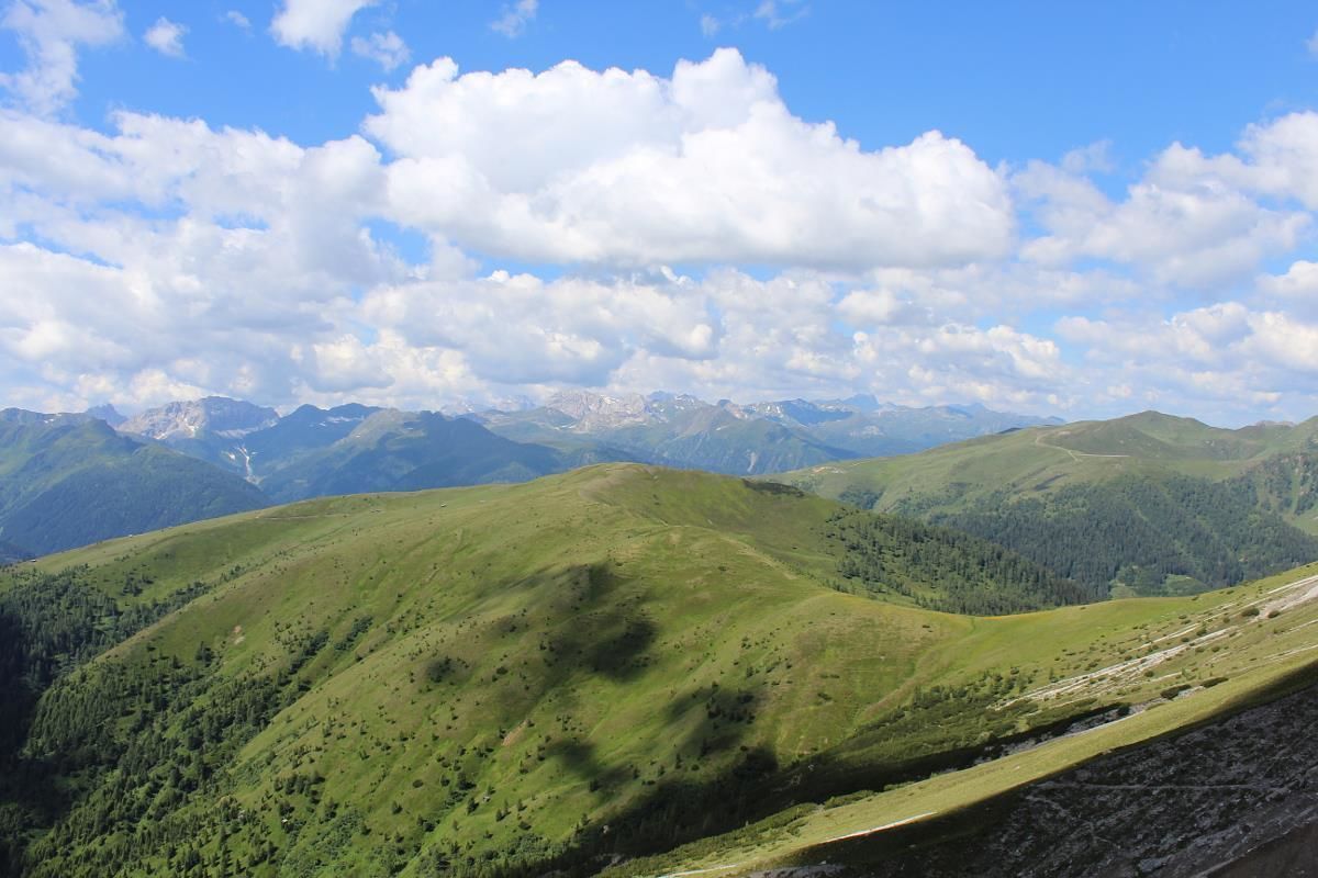
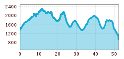
In the south of the Lienz Dolomites and in the west wings of the Gailtal Alps, the Gailtal altitude trail proceeds through impressive natural landscapes in the Gailtal and Lesachtal. Bounded in the north by the Pustertal and in the south by Tirol‘s Gailtal and Lesachtal, the Gailtal altitude trail is a gentle complement to the Peace trail (Carnic altitude trail 403) on the Carnic ridge. The entire route of the Gailtal altitude trail is not difficult.
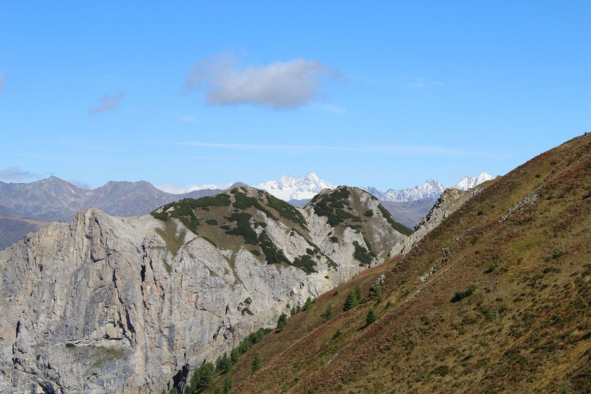
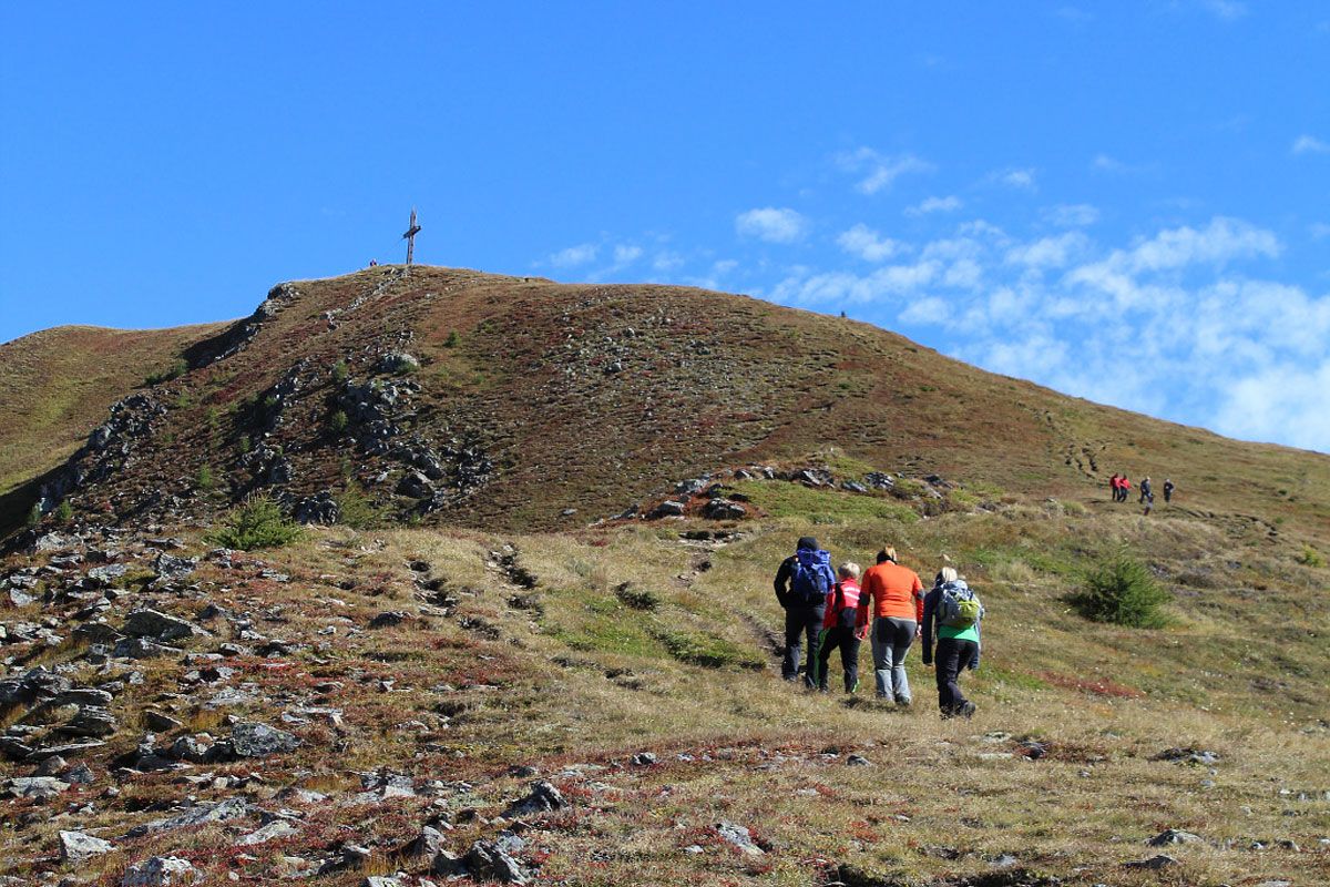
The route begins in St. Oswald near Kartitsch and proceeds via the Dorfberg up to the Golzentipp. Continue – after an overnight stay in the "Connyalm" above Obertilliach – via the Kofelspitz to the Gontrunsattel. You have a choice here, either proceed in the valley to the Ochsengartenalm and up again to Gumpedall, or opt for the somewhat steeper climb to the Tamerlanhöhe and from there cross a few steeper gravel gullies to get there. Another trail proceeds at the base of the Eggekofel massif, which has two distinct gravel gullies, across to Hals above the Kircher Almen and from there down to Lotteralm. Emergency accommodation is available here, should it be too late for another stage to Tuffbad via the Guggenberger Sattel.
Up to the Gailbergsattel (above Kötschach and Oberdrauburg) there are unfortunately no other overnight stay options! So it is recommended that you choose a day tour so that you may still descend again into one of the villages in Lesachtal to spend the night.

Nearby huts and mountain restaurants

Getting here

  • Parking

    Parkplatz beim Dorfberglift in St. Oswald

More long-distance hiking trails

  • KAT WALK FAMILY

    Difficulty:medium
    Length:52.5 kmDuration:4 daysElevation uphill:3,390 m
  • KAT WALK ALPINE

    Difficulty:medium
    Length:113.0 kmDuration:6 daysElevation uphill:6,300 m
  • Arlberg Trail

    Opening hours:closed
    Difficulty:difficult
    Length:52.1 kmElevation uphill:4,730 m
  • KAT WALK COMPACT

    Difficulty:medium
    Length:83.0 kmDuration:5 daysElevation uphill:5,462 m
  • Two day tour - Höhenweg Zahmer Kaiser

    Opening hours:open
    Difficulty:medium
    Length:30.0 kmDuration:13:15 hElevation uphill:2,100 m
  • Two days tour Wilder Kaiser

    Difficulty:difficult
    Length:42.5 kmDuration:15:57 hElevation uphill:2,475 m
  • Pilgerweg Prägraten a.G.

    Difficulty:medium
    Length:33.1 kmElevation uphill:2,793 m
  • Karwendel tour

    Difficulty:difficult
    Length:44.2 kmDuration:4 daysElevation uphill:3,955 m
  • KAT Walk: Three Valleys Hike

    Difficulty:medium
    Length:69.0 kmDuration:30:00 hElevation uphill:3,684 m
  • 3-day hut tour Wilder Kaiser

    Difficulty:difficult
    Length:24.6 kmDuration:14:00 hElevation uphill:2,060 m
  • Eagle Walk Tirol

    Difficulty:difficult
    Length:426.0 kmDuration:33 daysElevation uphill:30,000 m
  • Karwendel High Trail

    Difficulty:difficult
    Length:70.0 kmDuration:6 daysElevation uphill:4,470 m
Newsletter

The mountain is calling? So does our newsletter!

In our monthly newsletter we reveal the best holiday tips for Tyrol.