Mountain hikes Trail Talrundweg Kals am Großglockner

Kals am Großglockner / Schober Group
Difficulty ratings: easy
Route length: 19.5 km
Duration: 7:00 h

Enjoyable hikes for the whole family in Kals am Großglockner

Tour information

  • Requirement: easy
  • Length: 19.5 km
  • Duration: 7:00 h
  • Elevation uphill:623 hm
  • Elevation downhill:620 hm
Highest point1,582 m

Starting point

various

Finishing point

various
  • Fitness level 3 / 6
  • Technique 2 / 6

Features

  • Circular route
  • Suitable for families

Best time of year

  • January
  • February
  • March
  • April
  • May
  • June
  • July
  • August
  • September
  • October
  • November
  • December

Trail condition

Forest, meadow, gravel, asphalt

Equipment

comfortable shoes
Source: TVB Osttirol

Description

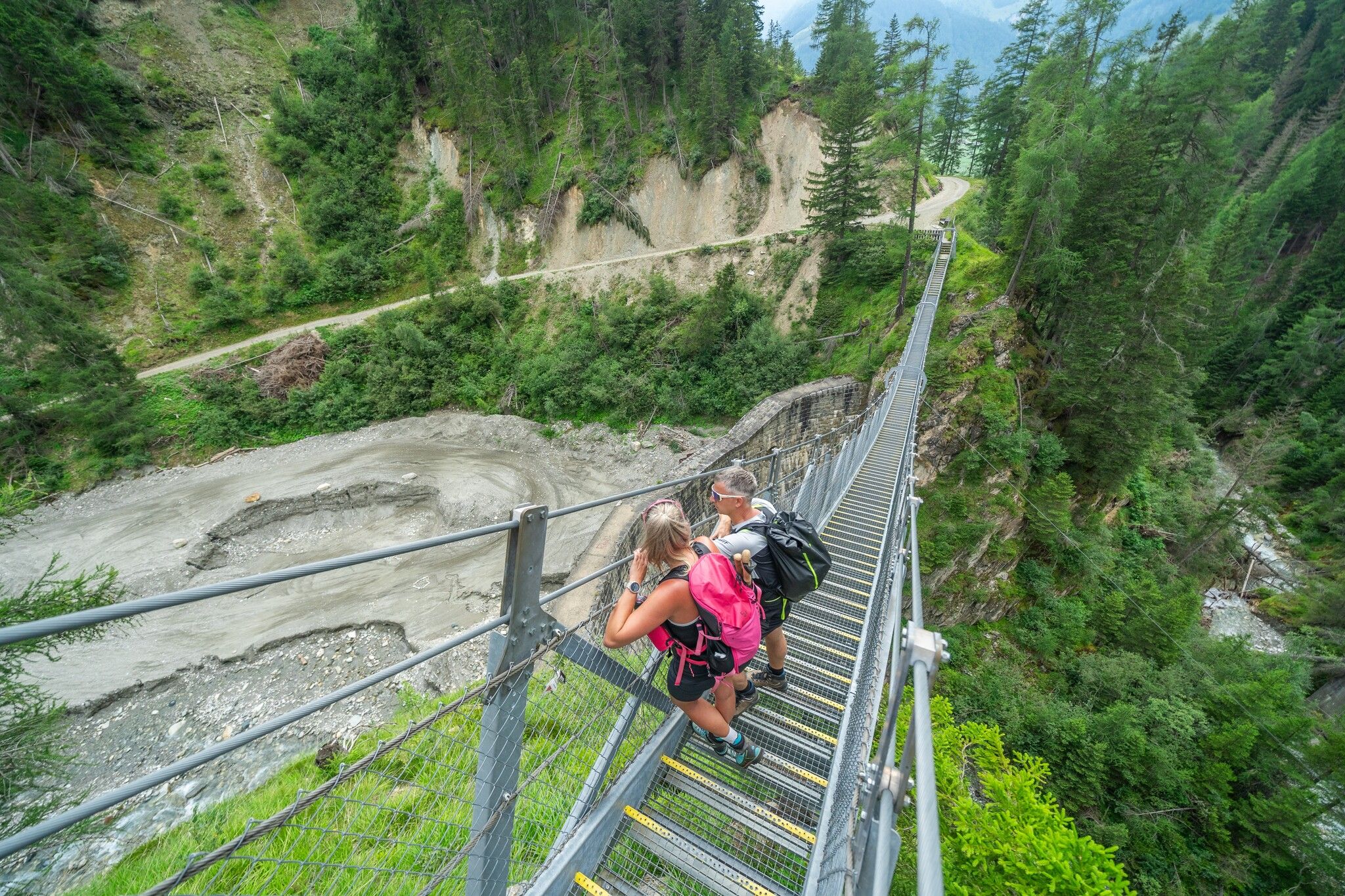
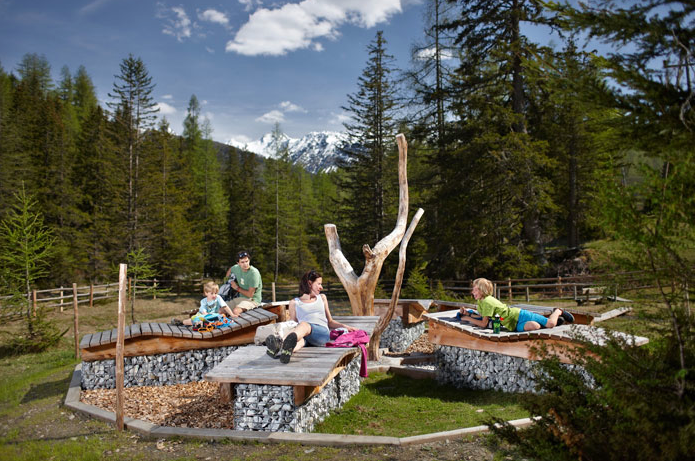
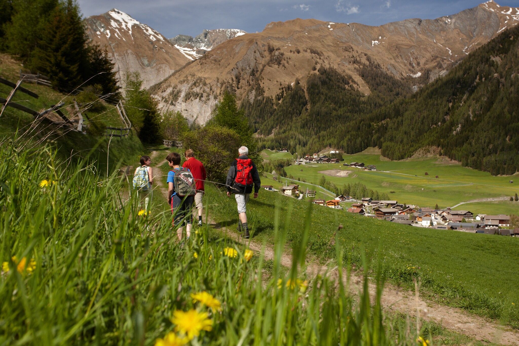
The entry points for walking on the 19.5 km valley circuit trail in Kals have been provided with lovely information boards and hiking maps. These are located at the Knopfbrücke near Arnig, in Lesach near the bridge, at the end of the valley in the parish of Taurer, before the head of the valley in Dorfertal, in Großdorf/Tembler and in Kals/Glor. The pure walking time for the entire circuit takes some six to seven hours, but can be subdivided into individual stages, with points where you can enter and exit as you wish. There are rest areas at several viewing points which have rustic ‘Glocknersessel’ chairs and information boards. Numerous fountains provide crystal-clear drinking water to the entire circular valley trail in Kals, which is not difficult and has been carefully maintained. Moderate altitude differences provide a reasonable and recommended undertaking for all age groups. Car parking is available at all access points.

Nearby huts and mountain restaurants

Getting here

  • Arrival by public transport

    by public bus 952 to the individual bus stops of the entrances

  • Parking

    at the designated parking lots at the entrances to the valley circular trail

More long-distance hiking trails

  • Arlberg Trail

    Opening hours:closed
    Difficulty:difficult
    Length:52.1 kmElevation uphill:4,730 m
  • Two days tour Wilder Kaiser

    Difficulty:difficult
    Length:42.5 kmDuration:15:57 hElevation uphill:2,475 m
  • 3-day hut tour Wilder Kaiser

    Difficulty:difficult
    Length:24.6 kmDuration:14:00 hElevation uphill:2,060 m
  • Eagle Walk Tirol

    Difficulty:difficult
    Length:426.0 kmDuration:33 daysElevation uphill:30,000 m
  • 3-Tages-Tour Wilder

    Difficulty:difficult
    Length:11.0 kmDuration:4:51 hElevation uphill:1,122 m
  • 3-Tages-Tour Wilder

    Difficulty:difficult
    Length:13.6 kmDuration:7:09 hElevation uphill:694 m
  • Koasa Trail

    Difficulty:medium
    Length:83.0 kmDuration:5 daysElevation uphill:4,700 m
  • KAT WALK FAMILY

    Difficulty:medium
    Length:52.5 kmDuration:4 daysElevation uphill:3,390 m
  • KAT WALK COMPACT

    Difficulty:medium
    Length:83.0 kmDuration:5 daysElevation uphill:5,462 m
  • Talweg Matrei i. O.

    Difficulty:medium
    Length:15.9 kmDuration:4:30 hElevation uphill:407 m
  • Two day tour - Höhenweg Zahmer Kaiser

    Opening hours:open
    Difficulty:medium
    Length:30.0 kmDuration:13:15 hElevation uphill:2,100 m
  • Tour 3

    Difficulty:difficult
    Length:32.8 km
  • Pilgerweg Prägraten a.G.

    Difficulty:medium
    Length:33.1 kmElevation uphill:2,793 m
  • Karwendel tour

    Difficulty:difficult
    Length:44.2 kmDuration:4 daysElevation uphill:3,955 m
Newsletter

The mountain is calling? So does our newsletter!

In our monthly newsletter we reveal the best holiday tips for Tyrol.