

Opening hours:Open today
Place:Tristach
:Alpine pasture / hut / mountain restaurant
7 ‘Törls’ (mountain crossings), 4 summits and 3 alpine lodges in 4-5 days
1st stage
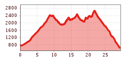
Starting from the Luggauer Bridge (between Leisach and Thal, on the road from Lienz in direction of Sillian) follow the marked path above the quarry to get to Leisacher Almbach River. Now the trail leads up to the Dapra Cross, and from there across more flat terrain inbound by the right mountainside. After about two hours, the valley bends to the left. Follow the path to a large moraine, which opens up access to the Kühbodentörl gap. From there follow the trail, keeping to the right, in direction of Hallebachtörl. Then continue across ridges and troughs down to the Kerschbaumer Alm. Climbers with good fitness can additionally tackle the ascent up to the Lienz local mountain, the Spitzkofel.
2nd stage
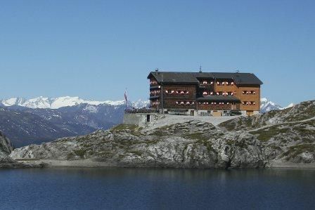
Across the Kerschbaumer Törl gap to the hut Karlsbader Hütte. From the Kerschbaumer Alm, it's up to the Kerschbaumer Törl gap. Shortly before reaching the gap, a path branches off which leads up to the summit of the Grosse Gamswiesenspitze in switchbacks. Descend along the same route. Now it's a short climb up to the Kerschbaumer Törl gap, from where you can also see the destination for the day – the Karlsbader Hütte.
3rd stage
Along Dreitörlweg (three-gap-path) up to hut Hochstadel. The stage begins with the climb up to the Laserztörl gap. From there, the route leads downhill to the Lavanter Alm covering some 400 m difference in altitude. Then a short climb first leads up to Kuhleitentörl gap. After a short descent and ascent past bizarre rock formations, you will get to the Baumgartnertörl. The climb now continues on to the Leitentörl gap. After a descent and the hike, the stage finishes in a south-facing semi-circle around the Hochstadel at the hut Hochstadel. With adequate fitness, a side trip from the Dreitörlweg path up to the Hochstadel provides a further highlight.
4th stage
After a night in the hut Hochstadel, it's down to Pirkach, from where it's another 4 km to the Oberdrauburg railway station. Alternatively to the long descent, you can also order a Hüttentaxi in advance.
Luggauer Brücke


