Multi-day hikes EUREGIO Marien-Weg-M6

Kufstein / Brandenberg Alps (Rofan)
Difficulty ratings: easy
Route length: 12.1 km
Duration: 3:38 h

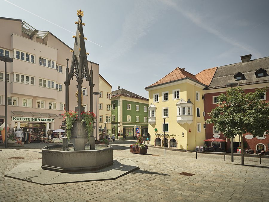
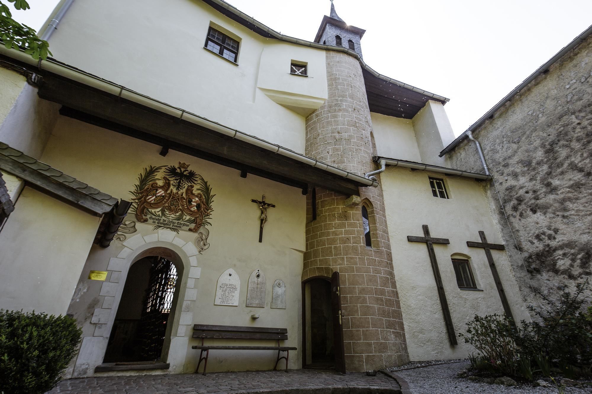
Auf dieser 12 Kilometer langen Pilger-Weitwanderung erkundet man die ganze Region des Kufsteinerlandes. Im Vordergrund stehen diverse Marien Denkmäler die zum Verweilen und zur Ruhe kommen einladen. Die Etappenlänge kann je nach Kondition selbst gewählt werden.

Tour information

  • Requirement: easy
  • Length: 12.1 km
  • Duration: 3:38 h
  • Elevation uphill:268 hm
  • Elevation downhill:264 hm
Highest point715 m

Starting point

Kufstein Marienbrunnen

Finishing point

Kufstein Marienbrunnen
  • Fitness level 2 / 6
  • Technique 2 / 6

Features

  • Circular route

Best time of year

  • January
  • February
  • March
  • April
  • May
  • June
  • July
  • August
  • September
  • October
  • November
  • December

Trail condition

Exclusively wide gravel and forest paths, as well as asphalted roads.

Equipment

Breathable outdoor clothing that also corresponds to the weather of the next few days, Sufficient food for all days (check availability at the huts), First aid kit, Cell phone with full battery and cell phone charger, Hiking map and guide literature, Sun protection (sunglasses, sunscreen and cap), Overnight utensils, hut sleeping bag, etc., Rain protection, Cash.
Source: TVB Kufsteinerland

Description

No luggage transfer is offered in Kufsteinerland for this long-distance hiking trail.

Getting here

  • Arrival by public transport

    Kufstein main station is only a few minutes walk from the starting point.
     

  • Parking

    Kufstein center
     

More long-distance hiking trails

  • Arlberg Trail

    Difficulty:difficult
    Length:52.1 kmElevation uphill:4,730 m
  • KAT WALK COMPACT

    Difficulty:medium
    Length:83.0 kmDuration:5 daysElevation uphill:5,462 m
  • Karwendel tour

    Difficulty:difficult
    Length:44.2 kmDuration:4 daysElevation uphill:3,955 m
  • Talweg Matrei i. O.

    Difficulty:medium
    Length:15.3 kmDuration:4:50 hElevation uphill:397 m
  • KAT Walk: Three Valleys Hike

    Difficulty:medium
    Length:69.0 kmDuration:30:00 hElevation uphill:3,684 m
  • EUREGIO Marien-Weg-M7

    Difficulty:easy
    Length:50.8 kmDuration:15:20 hElevation uphill:984 m
  • 3-day hut tour Wilder Kaiser

    Difficulty:difficult
    Length:24.6 kmDuration:14:00 hElevation uphill:2,060 m
  • EUREGIO-Maria-Weg-M5

    Difficulty:easy
    Length:166.6 kmDuration:46:16 hElevation uphill:2,971 m
  • Lechtaler Höhenweg

    Difficulty:difficult
    Length:84.5 kmDuration:11 daysElevation uphill:6,773 m
  • Tiroler Pilgerweg

    Difficulty:medium
    Length:220.0 kmElevation uphill:1,840 m
  • Eagle Walk Tirol

    Difficulty:difficult
    Length:426.0 kmDuration:33 daysElevation uphill:30,000 m
  • EUREGIO-Marien-Weg-M3

    Difficulty:easy
    Length:179.0 kmDuration:52:17 hElevation uphill:3,190 m
  • EUREGIO-Maria-Weg-M4

    Difficulty:easy
    Length:123.0 kmDuration:36:00 hElevation uphill:2,330 m
  • EUREGIO Mary Way-M1

    Difficulty:medium
    Length:84.1 kmDuration:25:01 hElevation uphill:2,238 m
  • Senn's WunderWanderWeg

    Difficulty:easy
    Length:1.0 kmDuration:0:30 hElevation uphill:81 m
Newsletter

The mountain is calling? So does our newsletter!

In our monthly newsletter we reveal the best holiday tips for Tyrol.