Multi-day hikes Mountain lakes and a panoramic peak in a class of its own

Tux / Tux Alps
Difficulty ratings: medium
Route length: 23.9 km
Duration: 11:30 h

To the natural paradise of the Tux Alps!

Tour information

  • Requirement: medium
  • Length: 23.9 km
  • Duration: 11:30 h
  • Elevation uphill:2,188 hm
  • Elevation downhill:1,611 hm
Highest point2,857 m

Starting point

Bus stop - Tuxer Mühle

Finishing point

Eggalmbahn Mountain Station
  • Fitness level 6 / 6
  • Technique 3 / 6

Features

  • Multi-day hike

Best time of year

  • January
  • February
  • March
  • April
  • May
  • June
  • July
  • August
  • September
  • October
  • November
  • December

Trail condition

Narrow mountain paths, mostly along the Almweg trail as far as Stoankasern. Overall, a moderately difficult two-day hike through a scenically stunning part of the Tux Alps. However, there are a few steep sections and a short stretch secured by a wire rope on the ledge leading down to Lake Junssee.

Equipment

Correct footwear (sole with a tread, firm hiking shoes)

Clothing (quickly drying, protection against wind, rain and cold)

Sunscreen – ATTENTION: strong sunlight in the mountains! Sunglasses, head protection, sunscreen with a high sun protection factor

First aid kit (gauze bandage, plaster)

Charged mobile phone

Drinks and food (drink plenty of fluid on hikes – but avoid alcohol!)

Source: Zillertal Tourismus GmbH

Description

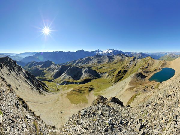
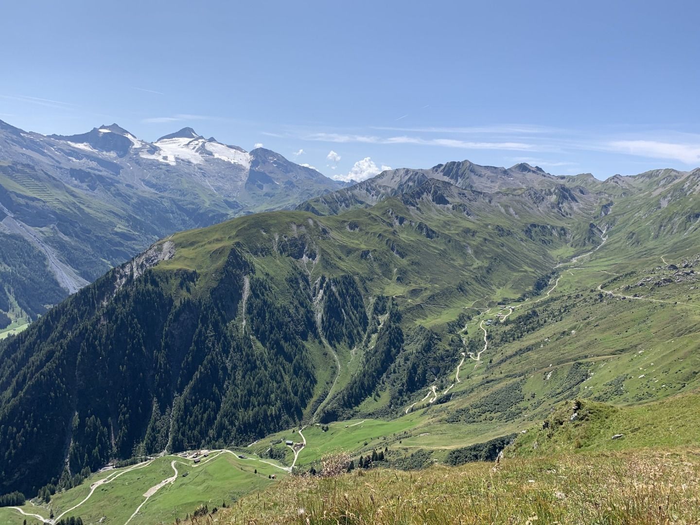
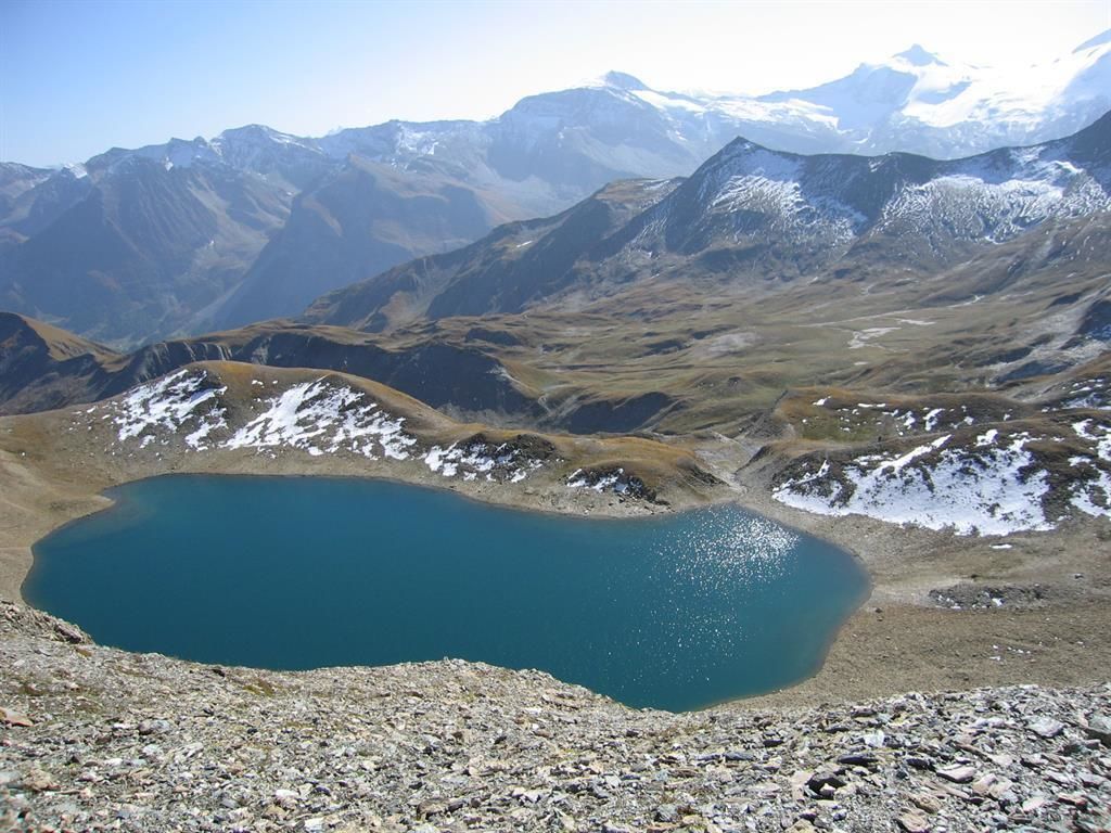
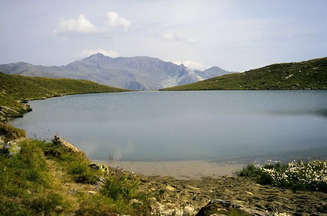
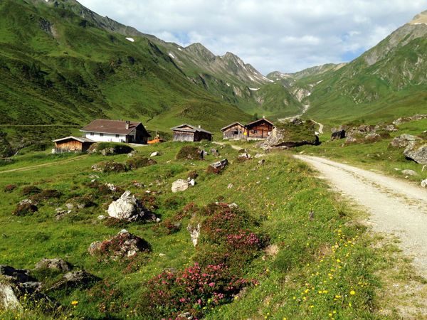
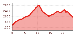
The two-day hike starts at the Tuxer Mühle and leads via the Junsbergalm – home to the historic Stoankasern mountain cheese dairy – up into the impressive high-mountain landscape of the Tux Alps. Passing marmot colonies, the Toten Böden and the idyllic Junssee, the route finally ascends to the Geier (2,857 m), which offers a magnificent panoramic view of the Zillertal and Tux Alps, the Karwendel and the Stubai Alps. The route then descends to the Lizumer Hütte (2,019 m), where the first stage comes to a leisurely end.

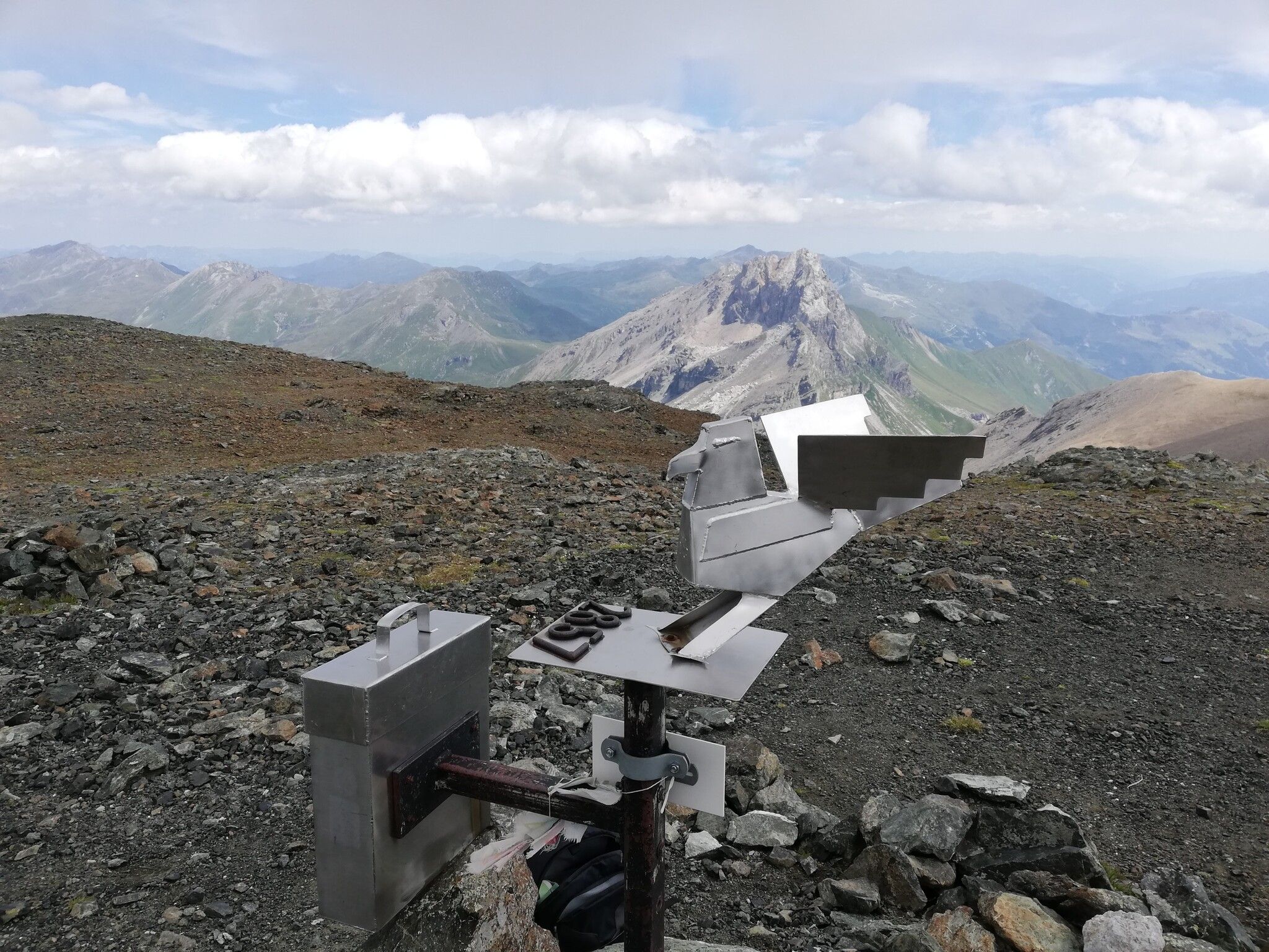
On the second day, the route continues over the Torjoch and the picturesque Torsee to the Ramsjoch with its famous Stammgästekreuz. After the descent to the Zilljöchl, you reach the striking Grüblspitze (2,395 m), which offers an impressive view over the Tux Valley. Via scenic high-altitude trails, you finally reach the top station of the Eggalmbahn, which takes you comfortably back down into the valley to Lanersbach.

Getting here

  • Arrival by public transport

    Bus Line 4104
    Stop on Day 1: Juns Tuxer Mühle
    Stop on Day 2: Lanersbach Eggalmbahnen/Tux-Center

  • Parking

    Heliport Alpin 5 Madseit / Tuxer Mühle
    Tux Lanersbach Tux-Center 401

More long-distance hiking trails

  • 3-day Family Tour Alpbachtal

    Difficulty:easy
    Length:18.3 kmDuration:7:00 hElevation uphill:998 m
  • 4 days - 4 summits tour

    Difficulty:medium
    Length:54.4 kmDuration:23:00 hElevation uphill:3,408 m
  • Koasa Trail

    Difficulty:medium
    Length:83.0 kmElevation uphill:4,700 m
  • Talweg Matrei i. O.

    Difficulty:medium
    Length:15.9 kmDuration:4:30 hElevation uphill:407 m
  • Two day tour - Höhenweg Zahmer Kaiser

    Opening hours:open
    Difficulty:medium
    Length:30.0 kmDuration:13:15 hElevation uphill:2,100 m
  • Two days tour Wilder Kaiser

    Difficulty:difficult
    Length:42.5 kmDuration:15:57 hElevation uphill:2,475 m
  • Gschnitztaler Hüttenstern

    Difficulty:medium
    Length:82.1 kmDuration:4:00 hElevation uphill:5,503 m
  • KAT WALK ALPINE

    Difficulty:medium
    Length:113.0 kmDuration:45:00 hElevation uphill:6,300 m
  • Arlberg Trail

    Difficulty:difficult
    Length:52.1 kmElevation uphill:4,730 m
  • Karwendel tour

    Difficulty:difficult
    Length:44.2 kmDuration:24:00 hElevation uphill:3,955 m
  • KAT Walk: Three Valleys Hike

    Difficulty:medium
    Length:69.0 kmDuration:30:00 hElevation uphill:3,684 m
  • 3-day hut tour Wilder Kaiser

    Difficulty:difficult
    Length:24.6 kmDuration:14:00 hElevation uphill:2,060 m
  • Tiroler Pilgerweg

    Difficulty:medium
    Length:220.0 kmElevation uphill:1,840 m
  • EUREGIO Mary Way-M1

    Difficulty:medium
    Length:84.1 kmDuration:25:01 hElevation uphill:2,238 m
  • Tiroler Burgenweg

    Difficulty:medium
    Length:63.0 kmDuration:25:00 hElevation uphill:2,228 m
Newsletter

The mountain is calling? So does our newsletter!

In our monthly newsletter we reveal the best holiday tips for Tyrol.