
Opening hours:Open today
Place:Längenfeld
:Alpine pasture / hut / mountain restaurant
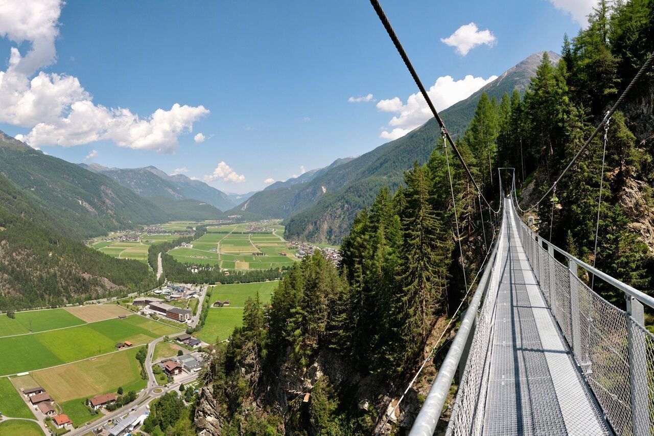
It's a good thing the best part of this hike comes at the end. After all, you might find yourself lingering a bit on the panoramic suspension bridge that leads straight to the Burgstein sun terrace.
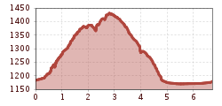
A moderately difficult loop hike from Längenfeld through the gorge up to Brand, featuring steep sections or, alternatively, the Felsensteig trail. After about 40 minutes, you’ll reach Brand and enjoy magnificent views of the valley. The trail continues on to Burgstein via an 84-meter-long suspension bridge 220 meters above the valley floor—the highlight of the tour. The return route follows the old Burgstein Road and the Albin Egger-Lienz themed trail back to the starting point.

Easy hiking trail; suitable for beginners and walkers. Please observe the current weather report.
The starting point of this hike is located in the center of Längenfeld at the Fischbach Bridge. The first steps lead into the so-called gorge, where some altitude meters have to be climbed in the direction of Brand.You take the forest path behind the church or dare to go over the rock path. After about 40 minutes, you have completed the most strenuous part of this hike and have arrived in Brand. There you will be rewarded with a wonderful view down to Längenfeld.
You continue to enjoy the magnificent view along the entire path to Burgstein. Just before Burgstein, you cross the 84-meter-long suspension bridge, which connects the two sun terraces Brand and Burgstein and hangs 220 meters above the valley floor. The view from the steel bridge is definitely the highlight of this hike. Upon arriving in Burgstein, you take the old Burgstein road (forest path) down to Längenfeld.In Längenfeld, you return to the starting point via the Albin Egger-Lienz themed trail.
Travel comfortably and safely by train. The final stop or exit point is the ÖTZTAL train station. Afterwards, you travel conveniently and quickly with public bus services or local taxi companies throughout the valley to your desired destination. The current bus schedule is available at: fahrplan.vvt.at
The following parking options are available in Längenfeld and Gries:


")
.jpg")

.jpg")


.jpg")
.jpg")

")


")
.jpg")
.jpg")

.jpg")


