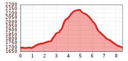
Mountain hikes Faltegartenköpfl peak

Haiming / Stubai Alps
Difficulty ratings: medium
Route length: 8.5 km
Duration: 4:30 h

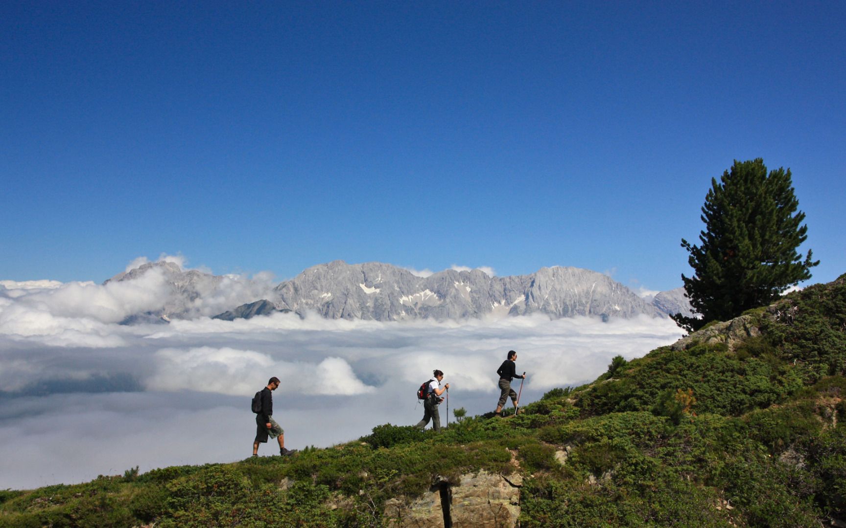
An inconspicuous summit? Maybe so! But when viewed from above, the Faltegartenköpfl boasts spectacular views and gently undulating alpine rose meadows.

Tour character

For the circular hike from the Sattele, first directly to the summit and back via the Feldringalm, or via the forest path to the Feldringalm and on to the summit. The Feldringalm is a great place to take a breather with fantastic views, topped off by the Faltegartenköpfl (2,184 m). The hike is easy to medium-difficult and is also suitable for children with mountain experience.

Tour information

  • Requirement: medium
  • Length: 8.5 km
  • Duration: 4:30 h
  • Elevation uphill:509 hm
  • Elevation downhill:500 hm
Highest point2,161 m

Starting point

Car park "Sattele", Haiming (pay parking)

Finishing point

Faltegartenköpfl

Features

  • Circular route
  • Suitable for families

Trail condition

gravel trail, trail
Source: Innsbruck Tourismus

Description

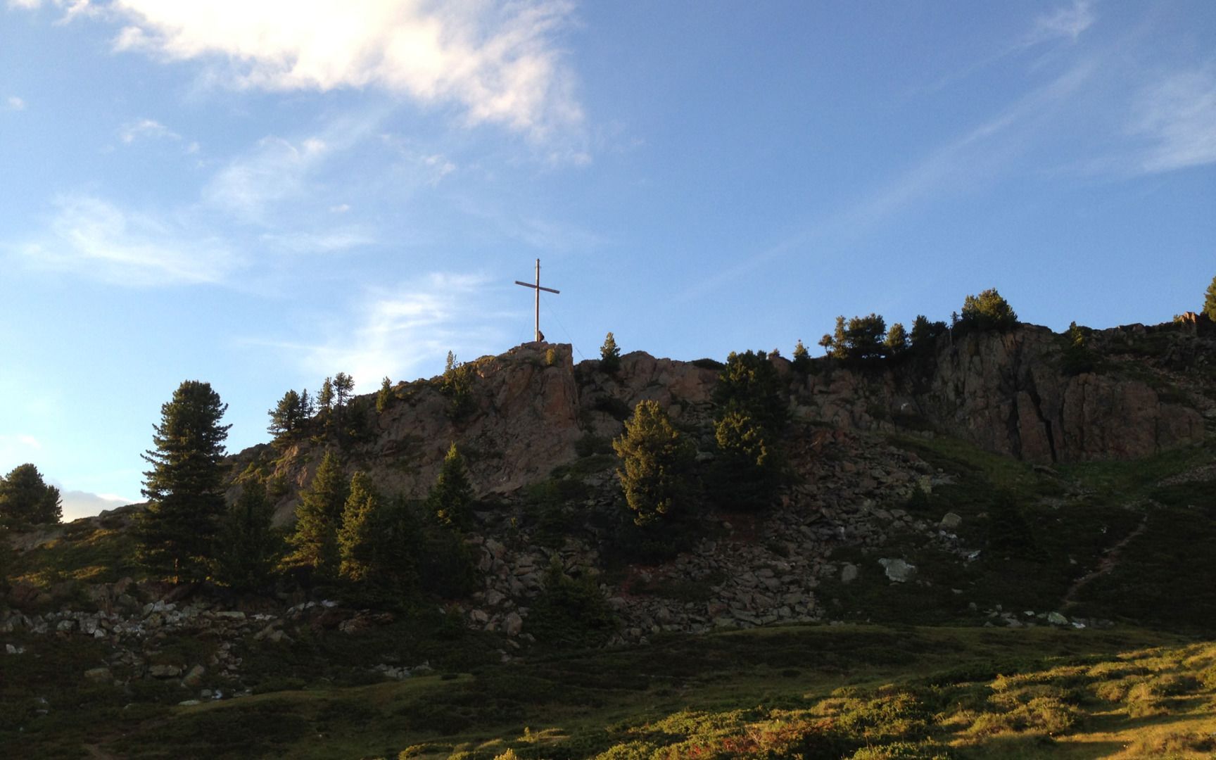
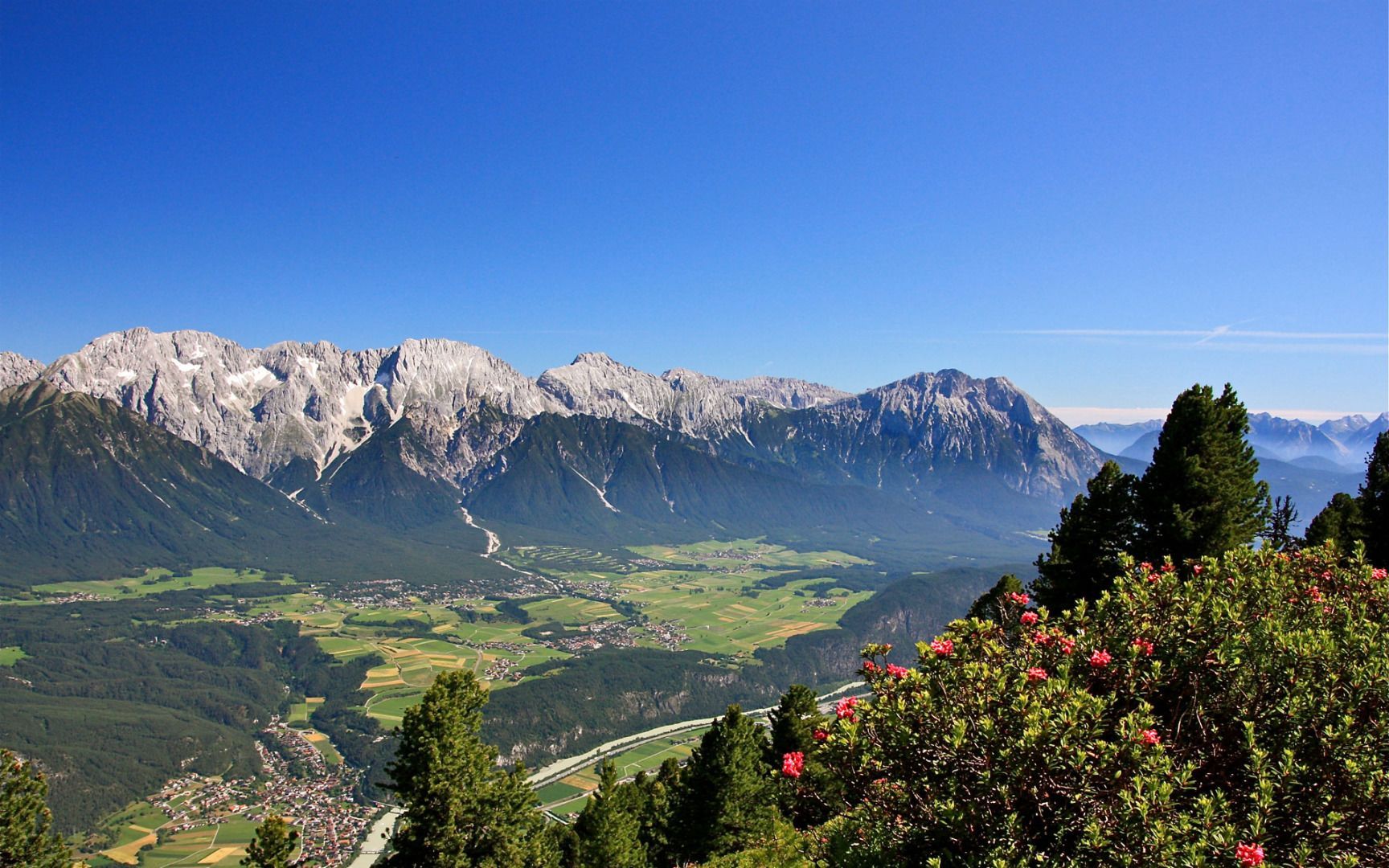
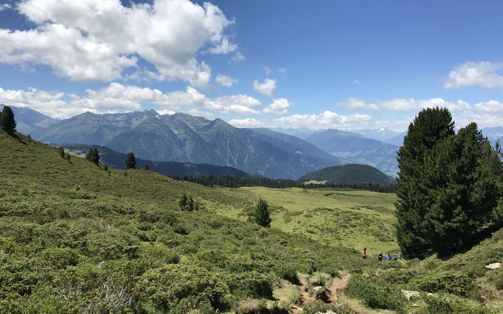
This hike starts just past the car park where you'll find a signposted and relatively flat forest trail that leads to the Gasthof Marlstein guesthouse. From there, a hiking trail continues up to the Grünwaslkreuz cross at an altitude of 2,027 metres above sea level before leading over a grassy ridge to the summit cross on Faltegartenköpfl peak, where you will be rewarded with fantastic views of the Mieming Plateau and the Inn Valley. The route back down leads though the extensive "Feldringer Böden" alpine meadows to the Feldringalm mountain hut and then continues along a forest road back to the starting point.

More tours in the surrounding area

  • Ötztal Trek Stage 6

    Difficulty:difficult
    Length:7.6 kmDuration:3:30 hElevation uphill:640 m
  • Ötztal Trek Stage 4

    Difficulty:difficult
    Length:8.9 kmDuration:4:00 hElevation uphill:802 m
  • Ötztal Trek Stage 3

    Difficulty:difficult
    Length:10.4 kmDuration:4:00 hElevation uphill:842 m
  • Ötztal Trek Stage 10

    Difficulty:difficult
    Length:11.1 kmDuration:4:30 hElevation uphill:1,476 m
  • Ötztal Trek Stage 7

    Difficulty:difficult
    Length:5.3 kmDuration:2:00 hElevation uphill:376 m
  • Ötztal Trek Stage 8

    Difficulty:difficult
    Length:9.3 kmDuration:3:30 hElevation uphill:274 m
  • Ötztal Trek

    Length:246.4 kmDuration:84:25 hElevation uphill:18,910 m
  • Ötztal Trek Stage 1

    Difficulty:medium
    Length:18.6 kmDuration:6:30 hElevation uphill:1,561 m
  • Ötztal Trek Stage 17

    Difficulty:difficult
    Length:16.4 kmDuration:6:00 hElevation uphill:1,080 m
  • Ötztal Trek Stage 14

    Difficulty:difficult
    Length:6.3 kmDuration:3:00 hElevation uphill:1,004 m
  • Ötztal Trek Stage 16

    Difficulty:difficult
    Length:6.9 kmDuration:2:30 hElevation uphill:358 m
  • Ötztal Trek Stage 20

    Opening hours:closed
    Difficulty:medium
    Length:6.4 kmDuration:3:00 hElevation uphill:610 m
  • Ötztal Trek Stage 12

    Difficulty:difficult
    Length:4.8 kmDuration:2:00 hElevation uphill:592 m
  • Ötztal Trek Stage 11

    Difficulty:difficult
    Length:12.0 kmDuration:5:00 hElevation uphill:705 m
  • Ötztal Trek Stage 5

    Difficulty:difficult
    Length:8.1 kmDuration:3:30 hElevation uphill:1,125 m
  • Ötztaler Urweg

    Length:189.1 kmDuration:72:19 hElevation uphill:9,428 m
  • Ötztal Trek Stage 22

    Difficulty:difficult
    Length:21.5 kmDuration:8:00 hElevation uphill:647 m
  • Ötztal Trek Stage 21

    Difficulty:difficult
    Length:9.4 kmDuration:4:30 hElevation uphill:1,270 m
  • Stuibenfall hike - Umhausen

    Opening hours:open
    Difficulty:easy
    Length:2.9 kmDuration:1:45 hElevation uphill:456 m
  • Mountain peak Rosskopf

    Difficulty:medium
    Length:2.0 kmDuration:2:00 hElevation uphill:379 m
Newsletter

The mountain is calling? So does our newsletter!

In our monthly newsletter we reveal the best holiday tips for Tyrol.