Long-distance hike Ötztal Trek Stage 1

Haiming / Stubaier Alpen
Difficulty ratings: medium
Route length: 18.6 km
Duration: 6:30 h

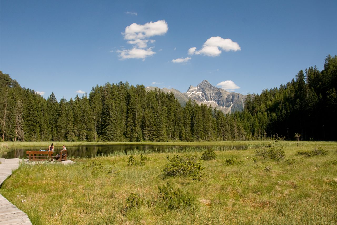
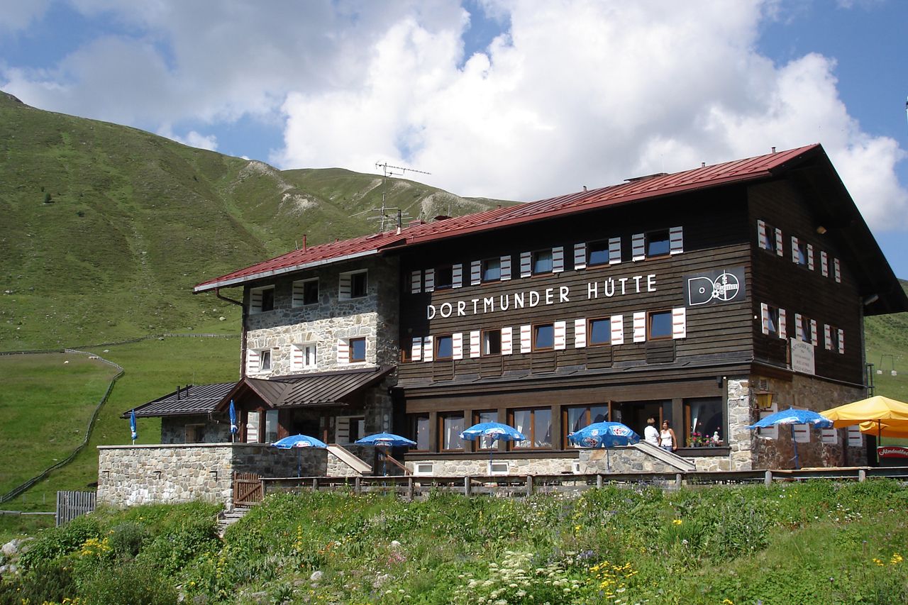
The first stage of the beginner's route, Route 1 of the Ötztal Trek, is a tough one. Right at the start, you have to conquer over 1,400 meters of ascent. It's a good thing that the hamlets and lakes enchant us and make us forget all our efforts. We climb up, leave everyday life in the valley and look forward to the first stage destination, the Dortmunder Hütte in Kühtai.

Tour character

Medium-difficulty stage on red mountain paths. Sure-footedness and a very good level of fitness are required. The tour follows footpaths, tracks and climbs.

Tour information

  • Requirement: medium
  • Length: 18.6 km
  • Duration: 6:30 h
  • Elevation uphill:1,561 hm
  • Elevation downhill:305 hm
Highest point1,949 m

Starting point

Ötztal Station

Finishing point

Dortmunder Hut
  • Fitness level 4 / 6

Best time of year

  • January
  • February
  • March
  • April
  • May
  • June
  • July
  • August
  • September
  • October
  • November
  • December

Equipment

Moderately difficult mountain path; suitable for sure-footed and experienced mountain hikers; good physical condition, mountain experience, and mountain equipment (see equipment) necessary. Please observe the current weather report.

Appropriate equipment such as breathable and weather-appropriate outdoor clothing is required for all hikes and routes. It is necessary to carry a first aid kit, a mobile phone, and possibly a hiking map, as well as sufficient provisions when hiking without opportunities for refreshment.

Source: Ötztal

Description

  • Trail type: path, footpath, forest road
  • Requirements: sure-footedness, fitness, endurance
  • Mountain path red
  • Difficulty: no special difficulties
  • Equipment: normal hiking equipment
  • Overnight stays, dining: Mountain hotel & guesthouse Marlstein, Almhof Mareil, Dortmunder Hut, nearby (Issalm, Feldringalm – no overnight stays)

Nearby huts and mountain restaurants

Getting here

  • Arrival by public transport

    Travel comfortably and safely by train to the Ötztal station. The final stop or exit point is ÖTZTAL station. Afterwards, you can travel comfortably and quickly through the entire valley to your desired destination by public transport or local taxi companies.

    The current bus schedule is available at: http://fahrplan.vvt.at

  • Parking

    The following parking options are available:

    - Infopoint Ambach | paid | tickets available at the Oetz information office or Infopoint Ambach 

More tours in the surrounding area

  • Ötztal Trek Stage 20

    Opening hours: closed
    Difficulty: medium
    Length: 6.4 km Duration: 3:00 h Elevation uphill: 610 m
  • Ötztal Trek Stage 5

    Difficulty: difficult
    Length: 8.1 km Duration: 3:30 h Elevation uphill: 1,125 m
  • Ötztal Trek Stage 4

    Difficulty: difficult
    Length: 8.9 km Duration: 4:00 h Elevation uphill: 802 m
  • Ötztal Trek Stage 3

    Difficulty: difficult
    Length: 10.4 km Duration: 4:00 h Elevation uphill: 842 m
  • Ötztal Trek Stage 10

    Difficulty: difficult
    Length: 11.1 km Duration: 4:30 h Elevation uphill: 1,476 m
  • Ötztal Trek Stage 11

    Difficulty: difficult
    Length: 12.0 km Duration: 5:00 h Elevation uphill: 705 m
  • Ötztal Trek Stage 7

    Difficulty: difficult
    Length: 5.3 km Duration: 2:00 h Elevation uphill: 376 m
  • Ötztal Trek Stage 12

    Difficulty: difficult
    Length: 4.8 km Duration: 2:00 h Elevation uphill: 592 m
  • Ötztal Trek Stage 22

    Difficulty: difficult
    Length: 21.5 km Duration: 8:00 h Elevation uphill: 647 m
  • Ötztal Trek Stage 21

    Difficulty: difficult
    Length: 9.4 km Duration: 4:30 h Elevation uphill: 1,270 m
  • Mountain peak Rosskopf

    Difficulty: medium
    Length: 2.0 km Duration: 2:00 h Elevation uphill: 379 m
  • Loop trail Stuibenfall Umhausen

    Opening hours: open
    Difficulty: easy
    Length: 9.2 km Duration: 4:00 h Elevation uphill: 608 m
  • Brizzisee

    Difficulty: medium
    Length: 9.0 km Duration: 3:30 h Elevation uphill: 1,057 m
  • Via Ferrate Stuibenfall | Umhausen

    Opening hours: closed
    Difficulty: medium
    Length: 1.5 km Duration: 4:00 h Elevation uphill: 162 m
  • Fundusfeiler - Umhausen

    Difficulty: difficult
    Length: 4.5 km Duration: 3:00 h Elevation uphill: 1,109 m
  • Gampe Thaya

    Difficulty: medium
    Length: 2.6 km Duration: 1:45 h Elevation uphill: 623 m
  • Ramolhaus - Obergurgl

    Difficulty: difficult
    Length: 7.8 km Duration: 4:00 h Elevation uphill: 1,095 m
Newsletter

The mountain is calling? So does our newsletter!

In our monthly newsletter we reveal the best holiday tips for Tyrol.