Mountain hikes Fundusfeiler - Umhausen

Umhausen / Ötztaler Alpen
Difficulty ratings: difficult
Route length: 4.5 km
Duration: 3:00 h

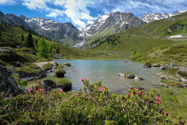
What a beautiful and lonely Fund(usfeiler) in the Ötztal Alps! It is quite possible that this is due to the long ascent to the rear Fundusalm. How good that you can get there easily with the hut cab.

Tour character

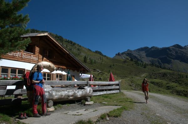
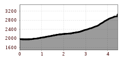
From the Hintere Fundusalm, which can be reached by hut cab, only a slight ascent to the Frischmannhütte and then via a narrow, steeper mountain path to the summit. Shortly before the summit, a secured gully with steel ropes and stirrups requires a bit of scrambling. For this alpine summit tour, you should have a basic level of alpine experience as well as surefootedness and a head for heights.

Tour information

  • Requirement: difficult
  • Length: 4.5 km
  • Duration: 3:00 h
  • Elevation uphill:1,109 hm
  • Elevation downhill:15 hm
Highest point3,079 m

Starting point

Hintere Fundusalm

Finishing point

Fundusfeiler
  • Fitness level 6 / 6

Best time of year

  • January
  • February
  • March
  • April
  • May
  • June
  • July
  • August
  • September
  • October
  • November
  • December

Equipment

Suitable for those free of fear of heights, sure-footed, and alpine experienced mountaineers;

Very good physical condition, alpine experience and mountaineering equipment (see under equipment), sometimes alpine safety equipment, good weather conditions recommended

Please observe the current weather report 

Appropriate equipment such as breathable and weather-appropriate outdoor clothing, ankle-high hiking boots, wind, rain and sun protection, hat, possibly gloves, is required for all hikes and routes. Carrying a first-aid kit, a mobile phone, and possibly a hiking map, as well as sufficient provisions for hikes without refreshment options, is necessary.

Source: Ötztal

Description

The mountain route starts from the Hintere Fundusalm (hut taxi) and you first hike to the Frischmann hut. From here, a narrow, steep path leads towards Feilerscharte (2,926 m). From Feilerscharte, it takes about half an hour to hike to the summit. The descent is possible via the Leierstal or the same way back.

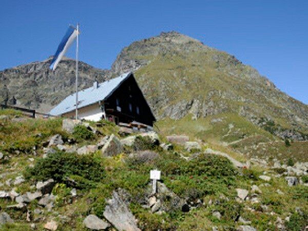
Tip: Mountain route from the Frischmann hut via the Fundusfeiler continuing along the Forchheimer Höhenweg to the Erlanger hut. There is the option to take the hut taxi to the Hintere Fundusalm.


Nearby huts and mountain restaurants

Getting here

  • Arrival by public transport

    Travel comfortably and safely by train to the Ötztal train station. The final stop or exit point is the ÖTZTAL station. Then you can conveniently and quickly travel with public transport or local taxi companies through the entire valley to your desired destination.

    The current bus schedule is available at: http://fahrplan.vvt.at 

  • Parking

    The following parking options are available in Umhausen:

    • Mure parking lot | free of charge

More tours in the surrounding area

  • Ötztal Trek Stage 6

    Difficulty: difficult
    Length: 7.6 km Duration: 3:30 h Elevation uphill: 640 m
  • Ötztal Trek Stage 8

    Difficulty: difficult
    Length: 9.3 km Duration: 3:30 h Elevation uphill: 274 m
  • Ötztal Trek Stage 17

    Difficulty: difficult
    Length: 16.4 km Duration: 6:00 h Elevation uphill: 1,080 m
  • Ötztal Trek Stage 16

    Difficulty: difficult
    Length: 6.9 km Duration: 2:30 h Elevation uphill: 358 m
  • Ötztal Trek Stage 20

    Opening hours: closed
    Difficulty: medium
    Length: 6.4 km Duration: 3:00 h Elevation uphill: 610 m
  • Ötztal Trek Stage 5

    Difficulty: difficult
    Length: 8.1 km Duration: 3:30 h Elevation uphill: 1,125 m
  • Winter hiking trail Rotes Wandl - No. 431

    Opening hours: closed
    Difficulty: easy
    Length: 1.5 km Duration: 0:45 h Elevation uphill: 52 m
  • Ötztal Trek Stage 4

    Difficulty: difficult
    Length: 8.9 km Duration: 4:00 h Elevation uphill: 802 m
  • Ötztal Trek Stage 3

    Difficulty: difficult
    Length: 10.4 km Duration: 4:00 h Elevation uphill: 842 m
  • Ötztal Trek Stage 10

    Difficulty: difficult
    Length: 11.1 km Duration: 4:30 h Elevation uphill: 1,476 m
  • Ötztal Trek

    Length: 246.4 km Duration: 84:25 h Elevation uphill: 18,910 m
  • Ötztal Trek Stage 1

    Difficulty: medium
    Length: 18.6 km Duration: 6:30 h Elevation uphill: 1,561 m
  • Ötztal Trek Stage 14

    Difficulty: difficult
    Length: 6.3 km Duration: 3:00 h Elevation uphill: 1,004 m
  • Ötztal Trek Stage 11

    Difficulty: difficult
    Length: 12.0 km Duration: 5:00 h Elevation uphill: 705 m
  • Ötztaler Urweg

    Length: 189.1 km Duration: 72:19 h Elevation uphill: 9,428 m
  • Ötztal Trek Stage 7

    Difficulty: difficult
    Length: 5.3 km Duration: 2:00 h Elevation uphill: 376 m
  • Ötztal Trek Stage 12

    Difficulty: difficult
    Length: 4.8 km Duration: 2:00 h Elevation uphill: 592 m
  • Ötztal Trek Stage 22

    Difficulty: difficult
    Length: 21.5 km Duration: 8:00 h Elevation uphill: 647 m
  • Ötztal Trek Stage 21

    Difficulty: difficult
    Length: 9.4 km Duration: 4:30 h Elevation uphill: 1,270 m
  • Vent - Breslauer Hütte - Vernagthütte

    Difficulty: medium
    Length: 10.4 km Duration: 4:00 h Elevation uphill: 1,203 m
Newsletter

The mountain is calling? So does our newsletter!

In our monthly newsletter we reveal the best holiday tips for Tyrol.