Arrival by public transport
By train to Brennero/Brenner railway station, from there on foot to Brennersee and Venntal. Information on the timetable at www.vvt.at
Being out and about in particularly remote places is often a borderline experience. This applies to the Landshut Europahütte (closed in 2025) not only figuratively, but also literally: the hut is also called Rifugio Venna alla Gerla, and the border to South Tyrol runs right through the middle of the guest area.
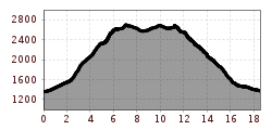
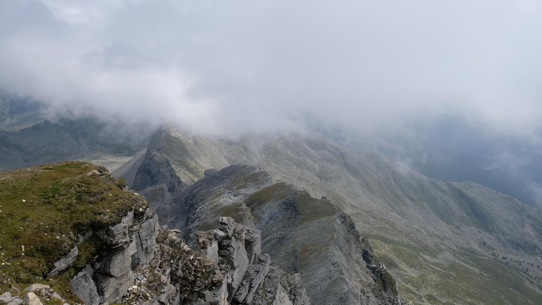
Panoramic hut tour with two scenic approaches through secluded valleys not far from the Brenner Pass. In between, a fantastic ridge crossing with two fantastic panoramic peaks: Wolfendorn and Wildseespitze. Between Wildseespitze and Landshuter Hütte, the demands increase somewhat and some parts of the trail are secured with steel ropes. If you spend the night at the Landshuter Europahütte, you can make a detour to the almost three-thousand-meter Kraxentrager before descending.
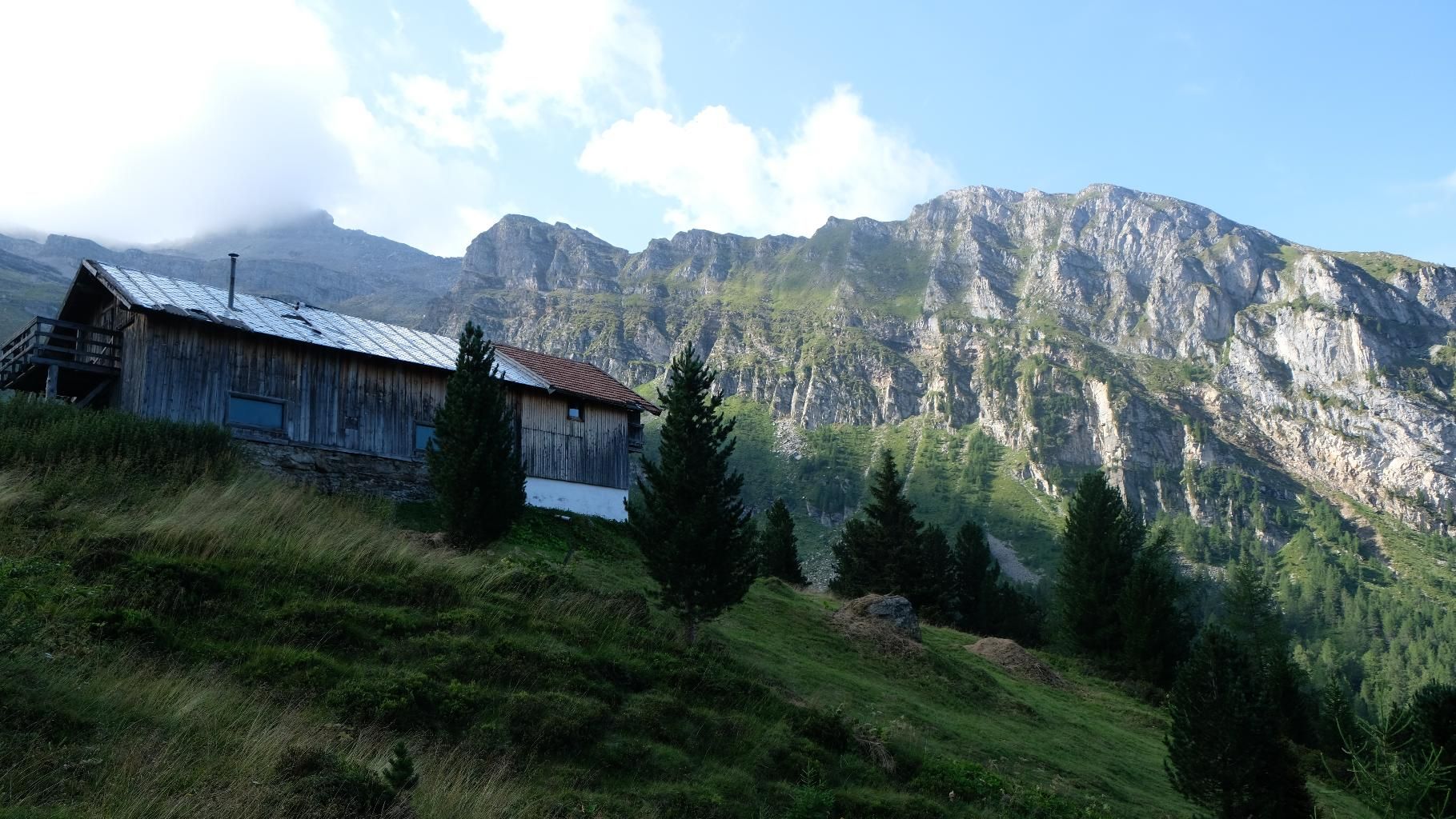
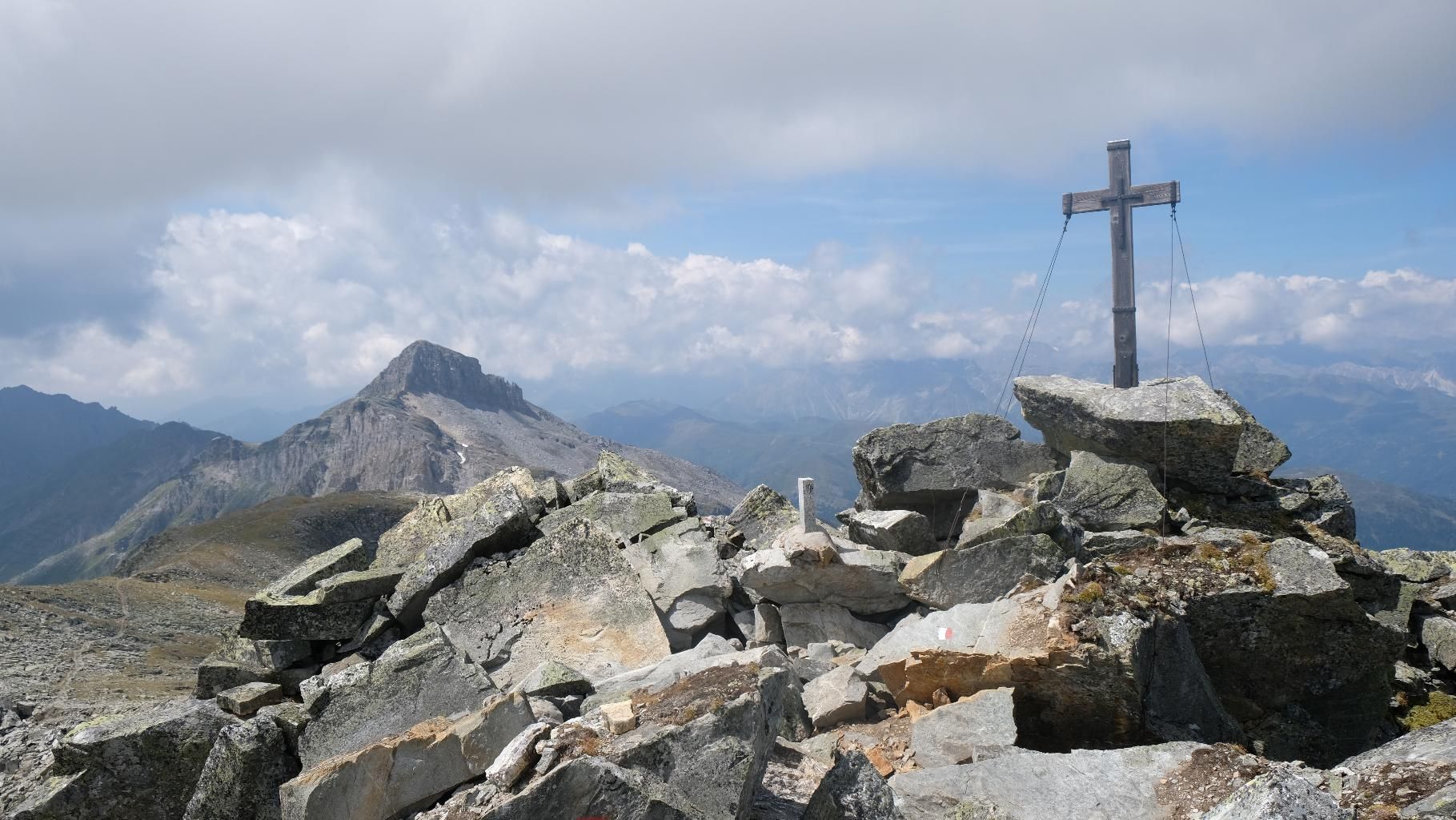
From Brennersee, the trail leads via Griesberg past a quarry to Griesbergalm, which lies lonely and untouched below Wolfendorn and Wildseespitze. Through sparse pine forests and alpine meadows, the trail continues in a curve to the Mäuerlscharte and thus to the border between Austria and Italy. After some time along a ridge, on which you virtually circle the mountain peak, you finally reach the ascent to the summit of the Wolfendorn, which you also reach after a few hairpin bends. You are rewarded with a breathtaking view over the Wipptal valley and the border region. After a short descent, you continue along the old, well-built Zöllnerweg along the border ridge to the Wildseespitz, which towers directly above its namesake, the Wildsee. On reaching the Wildseespitz, the Landshuterhütte also becomes visible, exposed on the Friedrichshöhe. Once again, the trail follows the ridge, always with a view of the Pfitschtal valley and the mighty peaks of the Zillertal Alps, until you finally reach the alpine restaurant and can look forward to refreshments. The descent is first across the alpine meadows of the Hochleger of the Venntalalm and then later across the lonely Venntal back to the Brennersee.
ROUTE DESCRIPTION
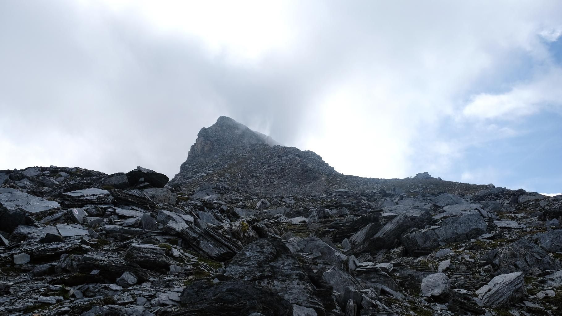
From the Brennersee car park, take the road to the right after the subway and walk up above the motorway to the Griesberghof farm and then on to the quarry. At 1600 m above sea level, immediately after the first bend before the start of the quarry area, marked by a small bridge, the trail with the No. 5A branches off to the alpine pasture, somewhat hidden. The trail climbs in serpentines on the left side of the valley, first through a spruce forest, later through old, abandoned mountain meadows. Finally you reach the rustic hut of the Griesbergalm, beautifully situated at the beginning of the opening alpine basin. The Wolfendorn also already smiles at the climber. The trail now leads in a wide arc through the last groups of pine trees and alpine pastures to the Mäuerlscharte, which lies exactly on the national border. Now there are a few narrow serpentines up a ridge before you reach the old Zöllnerstraße and with it the direct access path (Tiroler Höhenweg) from Brenner. The trail then continues relatively level without gaining any further altitude around the Wolfendorn massif until it almost reaches the ridge to the Pfitschtal valley, where the ascent to the 2776 m summit begins on the south side of the massif. After enjoying the wonderful panorama for a while and taking a snack or two, you have to descend again briefly before the trail turns east and follows the border ridge through impressive rock formations. The trail now climbs and descends gently towards the Wildseespitz, which is reached after about 1.5 hours. As an alternative to the path over the Wildspitz, there is also a shortcut along the path on the Pfitscher valley side, but this is not recommended as it is always difficult to find due to the loose rock. From Wildseespitz, the route is a bit more exposed, first down the right side of the valley and later along the ridge to the Landshuter Hütte, with one or two secured passages. After a good hour, this section of the tour is also completed and the hut is reached. After the stop for refreshments, the descent leads along the well-maintained trail (no. 531) first to the Hochleger of the Venner Alm and from there on the left side in serpentines down the spruce forest to the valley floor. Now you only have to return via the Venntal forest path to the car park at the Brennersee, and you can also stop off at the Venntal snack bar.
SAFETY ADVICE
Below the Wildseespitz, the path is quite difficult to find due to the crumbly terrain. Special concentration is required here. There is also a short secured passage between the summit of the Wildseespitz and the Landhuterhütte, but this is easily manageable.
TIP OF THE AUTHOR
Beautiful round tour along the national border between Austria and Italy with breathtaking views over the Wipptal valley and to the Tuxer and Zillertaler main alpine ridges.
By train to Brennero/Brenner railway station, from there on foot to Brennersee and Venntal. Information on the timetable at www.vvt.at
Car park Brennersee


 (1).jpg")
.jpg")

")


.JPG")


