.JPG")
Ort:Trins
:Alpine pasture / hut / mountain restaurant
Someone must have made a mistake with the cross and placed it on the mountain instead of the church. Well, the Gschnitztal can now boast what is probably the most beautiful church roof in the world.
Panoramic, physically demanding mountain tour in the Stubai Alps to the strikingly church-roof-shaped Kirchdachspitze. The hike up to the Padasterjochhaus is doable without any particular difficulties, after which the trail becomes much more alpine and leads through steep, exposed rocky terrain that requires surefootedness and a head for heights. The last few meters to the summit are secured with a steel cable. An impressive panoramic view awaits at the top, with the Karwendel to the north, the Habicht to the west, the Dolomites in South Tyrol and the Olperer to the east. The Padasterjochhaus is a good place to stop for refreshments and a useful rest stop and is also a good base for further summit tours. Access by mountain bike to the Padasterjochhaus is possible.
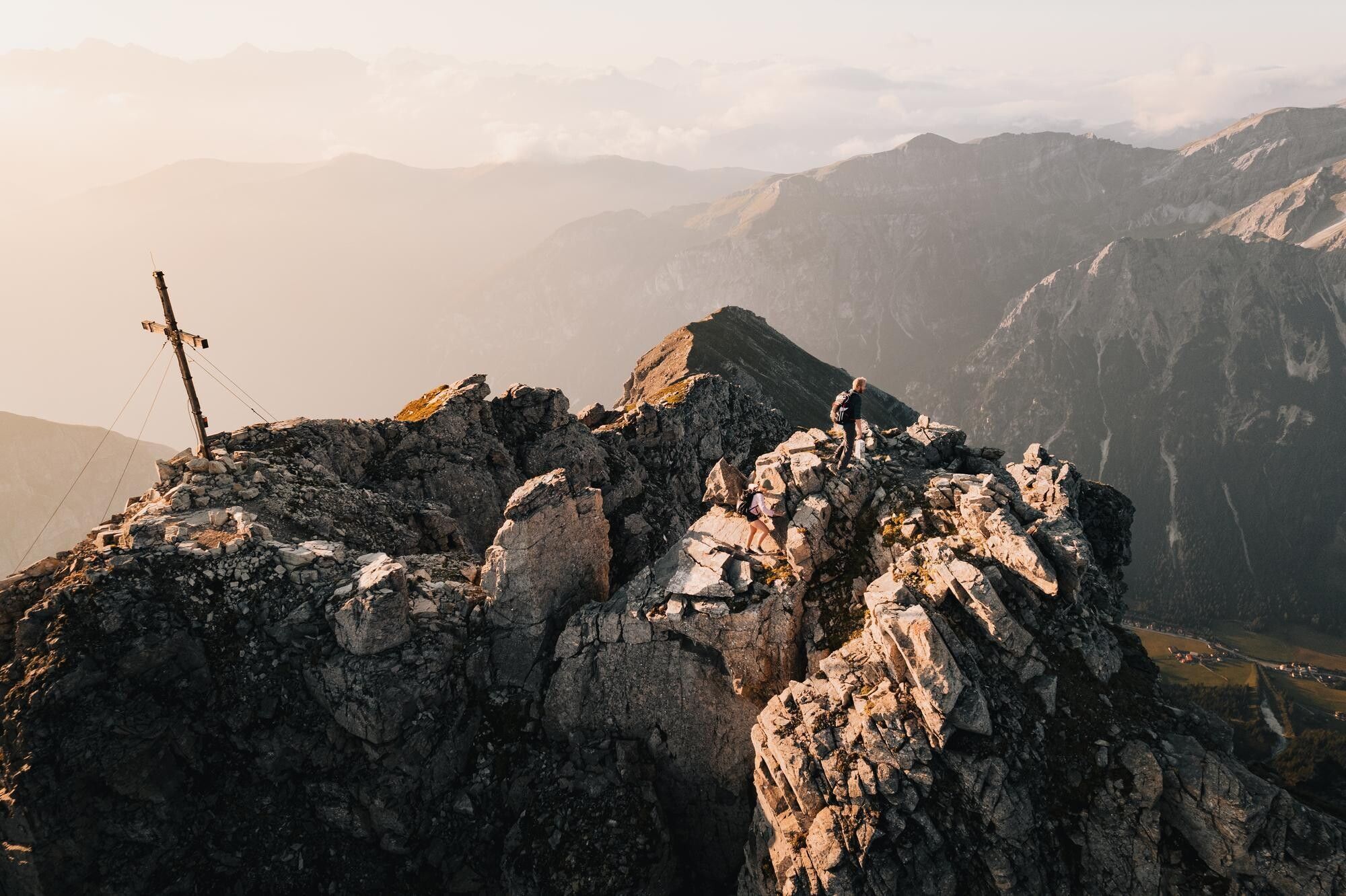


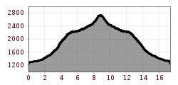
The starting point is the "Trins Waldfest" bus stop or the "Waldfest" parking lot. The trail initially runs mostly through the forest into the Padastertal valley until the first sharp right-hand bend. Now follow the marked Herrenweg trail no. 122 straight ahead across a meadow, over a bridge and uphill through the forest, always cutting off the bends in the forest road. You now reach the tree line under the Foppmandl. Another steep climb, then turn left to the Padasterjochhaus. The ascent can also be tackled by mountain bike. From the hut, cross the slopes along trail no. 122 southwards to a shoulder above the Padasterjoch. Continue through steep slopes, past the Schäferhütte, to a cut in the terrain and then up into the nameless saddle between the Hammerspitze and Kirchdachspitze to the Silbersattel. From there it is only a few meters up to the summit, the trail is secured by ropes here. Once at the top, you are rewarded with a magnificent view! Descent as ascent.
Take the regional bus 4146 from Steinach a. Br. station to "Trins Waldfestplatz".
Public transport in the Wipptal is included in the guest card. included in the guest card. More information about the timetable www.vvt.at.
Parking lot Waldfest


.JPG")


