
Place:Navis
:Alpine pasture / hut / mountain restaurant
Five fairytales in one go: the Naviser Almenrunde connects Peeralm, Klammalm, Poltenalm and Stöcklalm. In between, wonderful hiking trails through mountain landscapes and alpine meadows.
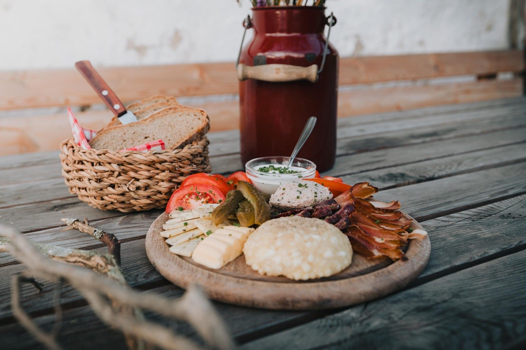
Hiking enjoyment combined with culinary delights: the approx. 14-kilometre, moderately difficult circular tour through the alpine pasture and mountain landscape in the Tyrolean Wipptal offers many scenic and culinary highlights. It leads along forest, alpine and meadow paths with five refreshment stops at regular intervals. Excellent Tyrolean fare is served at the huts: Kaspressknödel dumplings, mushroom dishes, Brettljausen snacks with delicacies straight from the dairyman. No matter which alp you head for first - the tour is equally beautiful in both directions! There are either playgrounds or petting zoos on the mountain pastures. The tour can also be shortened, and the individual mountain pastures are worthwhile destinations in their own right in a very special valley. The Navistal is pristine and in summer various breeds of cattle as well as Haflinger and other horses graze on the alpine meadows.
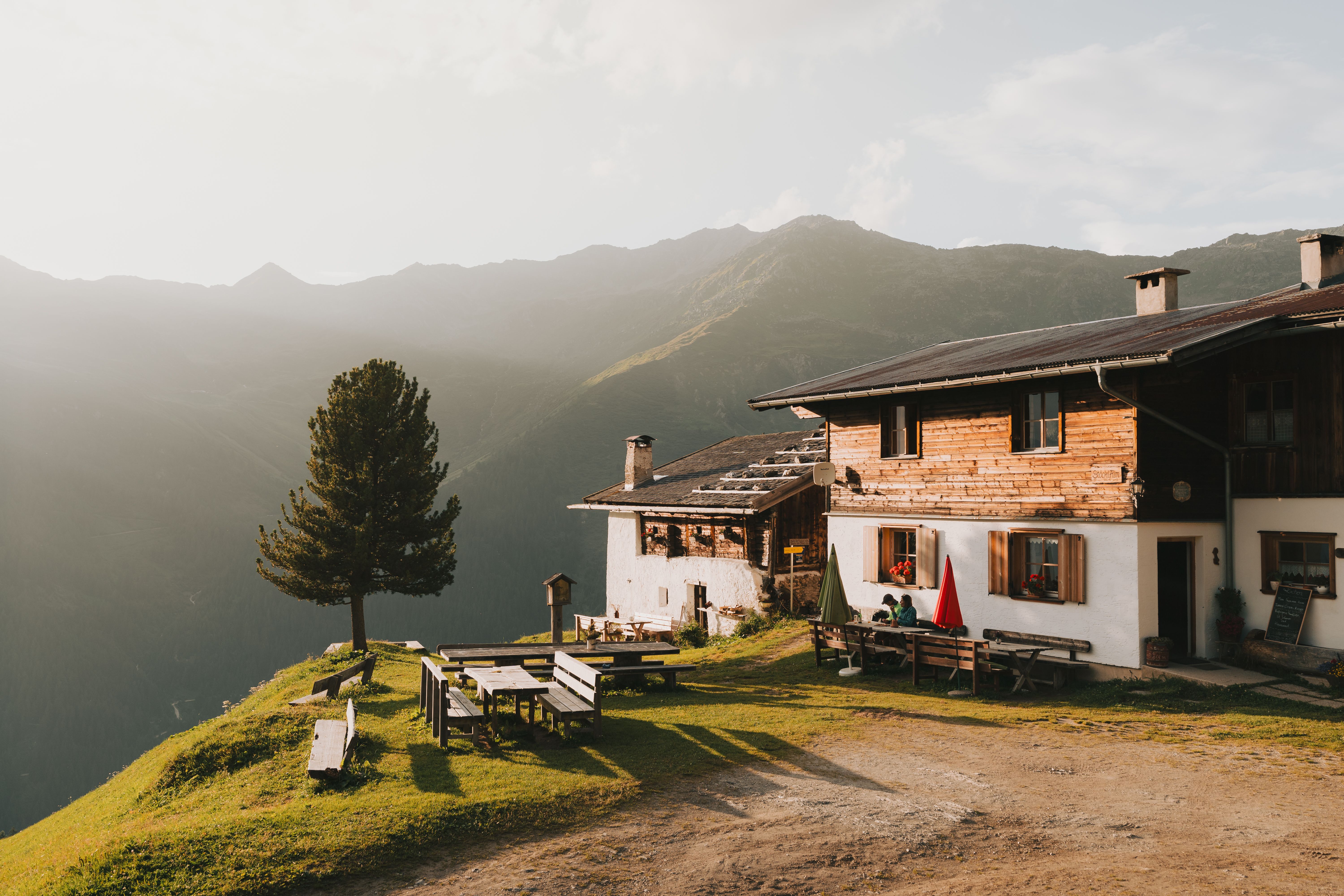
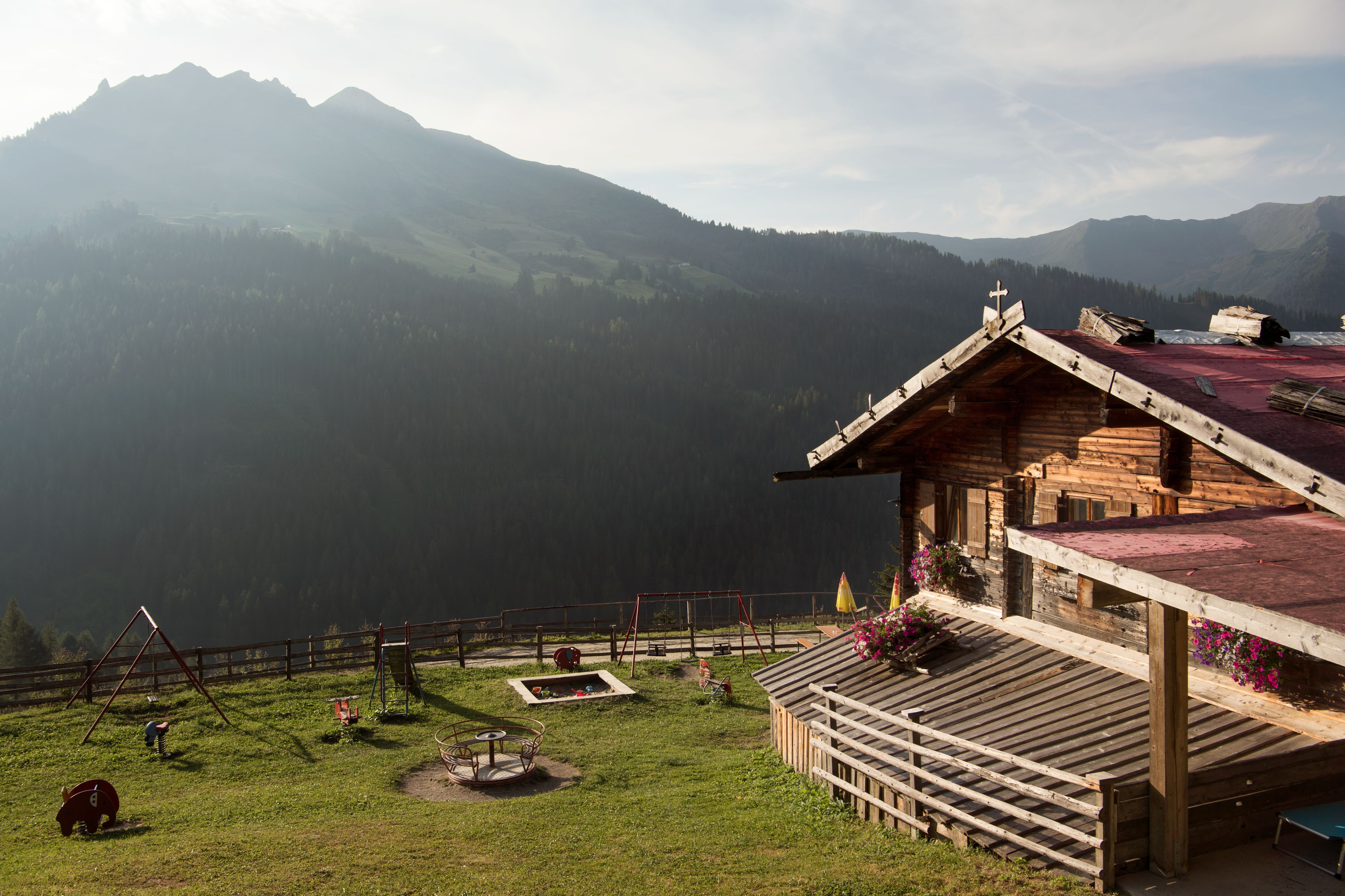
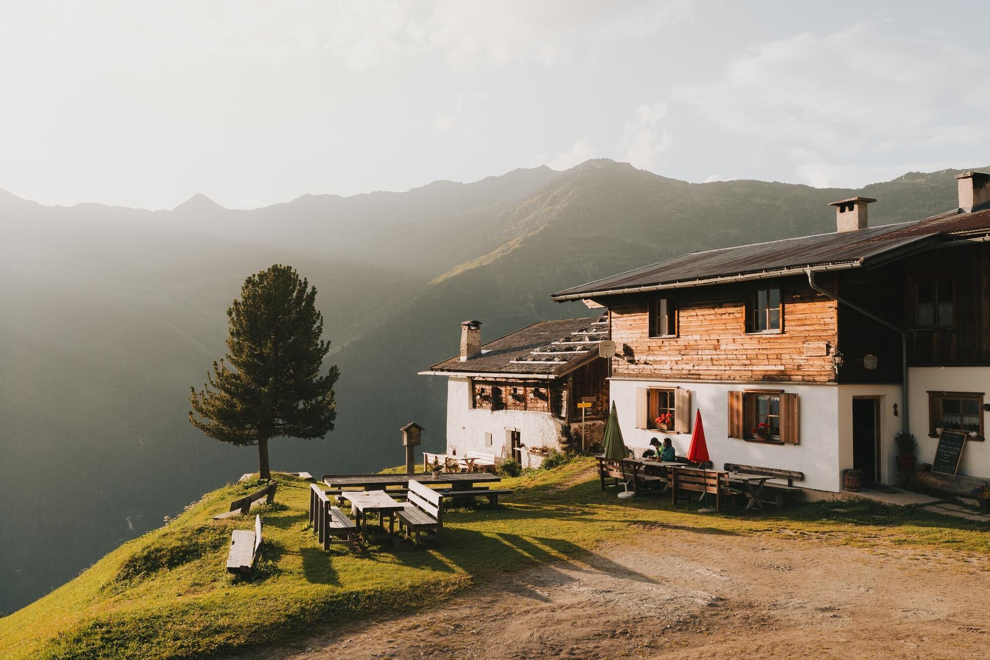
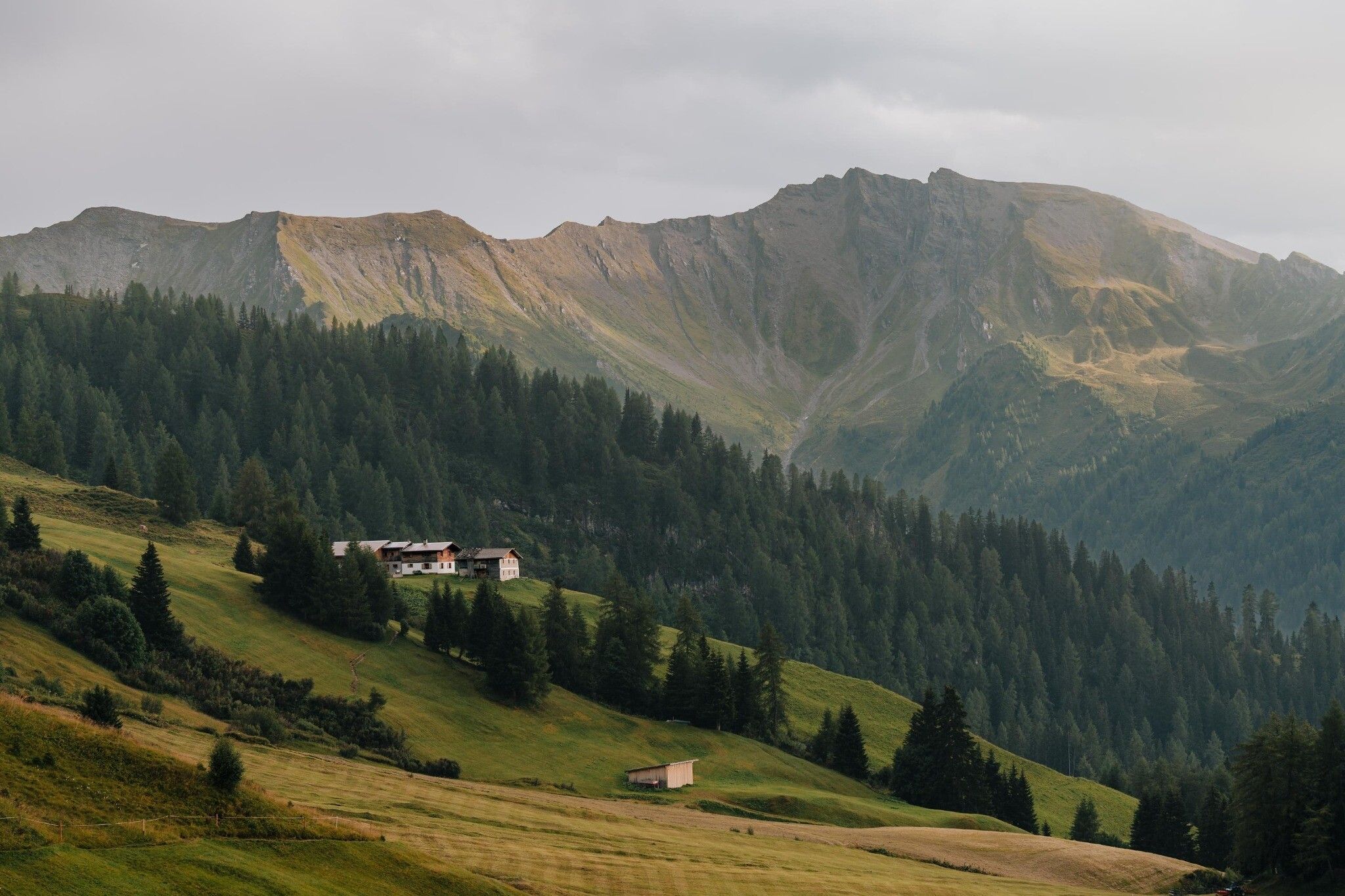
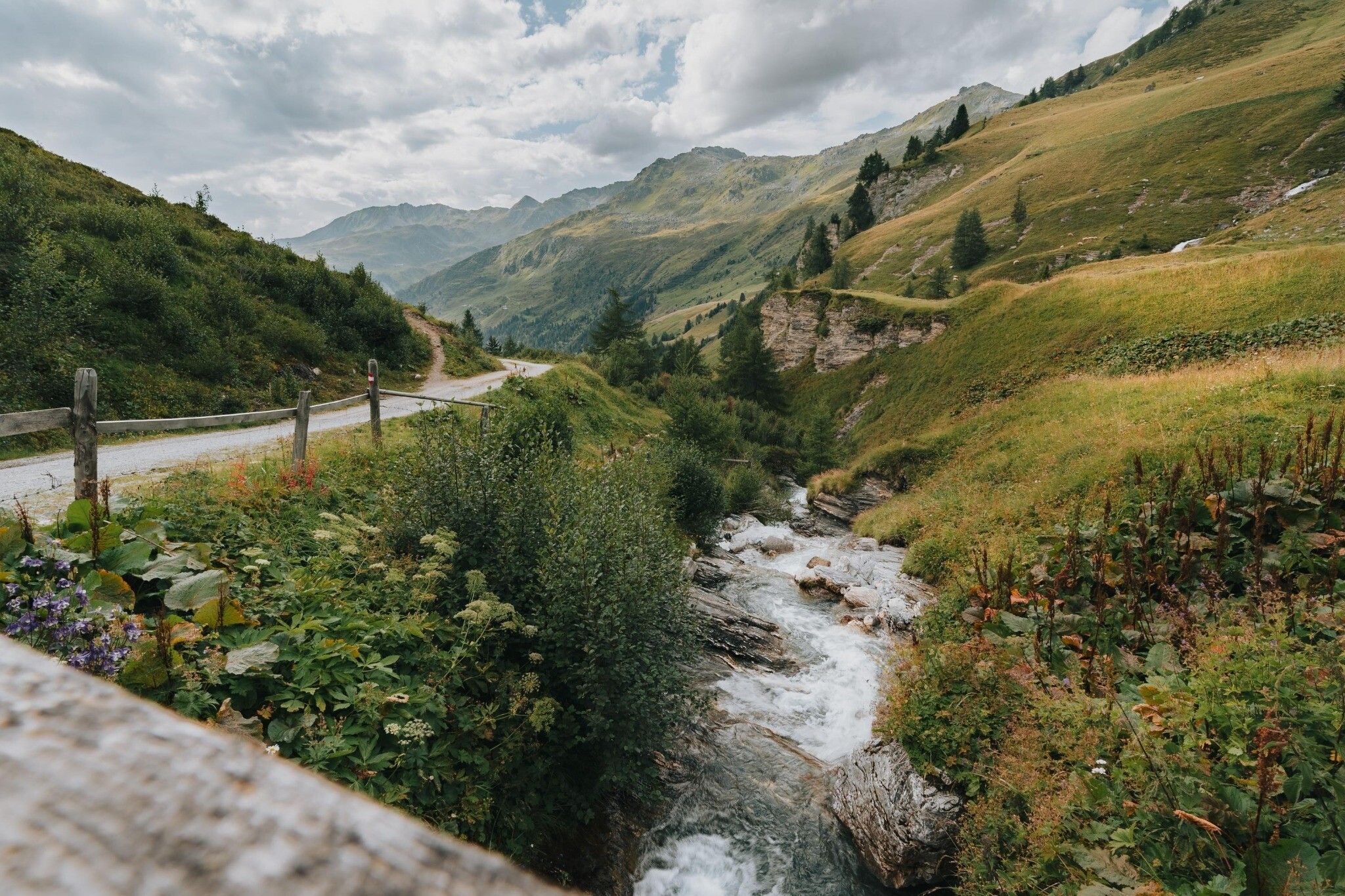
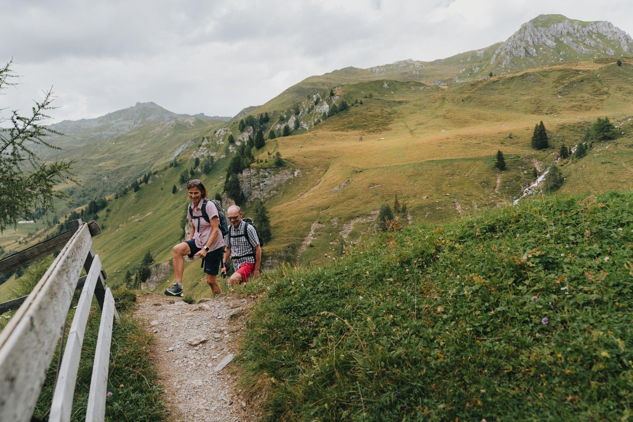
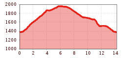
Huts and alpine pastures can be hiked on the award-winning anniversary trail Naviser Almenrunde. This promises not only great nature experiences in fascinating high mountain scenery but also culinary delights. The hike starts at the car park at the end of the road through the Navis valley. For the ascent, a wide, only slightly ascending forest path through the forest is used. Over free alpine meadows, past the Naviser Hütte, the trail continues to the Stöcklalm. Speciality of the hut host are delicious "mushroom dishes". The ingredients could already be inspected during the ascent through the forest. The most beautiful view of the Wipptal alpine paradise is from the neighbouring Poltenalm. Now the comfortable way becomes a wild romantic climb through carpets of alpine roses to the Klammalm. The rearmost alp of the Navi valley is with its location at 1,947 meters also the highest point on the alpine pasture circuit. Panoramic views of the Tuxer Alps sweeten the way. The change of sides of the valley, which is constantly losing height, can be mastered at your leisure on the comfortable alpine road or with short cuts along narrow forest and meadow paths. The destination is the Peeralm at 1,663 metres, just opposite the Polten- and Stöcklalm. The cosy alpine hut tempts you to stop for a break before you quickly descend on an alpine path to the car park at the bottom of the valley.
Tip: Use the various alpine pastures as a stop-off point. Here you can get various delicacies directly from the alpine dairyman!


.JPG")
.jpg")


.jpg")


.jpg")


")


