Mountain hikes Children's mile Golzentipp

Obertilliach / Gailtal Alps
Difficulty ratings: easy
Route length: 3.7 km
Duration: 2:00 h

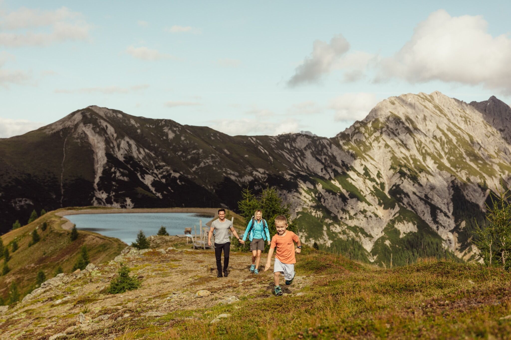
Families with children and toddlers take note: This is our pram-friendly tip in East Tyrol - the Golzentipp! On the children's mile between the mountain station and the Golzentipp summit, 13 stations ensure a wonderful day full of adventure and views.

Tour character

The Children's Mile on the Golzentipp is an easy family circuit suitable for baby carriages in the hiking area above Obertilliach. The starting point is the mountain station of the Golzentipp gondola lift - from there, a short, varied circular trail leads across flower-filled mountain meadows to a total of 13 play and adventure stations. Along the way, elements such as a marble run, marble construction, water course, labyrinth and small skill and climbing tasks on wooden logs provide constant motivation for children (and relaxing breaks for adults). A particular highlight is the panoramic spot at the reservoir (Jochsee): Here an impressive panorama opens up from the Hohe Tauern with the Grossglockner over the Lienz Dolomites and Gailtal Alps to the Carnic ridge on the border with Italy.Relaxation zones invite you to linger, and at the barbecue stations everything is prepared for a cozy rest - please bring your own barbecue food (e.g. sausages). If you still feel like it after the family tour, you can add the last few meters to the Golzentipp as a "little summit extra": It is only a 20-minute walk from Jochsee to the summit - where a summit book (don't forget to sign it) and a magnificent panoramic view await.
Tour information

  • Requirement: easy
  • Length: 3.7 km
  • Duration: 2:00 h
  • Elevation uphill:140 hm
  • Elevation downhill:140 hm
Highest point2,220 m

Starting point

Cable railway mountain hut

Finishing point

Golzentipp
  • Fitness level 2 / 6
  • Technique 2 / 6

Features

  • Circular route
  • Suitable for families
  • suitable for pushchairs

Best time of year

  • January
  • February
  • March
  • April
  • May
  • June
  • July
  • August
  • September
  • October
  • November
  • December

Trail condition

Wide path, suitable for prams and free of trees

Equipment

Basic equipmentformountainhikingincludessturdy hiking bootswith a goodtread, a 30-35 literbackpack, and functionalclothingbased on thelayeringprinciple, includingsufficient spare clothes. Essential itemsare rain, cold, and sunprotection, adequatefluids and food, aswellas a first-aid kit and a charged mobile phone. A mapor a GPS devicesupportsorientation. 

The informationservesas a guideline and does not claimtobe exhaustive. Equipment mustalwaysbeadaptedtothe planned route, weatherconditions, season, naturalhazards, environmental influences, and personal needs. 

Source: TVB Osttirol

Description

The Obertilliach children's mile leads to a total of 13 stations along the pram-friendly hiking trail from the mountain station of the Golzentippbahn to Jochsee. A marble run, a marble lair, a watercourse, a skill test while climbing on wooden trunks and a labyrinth and much more.

Nearby huts and mountain restaurants

Getting here

  • Arrival by public transport

    By bus until bus stopp "Obertilliach Dorf"

  • Parking

    By car until the parking area at the gondola Golzentipp.
    Parking area at the gondola Golzentipp.

Weather

Today

partly Cloudy
4°C/-2°C
35%0.2l10 km/h

Wed

cloudy
3°C/-1°C
35%0.4l10 km/h

Thu

mainly clear
6°C/-2°C
0%0l5 km/h
Go to weather forecast

More tours in the surrounding area

  • Figerhorn

    Difficulty:difficult
    Length:6.6 kmDuration:6:00 hElevation uphill:811 m
  • Theme path "Virgen crossroads"

    Difficulty:easy
    Length:3.2 kmDuration:1:00 hElevation uphill:104 m
  • Lasörling altitude trail

    Difficulty:medium
    Length:55.4 kmDuration:25:00 hElevation uphill:3,718 m
  • Venediger altitude trail

    Difficulty:difficult
    Length:55.5 kmDuration:27:00 hElevation uphill:3,975 m
  • Böses Weibele

    Difficulty:medium
    Length:13.6 kmDuration:6:30 hElevation uphill:965 m
  • Badener Hütte

    Difficulty:difficult
    Length:23.2 kmDuration:12:00 hElevation uphill:1,754 m
  • Hiking tour to St. Pöltner Hütte and 3 lakes

    Difficulty:difficult
    Length:14.8 kmDuration:7:40 hElevation uphill:1,119 m
  • Lucknerhaus - Stüdlhütte

    Difficulty:medium
    Length:9.3 kmDuration:4:30 hElevation uphill:862 m
  • Trail Virgentaler Sonnseitenweg

    Difficulty:medium
    Length:41.9 kmDuration:1 dayElevation uphill:2,641 m
  • Iseltrail

    Difficulty:medium
    Length:75.3 kmDuration:24:30 hElevation uphill:2,347 m
  • Lake Schwarzsee

    Difficulty:medium
    Length:7.8 kmDuration:3:30 hElevation uphill:790 m
  • Rotenkogel

    Difficulty:difficult
    Length:3.9 kmDuration:3:00 hElevation uphill:383 m
  • Rote Spitze 2,956 m

    Difficulty:medium
    Length:10.2 kmDuration:5:30 hElevation uphill:1,260 m
  • Böses Weibl

    Difficulty:difficult
    Length:14.1 kmDuration:8:00 hElevation uphill:1,193 m
  • Dorfberg

    Difficulty:medium
    Length:17.6 kmDuration:5:30 hElevation uphill:770 m
Newsletter

The mountain is calling? So does our newsletter!

In our monthly newsletter we reveal the best holiday tips for Tyrol.
