Mountain hikes Böses Weibl

Kals am Großglockner / Glocknergruppe
Difficulty ratings: difficult
Route length: 14.1 km
Duration: 8:00 h

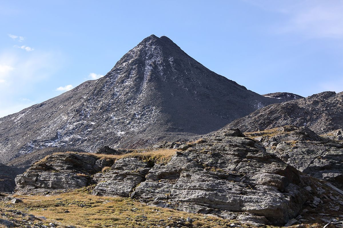
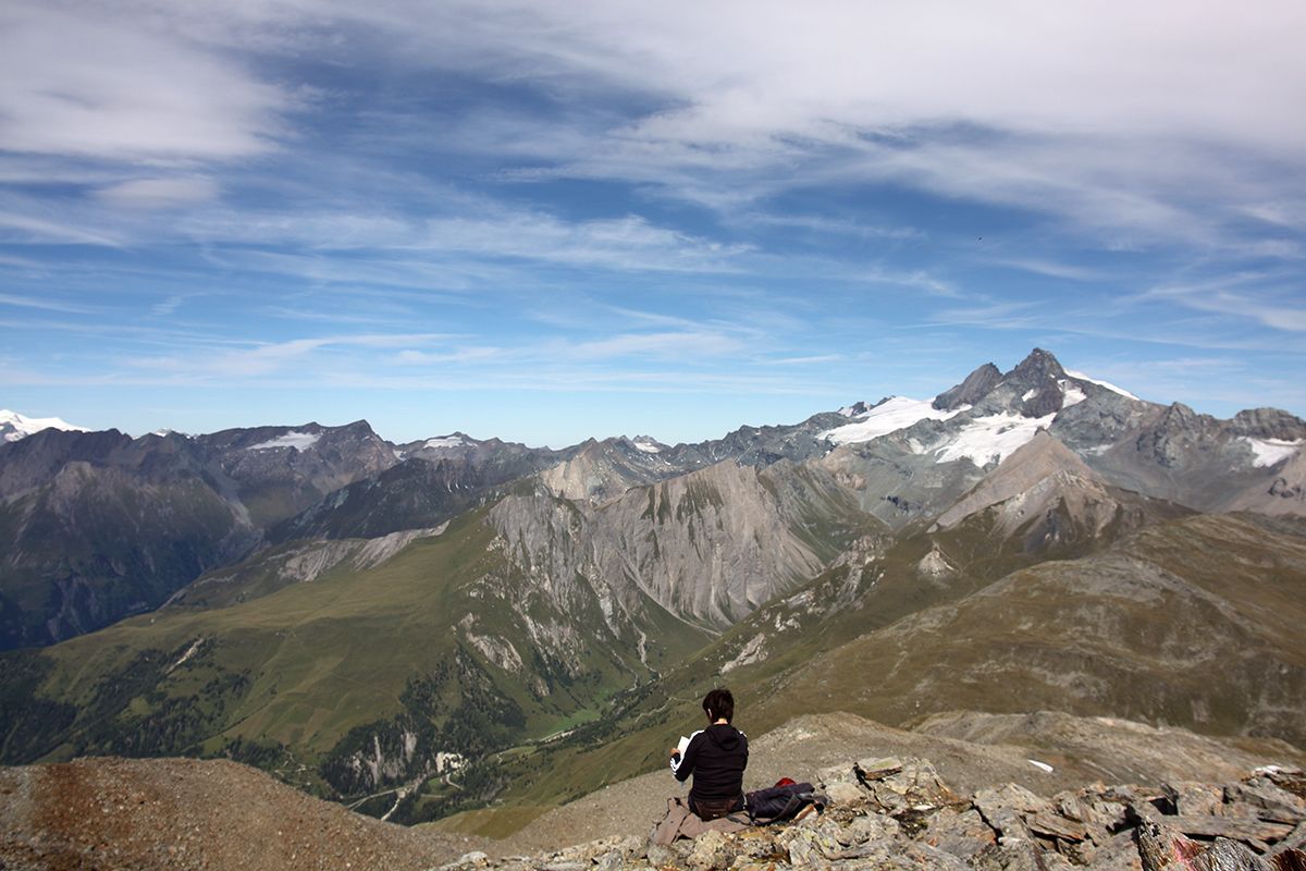
We are sure that the man who gave the mountain its name was quite envious of it. After all, the Böse Weibl is pretty close to the picture-book mountain and also enjoys a front-row view of the Glockner.

Tour character

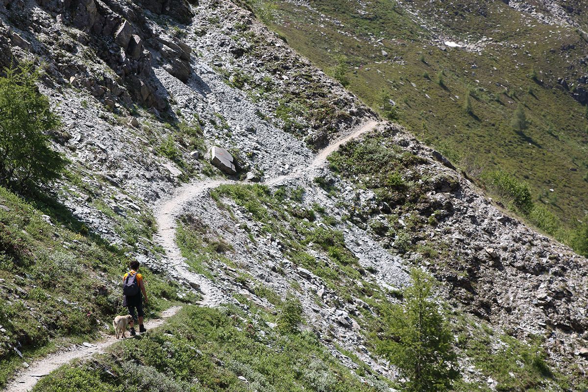
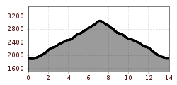
Beautiful and fairly easy ascent through alpine pastures and mountain paths, only from shortly before the finish is it more challenging through scree and boulders to the summit. Fantastic unobstructed view of the nearby Großglockner. Alternatively, the descent via the Kesselkeesattel can be chosen for the crossing. Due to the altitude and the black mountain paths throughout, you should have basic alpine experience despite the comparatively easy 3,000 m tour.

Tour information

  • Requirement: difficult
  • Length: 14.1 km
  • Duration: 8:00 h
  • Elevation uphill:1,193 hm
  • Elevation downhill:1,201 hm
Highest point3,112 m

Starting point

Parkplatz Glocknerwinkel

Finishing point

Parkplatz Glocknerwinkel
  • Fitness level 4 / 6
  • Technique 4 / 6
Source: Nationalparkregion Hohe Tauern Osttirol

Nearby huts and mountain restaurants

More tours in the surrounding area

  • Venediger altitude trail

    Difficulty: difficult
    Length: 55.5 km Duration: 27:00 h Elevation uphill: 3,915 m
  • Lasörling 3.098m

    Difficulty: difficult
    Length: 21.9 km Duration: 12:00 h Elevation uphill: 1,940 m
  • Rotenkogel

    Difficulty: difficult
    Length: 3.9 km Duration: 3:00 h Elevation uphill: 383 m
  • Hiking tour to Lasörlinghütte 2.350m

    Difficulty: medium
    Length: 14.6 km Duration: 7:10 h Elevation uphill: 1,080 m
  • Badener Hütte

    Difficulty: difficult
    Length: 23.2 km Duration: 11:30 h Elevation uphill: 1,750 m
  • Hike to Kalser Tauernhaus

    Difficulty: medium
    Length: 12.2 km Duration: 4:00 h Elevation uphill: 244 m
  • Umbal waterfalls nature force trail

    Difficulty: easy
    Length: 5.8 km Duration: 2:30 h Elevation uphill: 250 m
  • Hike to Neuen Reichenberger Hütte

    Difficulty: medium
    Length: 9.1 km Duration: 9:00 h Elevation uphill: 1,210 m
  • Hiking tour to Neue Sajathütte 2.600m

    Difficulty: medium
    Length: 10.3 km Duration: 6:50 h Elevation uphill: 1,080 m
  • Lucknerhaus - Stüdlhütte

    Difficulty: medium
    Length: 9.3 km Duration: 5:30 h Elevation uphill: 862 m
  • Muhs panorama trail

    Difficulty: medium
    Length: 15.2 km Duration: 6:00 h Elevation uphill: 1,090 m
  • Lasörling altitude trail

    Difficulty: medium
    Length: 57.0 km Duration: 25:00 h Elevation uphill: 3,740 m
  • Figerhorn

    Difficulty: difficult
    Length: 6.5 km Duration: 6:00 h Elevation uphill: 807 m
  • Hike to the Venedigerhaus Innergschlöß

    Difficulty: easy
    Length: 8.5 km Duration: 2:30 h Elevation uphill: 180 m
Newsletter

The mountain is calling? So does our newsletter!

In our monthly newsletter we reveal the best holiday tips for Tyrol.