Hut hike Lake Schwarzsee

Innervillgraten / Villgraten Mountains
Difficulty ratings: medium
Route length: 7.8 km
Duration: 3:30 h

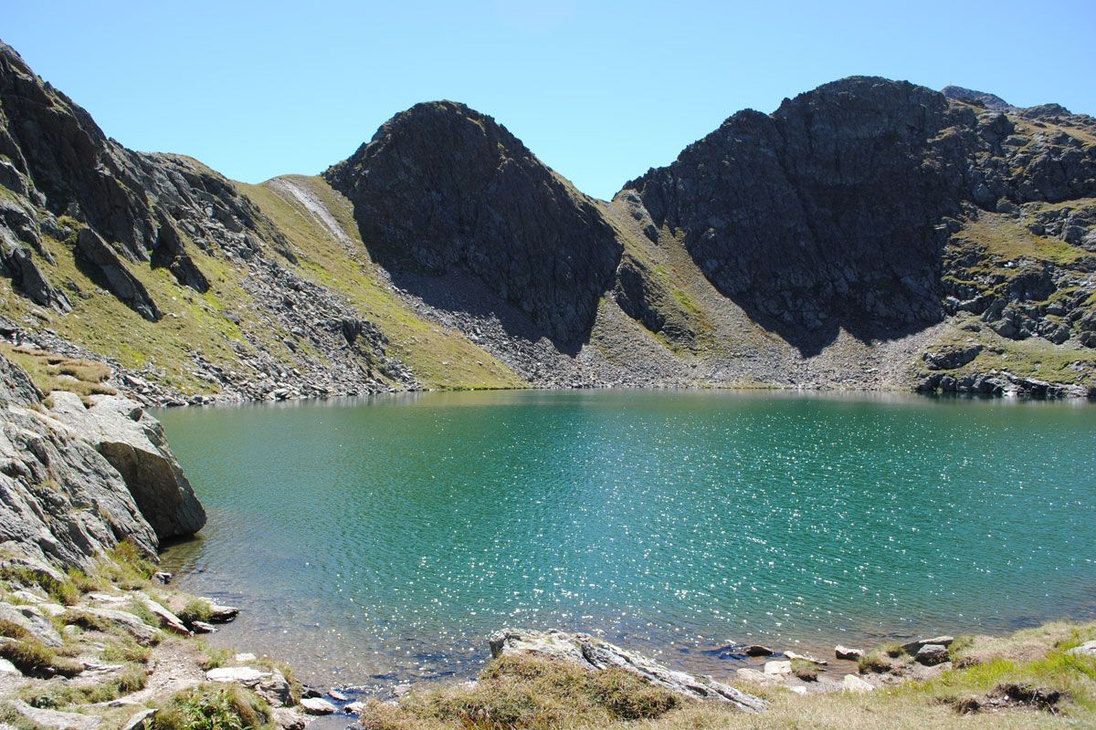
Admittedly, the Schwarzsee doesn't quite live up to its name. Fortunately! When the sun shines, it tends to shimmer in a glorious blue. But if you love alpine approaches and mystical mountain lakes, we're pretty sure that we've hit the mark with this tour.

Tour character

Rocky, alpine ascent via several hairpin bends and later through slab and boulder terrain to the Schwarzsee lake. Descent briefly via the same path and then past the Oberstalleralm and Unterstalleralm, one of the most beautiful alpine villages in East Tyrol.
Tour information

  • Requirement: medium
  • Length: 7.8 km
  • Duration: 3:30 h
  • Elevation uphill:790 hm
  • Elevation downhill:790 hm
Highest point2,453 m

Starting point

Jausenstation Unterstalleralm

Finishing point

Jausenstation Unterstalleralm
  • Fitness level 4 / 6
  • Technique 4 / 6

Features

  • Circular route

Best time of year

  • January
  • February
  • March
  • April
  • May
  • June
  • July
  • August
  • September
  • October
  • November
  • December

Equipment

Basic equipmentformountainhikingincludessturdy hiking bootswith a goodtread, a 30-35 literbackpack, and functionalclothingbased on thelayeringprinciple, includingsufficient spare clothes. Essential itemsare rain, cold, and sunprotection, adequatefluids and food, aswellas a first-aid kit and a charged mobile phone. A mapor a GPS devicesupportsorientation. 

The informationservesas a guideline and does not claimtobe exhaustive. Equipment mustalwaysbeadaptedtothe planned route, weatherconditions, season, naturalhazards, environmental influences, and personal needs. 

Source: TVB Osttirol

Description

From the car park at Unterstalleralm route 15 proceeds in the bottom of the altitude valley via Arntaler Bach to a partly stony steep path with plenty of bends up to what is known as the Restlangarten at 2241 m. This rocky, Alpine ascent continues via ledges and boulders up to the mysterious, dark Schwarzsee (pay attention to the signposts!). Descent via the same route to Restlangarten, bear left there onto route 15a, which proceeds initially to one of the loveliest Alpine villages in East Tirol, Oberstalleralm, continuing then to Unterstalleralm.

Nearby huts and mountain restaurants

Getting here

  • Arrival by public transport

    Mit dem Herz-Ass Wandertaxi bis zur Unterstaller Alm

  • Parking

    Mit dem Auto bis zur Jausenstation Unterstaller Alm
    Parkplatz Unterstaller Alm - kostenpflichtig

More tours in the surrounding area

  • Figerhorn

    Difficulty:difficult
    Length:6.6 kmDuration:6:00 hElevation uphill:811 m
  • Theme path "Virgen crossroads"

    Difficulty:easy
    Length:3.2 kmDuration:1:00 hElevation uphill:104 m
  • Lasörling altitude trail

    Difficulty:medium
    Length:55.4 kmDuration:25:00 hElevation uphill:3,718 m
  • Venediger altitude trail

    Difficulty:difficult
    Length:55.5 kmDuration:27:00 hElevation uphill:3,975 m
  • Children's mile Golzentipp

    Difficulty:easy
    Length:3.7 kmDuration:2:00 hElevation uphill:140 m
  • Böses Weibele

    Difficulty:medium
    Length:13.6 kmDuration:6:30 hElevation uphill:965 m
  • Badener Hütte

    Difficulty:difficult
    Length:23.2 kmDuration:12:00 hElevation uphill:1,754 m
  • Hiking tour to St. Pöltner Hütte and 3 lakes

    Difficulty:difficult
    Length:14.8 kmDuration:7:40 hElevation uphill:1,119 m
  • Lucknerhaus - Stüdlhütte

    Difficulty:medium
    Length:9.3 kmDuration:4:30 hElevation uphill:862 m
  • Trail Virgentaler Sonnseitenweg

    Difficulty:medium
    Length:41.9 kmDuration:1 dayElevation uphill:2,641 m
  • Iseltrail

    Difficulty:medium
    Length:75.3 kmDuration:24:30 hElevation uphill:2,347 m
  • Rotenkogel

    Difficulty:difficult
    Length:3.9 kmDuration:3:00 hElevation uphill:383 m
  • Rote Spitze 2,956 m

    Difficulty:medium
    Length:10.2 kmDuration:5:30 hElevation uphill:1,260 m
  • Böses Weibl

    Difficulty:difficult
    Length:14.1 kmDuration:8:00 hElevation uphill:1,193 m
  • Dorfberg

    Difficulty:medium
    Length:17.6 kmDuration:5:30 hElevation uphill:770 m
Newsletter

The mountain is calling? So does our newsletter!

In our monthly newsletter we reveal the best holiday tips for Tyrol.
