Mountain hikes Rotenkogel

Matrei in Osttirol / Granatspitzgruppe
Difficulty ratings: difficult
Route length: 3.9 km
Duration: 3:00 h

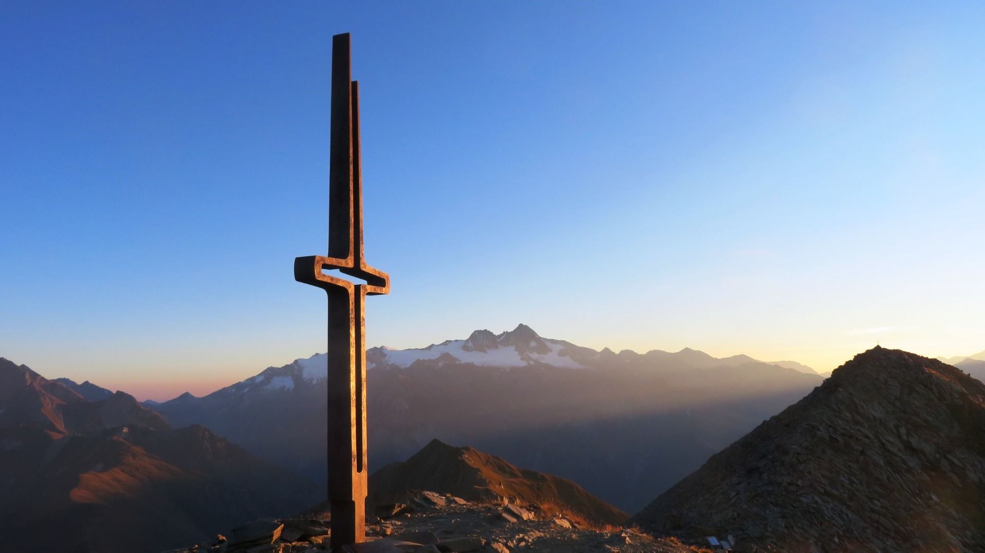
An artistic hymn of praise made of metal: the summit cross on the Rotenkogel panoramic mountain is reminiscent of a tuning fork. This is obvious, as it was erected by the East Tyrolean Men's Choral Society.

Tour character

Due to its central location, the Rotenkogel is one of the most beautiful panoramic mountains in East Tyrol. At the summit at 2,762 meters, the border between the national park communities of Kals am Großglockner and Matrei in East Tyrol runs high above the Goldried recreation area and the Großglockner Resort Kals-Matrei. The gondola lift from Kals takes you up to the Adlerlounge, where the marked trail begins. Difficult paths, which climb 383 meters in altitude, lead to the summit cross, which is well worth seeing.

Tour information

  • Requirement: difficult
  • Length: 3.9 km
  • Duration: 3:00 h
  • Elevation uphill:383 hm
  • Elevation downhill:383 hm
Highest point2,762 m

Starting point

Adler Lounge / Bergbahnen Kals

Finishing point

Adler Lounge / Bergbahnen Kals
  • Fitness level 3 / 6
  • Technique 3 / 6

Best time of year

  • January
  • February
  • March
  • April
  • May
  • June
  • July
  • August
  • September
  • October
  • November
  • December

Trail condition

Steig
Source: Nationalparkregion Hohe Tauern Osttirol

Description

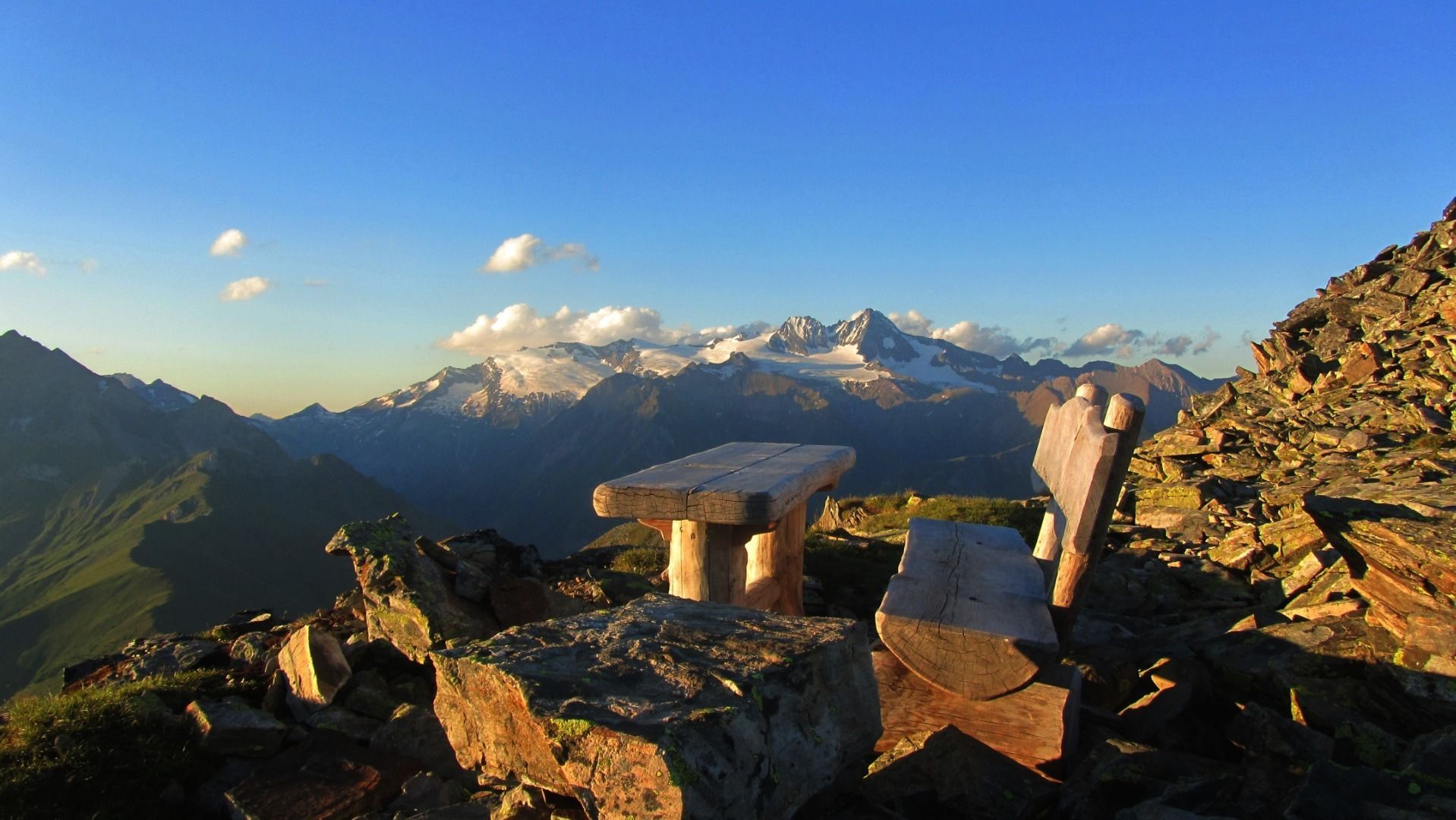
Head up on the gondola in Kals am Großglockner to the Adlerlounge. A signposted steep trail starts there. This hike for expert hikers provides unique panoramic views from the summit. Thanks to the central location it is not for nothing that the Rotenkogel is defined as being one of the loveliest viewing mountains in Osttirol.

Nearby huts and mountain restaurants

  • Adler Lounge 2.421m

    Opening hours:Open today
    Place: Kals am Großglockner
    : Restaurant, Alpine pasture / hut / mountain restaurant

More tours in the surrounding area

  • Venediger altitude trail

    Difficulty: difficult
    Length: 55.5 km Duration: 27:00 h Elevation uphill: 3,915 m
  • Lasörling 3.098m

    Difficulty: difficult
    Length: 21.9 km Duration: 12:00 h Elevation uphill: 1,940 m
  • Umbal waterfalls nature force trail

    Difficulty: easy
    Length: 5.8 km Duration: 2:30 h Elevation uphill: 250 m
  • Hike to the Venedigerhaus Innergschlöß

    Difficulty: easy
    Length: 8.5 km Duration: 2:30 h Elevation uphill: 180 m
  • Hiking tour to Neue Sajathütte 2.600m

    Difficulty: medium
    Length: 10.3 km Duration: 6:50 h Elevation uphill: 1,080 m
  • Hike to Neuen Reichenberger Hütte

    Difficulty: medium
    Length: 9.1 km Duration: 9:00 h Elevation uphill: 1,210 m
  • Hiking tour to Lasörlinghütte 2.350m

    Difficulty: medium
    Length: 14.6 km Duration: 7:10 h Elevation uphill: 1,080 m
  • Lasörling altitude trail

    Difficulty: medium
    Length: 57.0 km Duration: 25:00 h Elevation uphill: 3,740 m
  • Figerhorn

    Difficulty: difficult
    Length: 6.5 km Duration: 6:00 h Elevation uphill: 807 m
  • Muhs panorama trail

    Difficulty: medium
    Length: 15.2 km Duration: 6:00 h Elevation uphill: 1,090 m
  • Hike to Kalser Tauernhaus

    Difficulty: medium
    Length: 12.2 km Duration: 4:00 h Elevation uphill: 244 m
  • Badener Hütte

    Difficulty: difficult
    Length: 23.2 km Duration: 11:30 h Elevation uphill: 1,750 m
  • Lucknerhaus - Stüdlhütte

    Difficulty: medium
    Length: 9.3 km Duration: 5:30 h Elevation uphill: 862 m
  • Böses Weibl

    Difficulty: difficult
    Length: 14.1 km Duration: 8:00 h Elevation uphill: 1,193 m
Newsletter

The mountain is calling? So does our newsletter!

In our monthly newsletter we reveal the best holiday tips for Tyrol.