
Mountain hikes Rote Spitze 2,956 m

Innervillgraten / Villgraten Mountains
Difficulty ratings: medium
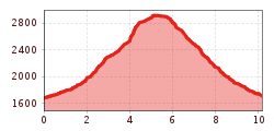
Route length: 10.2 km
Duration: 5:30 h

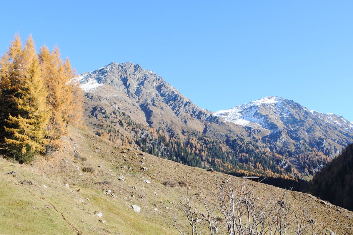
We can't say how many red peaks there are in the Alps. But we are sure that the most beautiful one is probably in East Tyrol.

Tour character

Steep climb across alpine meadows to the ridge. From there over boulders to the partially exposed ridge, which leads into a saddle secured by wire ropes in places. An easy scramble finally leads to the summit. This alpine mountain tour requires surefootedness and a head for heights.
Tour information

  • Requirement: medium
  • Length: 10.2 km
  • Duration: 5:30 h
  • Elevation uphill:1,260 hm
  • Elevation downhill:1,240 hm
Highest point2,919 m

Starting point

Parkplatz Jausenstation Unterstalleralm

Finishing point

Rote Spitze
  • Fitness level 4 / 6
  • Technique 4 / 6

Best time of year

  • January
  • February
  • March
  • April
  • May
  • June
  • July
  • August
  • September
  • October
  • November
  • December
Source: TVB Osttirol

Description

Get from Unterstalleralm to Oberstalleralm directly via route 16 to the Rote Spitze. From the Alpine inn there is a brief section through the forest initially, which later then rises steeply across Alpine pastures. Upon reaching the ridge, the path branches off to the east and gets to the ridge via boulders. Via this route it is somewhat exposed in a wind gap, however this is secured with wire cables. From there it is an easy climb up to the summit

Nearby huts and mountain restaurants

Getting here

  • Arrival by public transport

    Mit dem Herz-Ass Wandertaxi bis zur Unterstaller Alm

  • Parking

    Parkplatz Unterstaller Alm - kostenpflichtig

More tours in the surrounding area

  • Figerhorn

    Difficulty:difficult
    Length:6.6 kmDuration:6:00 hElevation uphill:811 m
  • Theme path "Virgen crossroads"

    Difficulty:easy
    Length:3.2 kmDuration:1:00 hElevation uphill:104 m
  • Muhs panorama trail

    Difficulty:medium
    Length:15.2 kmDuration:6:00 hElevation uphill:1,090 m
  • Herz-Ass Villgratental

    Difficulty:medium
    Length:75.6 kmDuration:34:00 hElevation uphill:5,703 m
  • Children's mile Golzentipp

    Difficulty:easy
    Length:3.7 kmDuration:2:00 hElevation uphill:140 m
  • Böses Weibl

    Difficulty:difficult
    Length:14.1 kmDuration:8:00 hElevation uphill:1,193 m
  • Hike to Kalser Tauernhaus

    Difficulty:medium
    Length:12.2 kmDuration:4:00 hElevation uphill:244 m
  • Badener Hütte

    Difficulty:difficult
    Length:23.2 kmDuration:12:00 hElevation uphill:1,754 m
  • Lucknerhaus - Stüdlhütte

    Difficulty:medium
    Length:9.3 kmDuration:4:30 hElevation uphill:862 m
  • Hike to Neuen Reichenberger Hütte

    Difficulty:medium
    Length:18.2 kmDuration:9:00 hElevation uphill:1,252 m
  • Hiking tour to St. Pöltner Hütte and 3 lakes

    Difficulty:difficult
    Length:14.8 kmDuration:7:40 hElevation uphill:1,119 m
  • Hiking tour to Neue Sajathütte 2.600m

    Difficulty:medium
    Length:10.3 kmDuration:6:50 hElevation uphill:1,086 m
  • Hiking tour to Zupalsee Hütte 2.350m

    Difficulty:medium
    Length:14.9 kmDuration:8:30 hElevation uphill:1,261 m
  • Hiking tour to Lasörlinghütte 2.350m

    Difficulty:medium
    Length:14.6 kmDuration:7:50 hElevation uphill:1,135 m
  • Hike to the Venedigerhaus Innergschlöß

    Difficulty:easy
    Length:8.6 kmDuration:2:30 hElevation uphill:184 m
Newsletter

The mountain is calling? So does our newsletter!

In our monthly newsletter we reveal the best holiday tips for Tyrol.
