Mountain hikes Hike to the Berghaus Außergschlöss

Matrei in Osttirol / Venedigergruppe
Difficulty ratings: easy
Route length: 5.2 km
Duration: 1:45 h

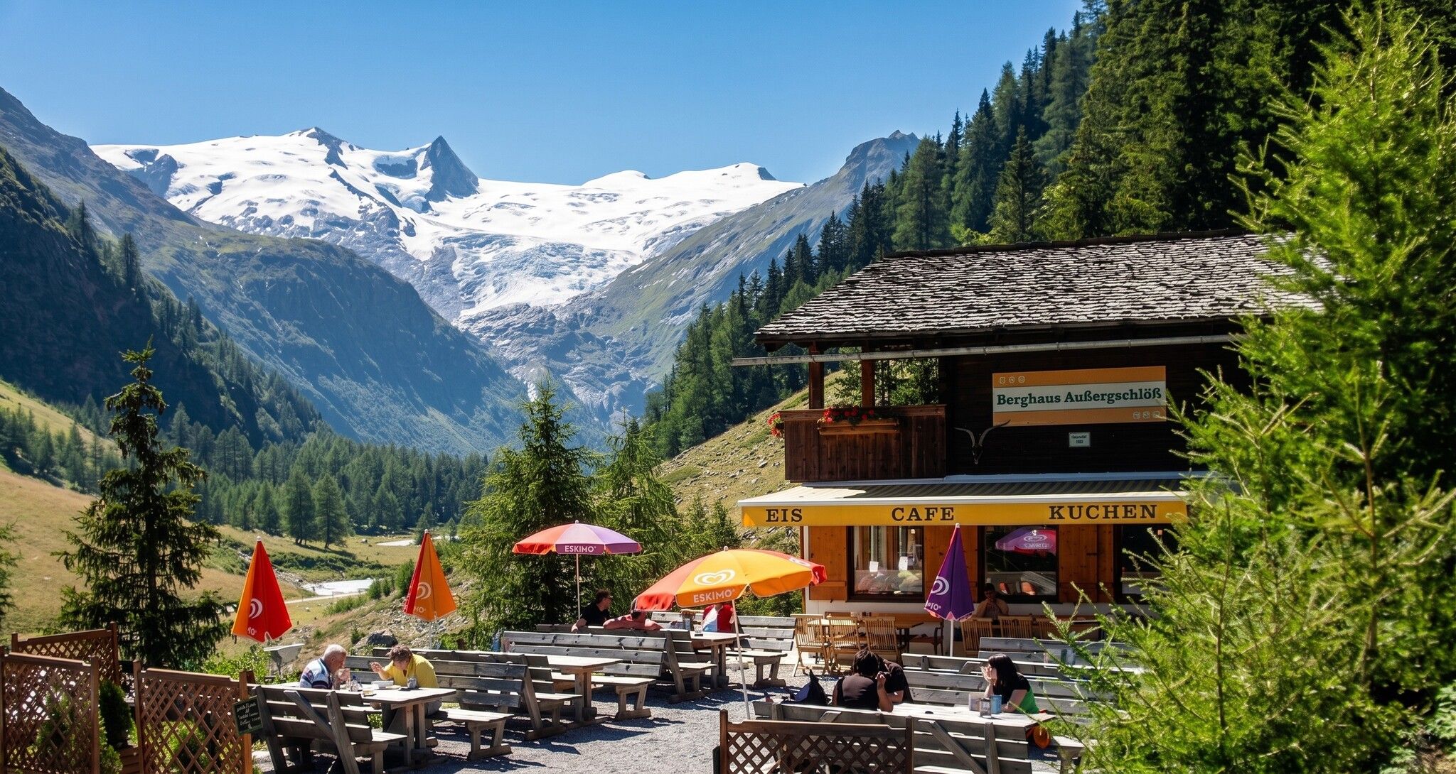
At Berghaus Außergschlöß we would like to recommend three views: the unobstructed view of the glaciated Großvenediger, the otherwise rare view of bearded vultures in the wild, and in between the view of your own plate, which is always lovingly prepared here.

Tour character

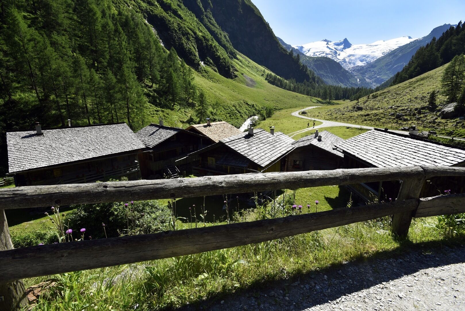
Easy, flat hike on a wide path through the Tauerntal valley to Berghaus Außergschlöß with a magnificent view of the Großvenediger. As there is a bearded vulture nest in the immediate vicinity of the hut, there is a very good chance of spotting bearded vultures in the wild.

Tour information

  • Requirement: easy
  • Length: 5.2 km
  • Duration: 1:45 h
  • Elevation uphill:169 hm
  • Elevation downhill:169 hm
Highest point1,700 m

Starting point

Car park Matreier Tauernhaus 1.400m

Finishing point

Car park Matreier Tauernhaus 1.400m
  • Fitness level 1 / 6
  • Technique 1 / 6

Best time of year

  • January
  • February
  • March
  • April
  • May
  • June
  • July
  • August
  • September
  • October
  • November
  • December
Source: TVB Osttirol

Description

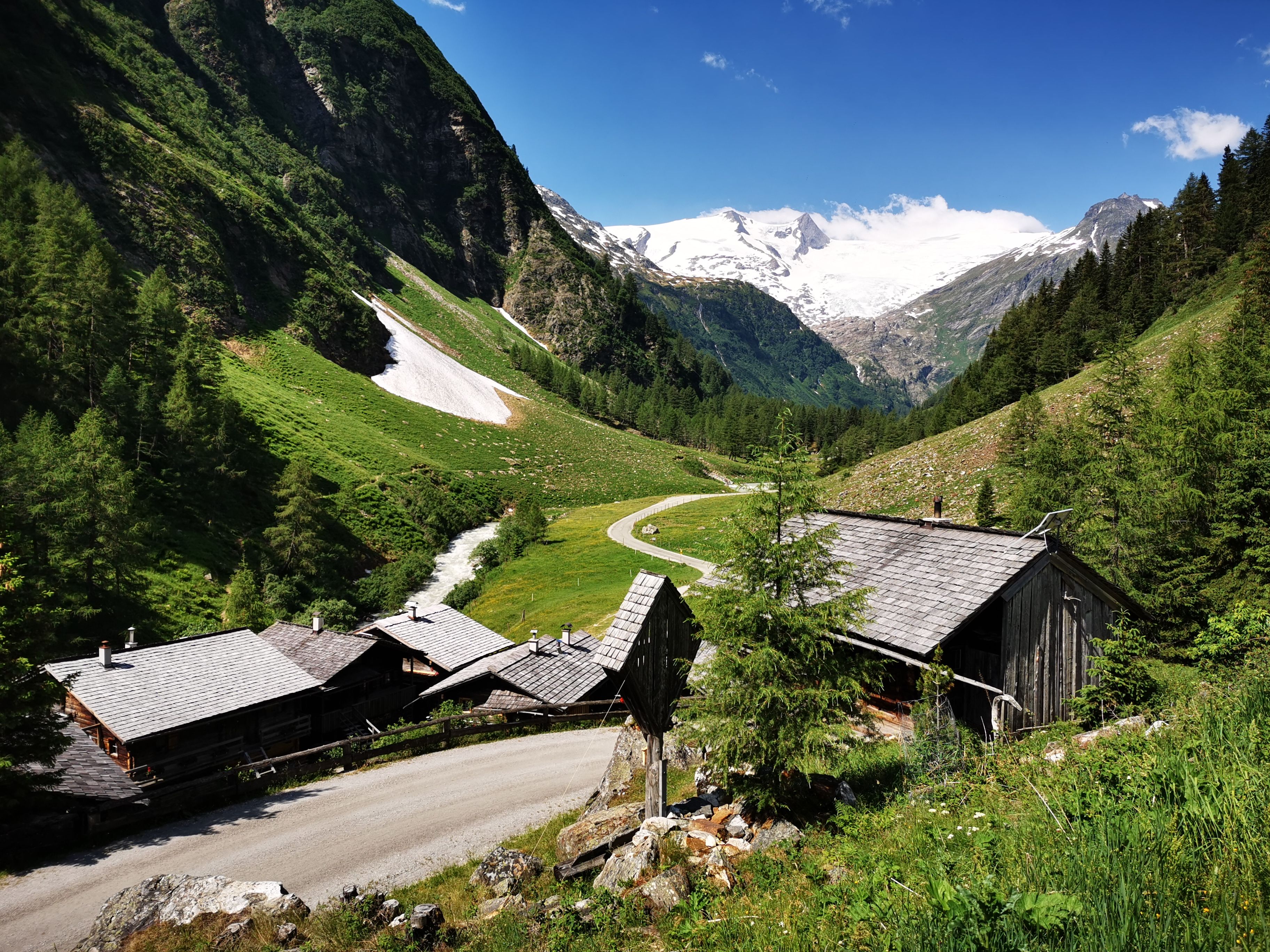
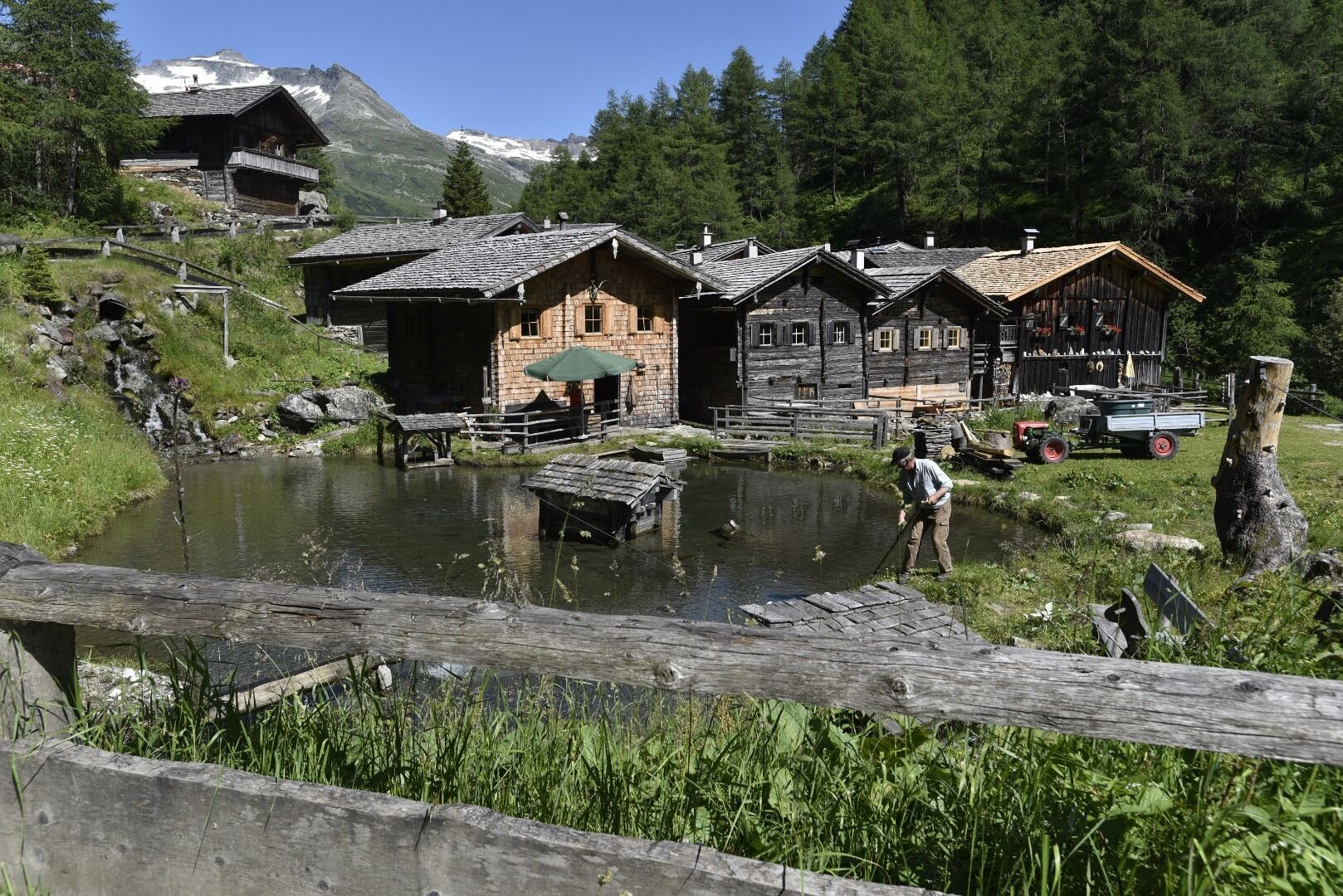
The moderate hike starts from the parking place Matreier Tauernhaus along a road through the forest. Shortly after leaving the forest, you can already see the Berghaus Außergschlöss.
Once you have reached your destination, you will be rewarded with a magnificent view of the Großvenediger.

Nearby huts and mountain restaurants

Getting here

  • Arrival by public transport

    Matreier Tauernhaus

  • Parking

    Parking place Matreier Tauernhaus

More tours in the surrounding area

  • Hike to the Venedigerhaus Innergschlöß

    Difficulty:easy
    Length:8.6 kmDuration:2:30 hElevation uphill:184 m
  • Lucknerhaus - Stüdlhütte

    Difficulty:medium
    Length:9.3 kmDuration:5:30 hElevation uphill:862 m
  • Badener Hütte

    Difficulty:difficult
    Length:23.2 kmDuration:11:30 hElevation uphill:1,754 m
  • Hike to Kalser Tauernhaus

    Difficulty:medium
    Length:12.2 kmDuration:4:00 hElevation uphill:244 m
  • Hiking tour to Neue Sajathütte 2.600m

    Difficulty:medium
    Length:10.3 kmDuration:6:50 hElevation uphill:1,086 m
  • Hike to Neuen Reichenberger Hütte

    Difficulty:medium
    Length:18.2 kmDuration:9:00 hElevation uphill:1,252 m
  • Hiking tour to Lasörlinghütte 2.350m

    Difficulty:medium
    Length:14.6 kmDuration:7:10 hElevation uphill:1,080 m
  • Theme path "Virgen crossroads"

    Difficulty:easy
    Length:3.2 kmDuration:1:00 hElevation uphill:104 m
  • Figerhorn

    Difficulty:difficult
    Length:6.5 kmDuration:6:00 hElevation uphill:807 m
  • Lasörling altitude trail

    Difficulty:medium
    Length:57.0 kmDuration:25:00 hElevation uphill:3,740 m
  • Venediger altitude trail

    Difficulty:difficult
    Length:55.5 kmDuration:27:00 hElevation uphill:3,915 m
  • Muhs panorama trail

    Difficulty:medium
    Length:15.2 kmDuration:6:00 hElevation uphill:1,090 m
  • Rollitour with Swiss Trac

    Difficulty:easy
    Length:3.2 kmDuration:1:30 hElevation uphill:135 m
  • Rotenkogel

    Difficulty:difficult
    Length:3.9 kmDuration:3:00 hElevation uphill:383 m
  • Lasörling 3.098m

    Difficulty:difficult
    Length:21.9 kmDuration:12:00 hElevation uphill:1,940 m
  • Umbal waterfalls nature force trail

    Difficulty:easy
    Length:6.0 kmDuration:2:30 hElevation uphill:257 m
  • Böses Weibl

    Difficulty:difficult
    Length:14.1 kmDuration:8:00 hElevation uphill:1,193 m
  • Eagle Walk Stage O1: Ströden - Johannis Hütte

    Difficulty:medium
    Length:13.0 kmDuration:6:30 hElevation uphill:1,430 m
Newsletter

The mountain is calling? So does our newsletter!

In our monthly newsletter we reveal the best holiday tips for Tyrol.