Mountain hikes Hiking tour to St. Pöltner Hütte and 3 lakes

Matrei in Osttirol / Granatspitzgruppe
Difficulty ratings: difficult
Route length: 14.8 km
Duration: 7:45 h

Hiking tour to St. Pöltner Hütte and 3 lakes

Tour information

  • Requirement: difficult
  • Length: 14.8 km
  • Duration: 7:45 h
  • Elevation uphill:980 hm
  • Elevation downhill:1,080 hm
Highest point2,470 m

Starting point

Parking place Matrei i. O. Tauernhaus

Finishing point

Parking place Matrei i. O. Tauernhaus
  • Fitness level 4 / 6
  • Technique 4 / 6

Best time of year

  • January
  • February
  • March
  • April
  • May
  • June
  • July
  • August
  • September
  • October
  • November
  • December
Source: TVB Osttirol

Description

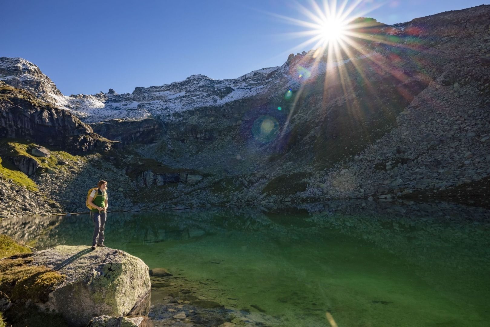
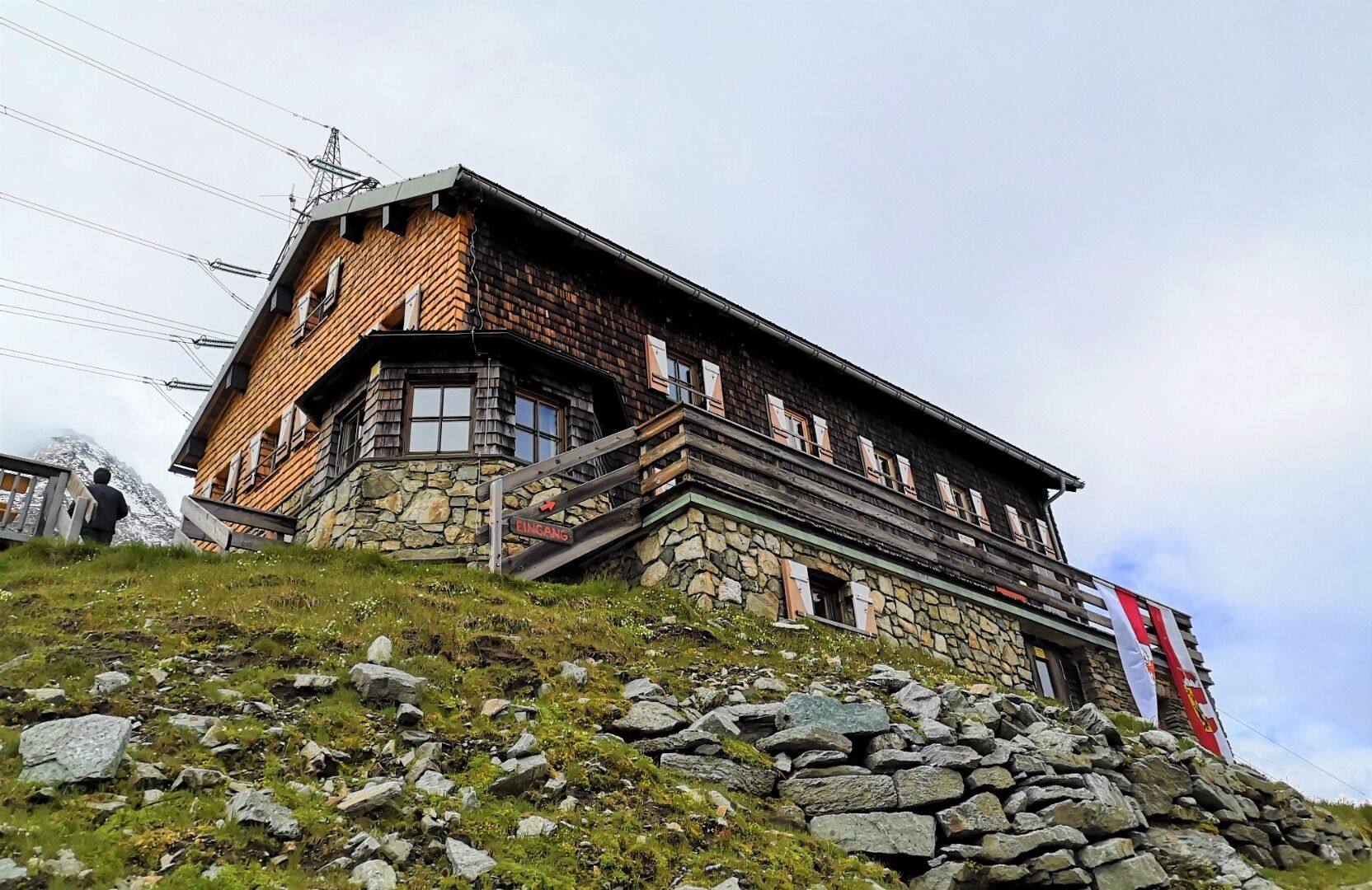
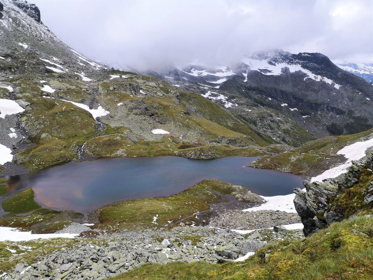
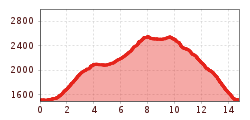
Follow the path from Matreier Tauernhaus towards the Gschlößtal. Nearby the Wohlgemuthalmen you will get to the starting point of the “Alter Tauernweg” (Old Tauern Path) to St. Pöltner Hütte (path no. 511). Passing by splendid observation spot “Zirbenkreuz”, you walk on to St. Pöltner Hütte. Climbing up to Messelingscharte, you can enjoy a fantastic view onto the Venediger range. Climb back down across a section of St. Pöltner Ostweg (East path) to pass by 3 lakes: Lake Grauer See, Lake Schwarzsee and Lake Grünsee. After you have passed by the waterfall of Messelingbach Stream and the flower-covered pastures, walk on towards Matreier Tauernhaus.

Nearby huts and mountain restaurants

Getting here

  • Arrival by public transport

    Matreier Tauernhaus

  • Parking

    Parking place Matreier Tauernhaus

More tours in the surrounding area

  • Lasörling 3.098m

    Difficulty: difficult
    Length: 21.9 km Duration: 12:00 h Elevation uphill: 1,940 m
  • Hike to the Venedigerhaus Innergschlöß

    Difficulty: easy
    Length: 8.5 km Duration: 2:30 h Elevation uphill: 180 m
  • Hiking tour to Neue Sajathütte 2.600m

    Difficulty: medium
    Length: 10.3 km Duration: 6:50 h Elevation uphill: 1,080 m
  • Badener Hütte

    Difficulty: difficult
    Length: 23.2 km Duration: 11:30 h Elevation uphill: 1,750 m
  • Böses Weibl

    Difficulty: difficult
    Length: 14.1 km Duration: 8:00 h Elevation uphill: 1,193 m
  • Hike to Neuen Reichenberger Hütte

    Difficulty: medium
    Length: 9.1 km Duration: 9:00 h Elevation uphill: 1,210 m
  • Hike to Kalser Tauernhaus

    Difficulty: medium
    Length: 12.2 km Duration: 4:00 h Elevation uphill: 244 m
  • Hiking tour to Lasörlinghütte 2.350m

    Difficulty: medium
    Length: 14.6 km Duration: 7:10 h Elevation uphill: 1,080 m
  • Lucknerhaus - Stüdlhütte

    Difficulty: medium
    Length: 9.3 km Duration: 5:30 h Elevation uphill: 862 m
  • Muhs panorama trail

    Difficulty: medium
    Length: 15.2 km Duration: 6:00 h Elevation uphill: 1,090 m
  • Eagle Walk Stage O1: Ströden - Johannis Hütte

    Difficulty: medium
    Length: 13.0 km Duration: 6:30 h Elevation uphill: 1,430 m
  • Lasörling altitude trail

    Difficulty: medium
    Length: 57.0 km Duration: 25:00 h Elevation uphill: 3,740 m
  • Venediger altitude trail

    Difficulty: difficult
    Length: 55.5 km Duration: 27:00 h Elevation uphill: 3,915 m
  • Figerhorn

    Difficulty: difficult
    Length: 6.5 km Duration: 6:00 h Elevation uphill: 807 m
  • Rotenkogel

    Difficulty: difficult
    Length: 3.9 km Duration: 3:00 h Elevation uphill: 383 m
  • Umbal waterfalls nature force trail

    Difficulty: easy
    Length: 5.8 km Duration: 2:30 h Elevation uphill: 250 m
Newsletter

The mountain is calling? So does our newsletter!

In our monthly newsletter we reveal the best holiday tips for Tyrol.